Purpose of TraX Pro
With TraX Pro, you have a tailor-made solution for professional airspace monitoring requirements. Our innovative web app offers precise real-time displays of air traffic and reliably warns you of potential dangers. Equipped with RADAR, ADS-B and FLARM, TraX:
- Companies that use drones over long distances for inspections, logistics, surveying or infrastructure projects
- Authorities and organizations with security or rescue tasks that share the airspace over operational sites
- Operators who require BVLOS permits and must comply with TMPR requirements
TraX Pro fulfills the detect-and-avoid verification according to SORA/TMPR and the requirements of risk class ARC-C - the perfect solution for approvable BVLOS applications."

Scope of delivery
A monthly subscription with automatic renewal and monthly billing is provided for the Germany region. The notice period is 14 days to the end of the term. Access to TraX Pro is transmitted digitally to the user.
Note for ordering: Subscription products must always be ordered individually in the store.

Feature overview of the TraX variants
Cards | TraX Free | TraX Basic | TraX Pro | TraX Enterprise |
---|---|---|---|---|
Selectable background maps for all application areas | x | x | x | x |
Geozone layer (Dipul layer) | x | x | x | x |
Airspace layer | x | x | ||
User uploads (KML) | x | x | ||
Geoserver integration (individual additional layers) | x |
Traffic & Tracking | TraX Free | TraX Basic | TraX Pro | TraX Enterprise |
---|---|---|---|---|
General air traffic | x | x | x | |
Traffic radius | 5 km | 50 km | individual | |
Automatic Identification System (marine traffic) | x | x | x | |
Location determination using various methods (GPS, address search, manual input) | x | x | x | |
Find position via GPS of the end device | x | x | x | |
Track a single aircraft | x | x | x | |
Drone Detection System | x | |||
Direct Remote ID | x | |||
Multiple monitoring zones | x |
Setting & display | TraX Free | TraX Basic | TraX Pro | TraX Enterprise |
---|---|---|---|---|
Customization of the application to user needs | x | x | x | x |
Customizable representation of air traffic | x | x | ||
Display of flight progress & flight preview | x | x | ||
Selection of height preferences | x | x | ||
Height filter | x | x |
Warnings & Alerts | TraX Free | TraX Basic | TraX Pro | TraX Enterprise |
---|---|---|---|---|
Intrusion alerting, visual & audio warnings, warning mode | x | x | x | |
Setting the size of the warning cylinder | x | x | x | |
Leave the display switched on | x | x | ||
Current position or destination as the focus of the warnings | x | x | ||
Exclude individual destinations from entry warnings | x | x |
Tools & Miscellaneous | TraX Free | TraX Basic | TraX Pro | TraX Enterprise |
---|---|---|---|---|
Measuring tool for distances | x | x | x | x |
Retrieve coordinates at a specific position | x | x | x | x |
System requirements
We recommend the following browsers/devices for using TraX Pro:
- Current PC, laptop, smartphone or tablet (at least 4 GB RAM)
- Windows 10+, macOS 11+, Android 10+, iOS 14+
- Current browser: Chrome, Firefox, Edge or Safari
- Stable Internet connection

Software features: TraX Pro

-
Card variety for full overview & control
Always keep an eye on your area of operation: The TraX map view combines modern background maps with static map layers and clearly displays important information such as geo-zones (DIPUL layers) and detailed airspace structures. In addition, you can easily integrate your own mission or planning data via KML upload - for maximum flexibility and precise mission preparation.
-
Tracking & traffic - everything in view, flexibly controlled
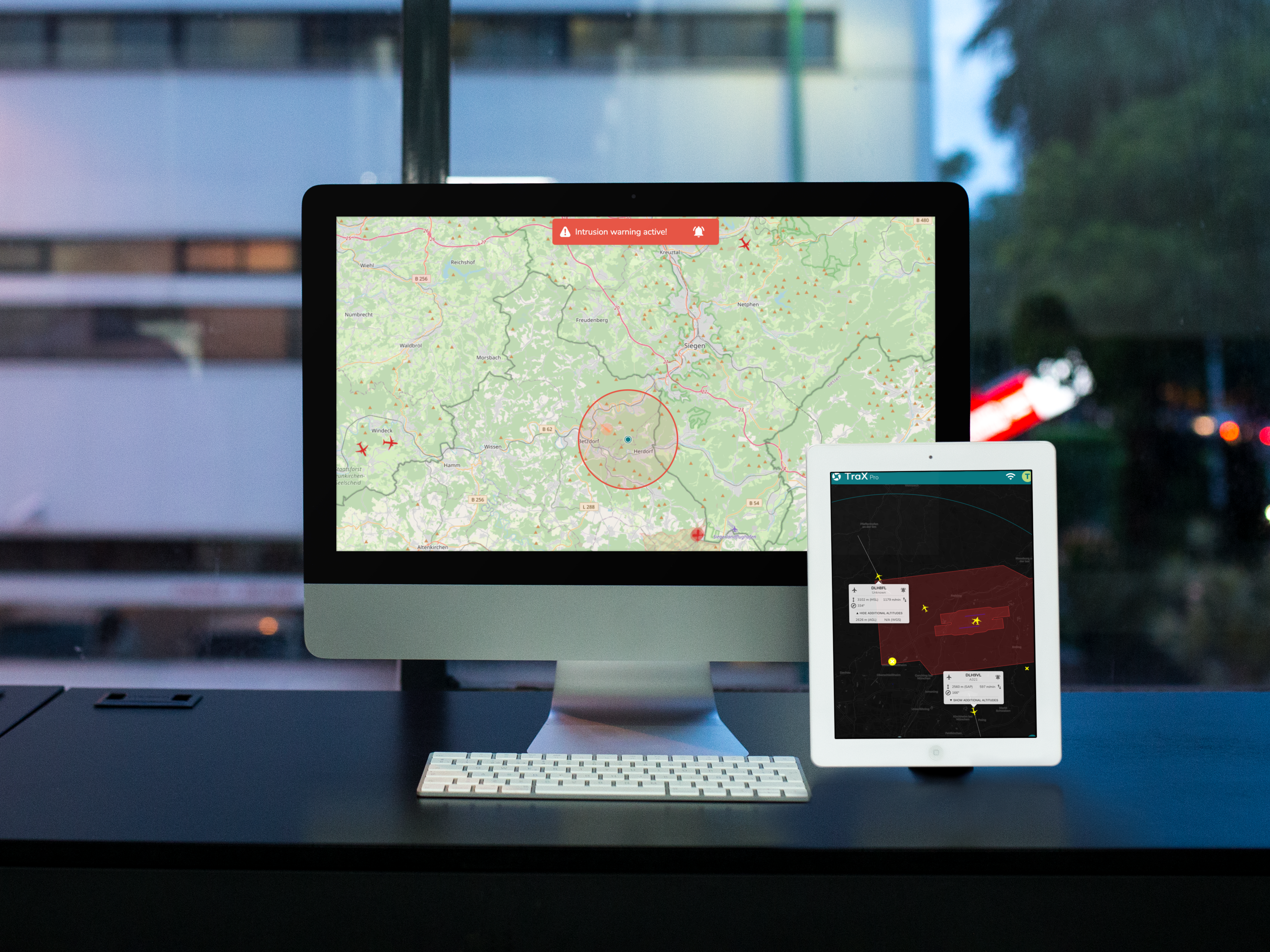
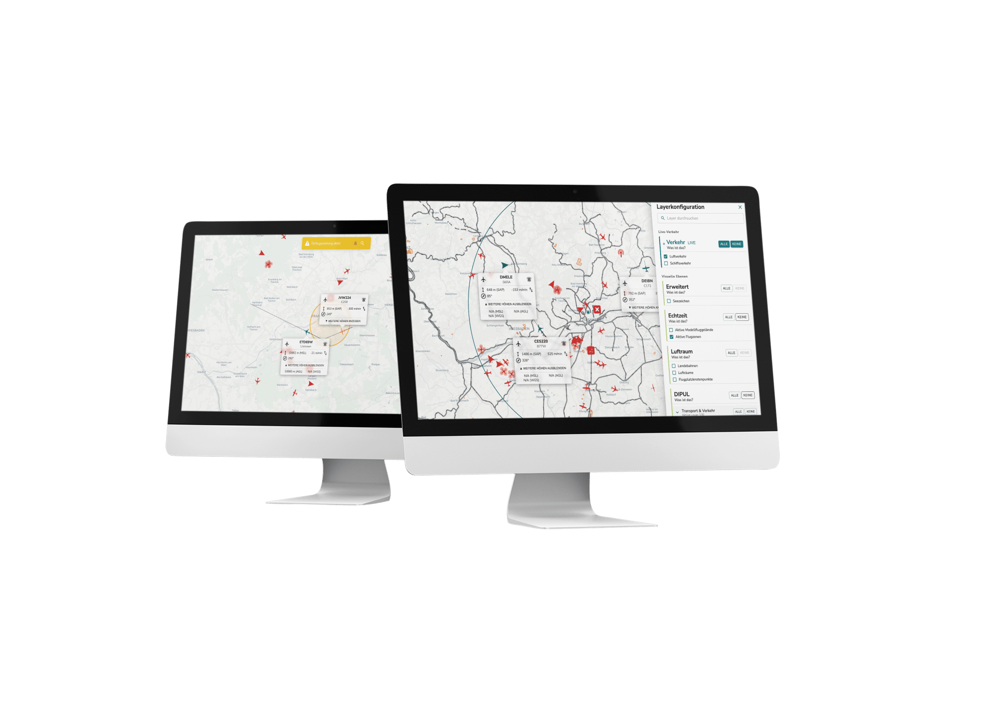
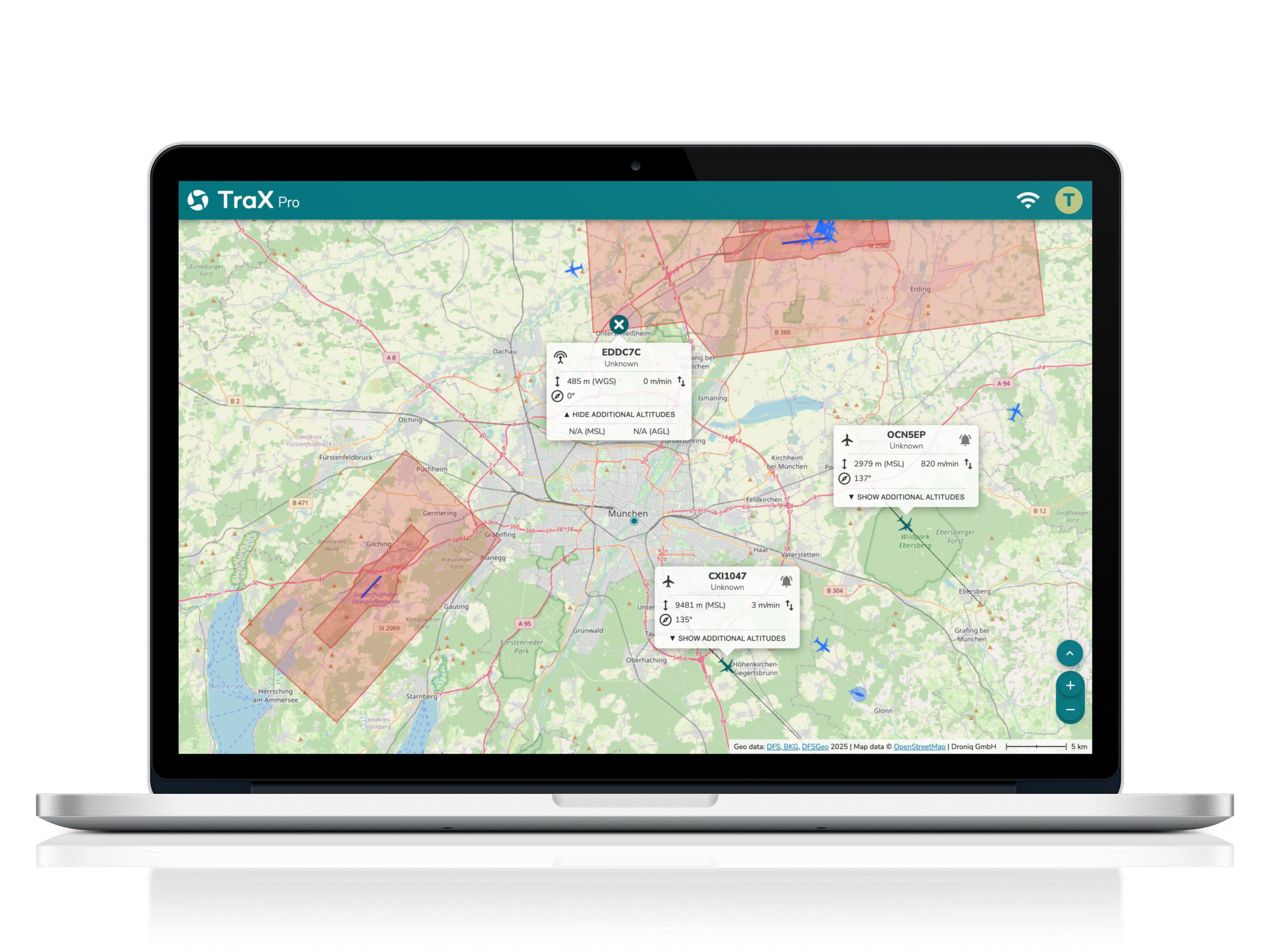
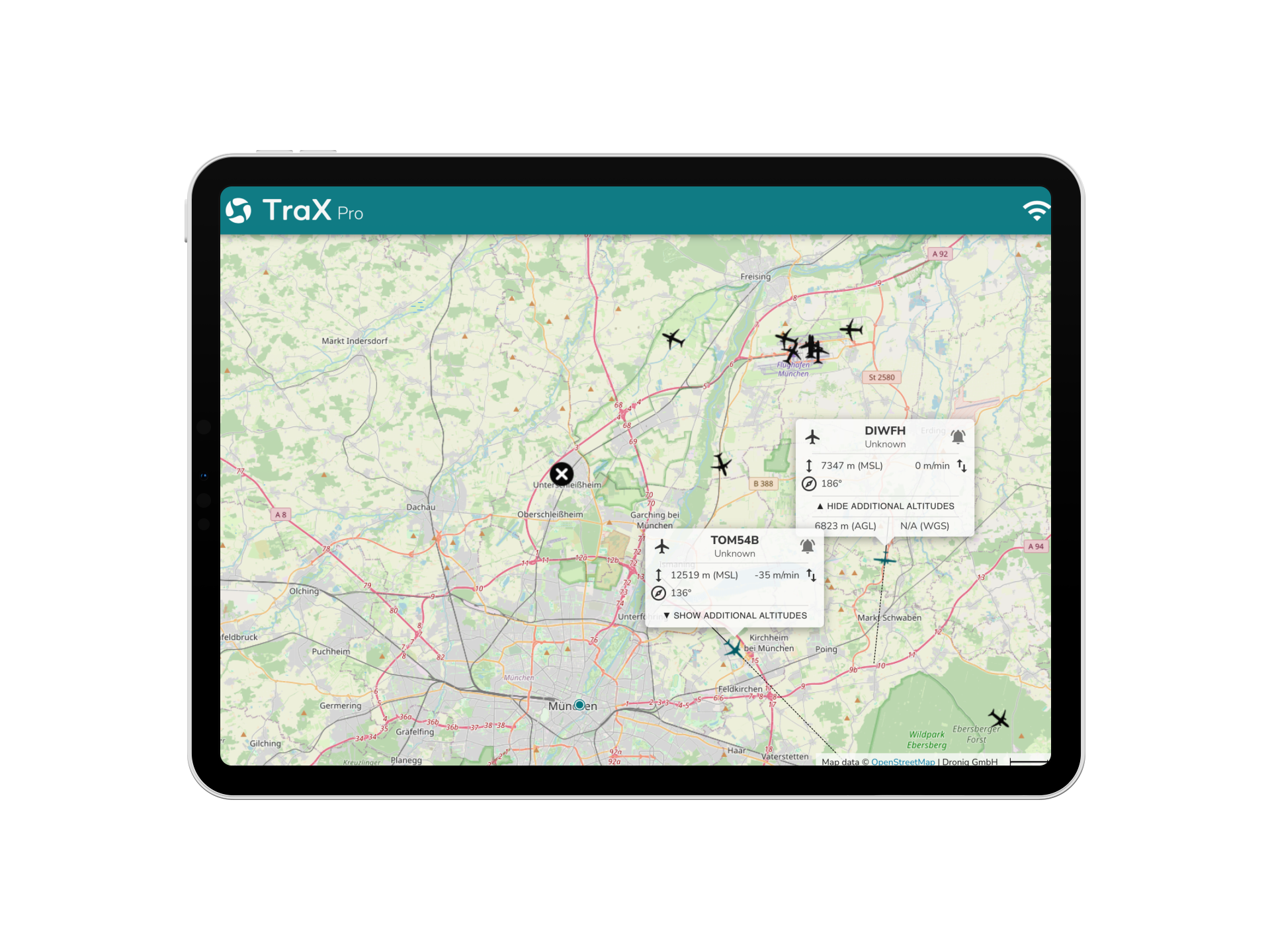
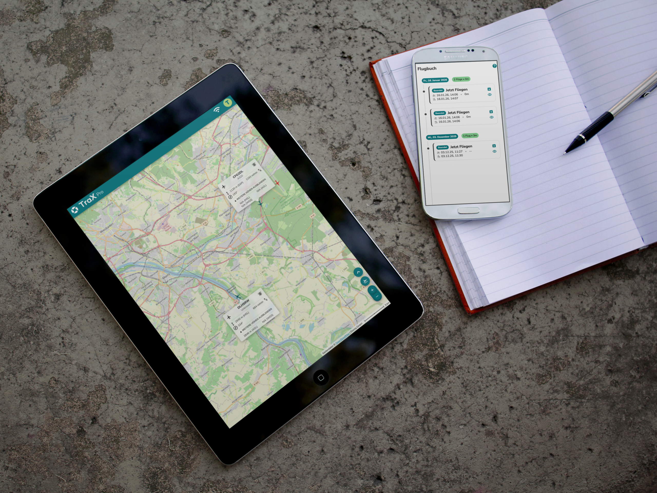
TraX Pro gives you an overview of all traffic in your area of operation: whether live traffic, air traffic or ship movements via the Automatic Identification System (AIS) - all relevant data is displayed in real time.
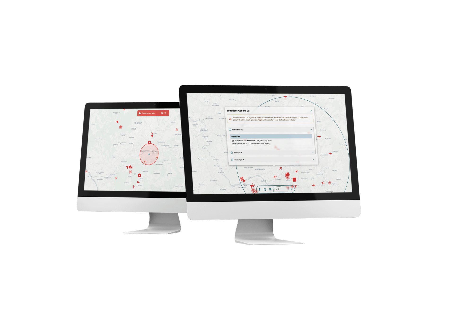
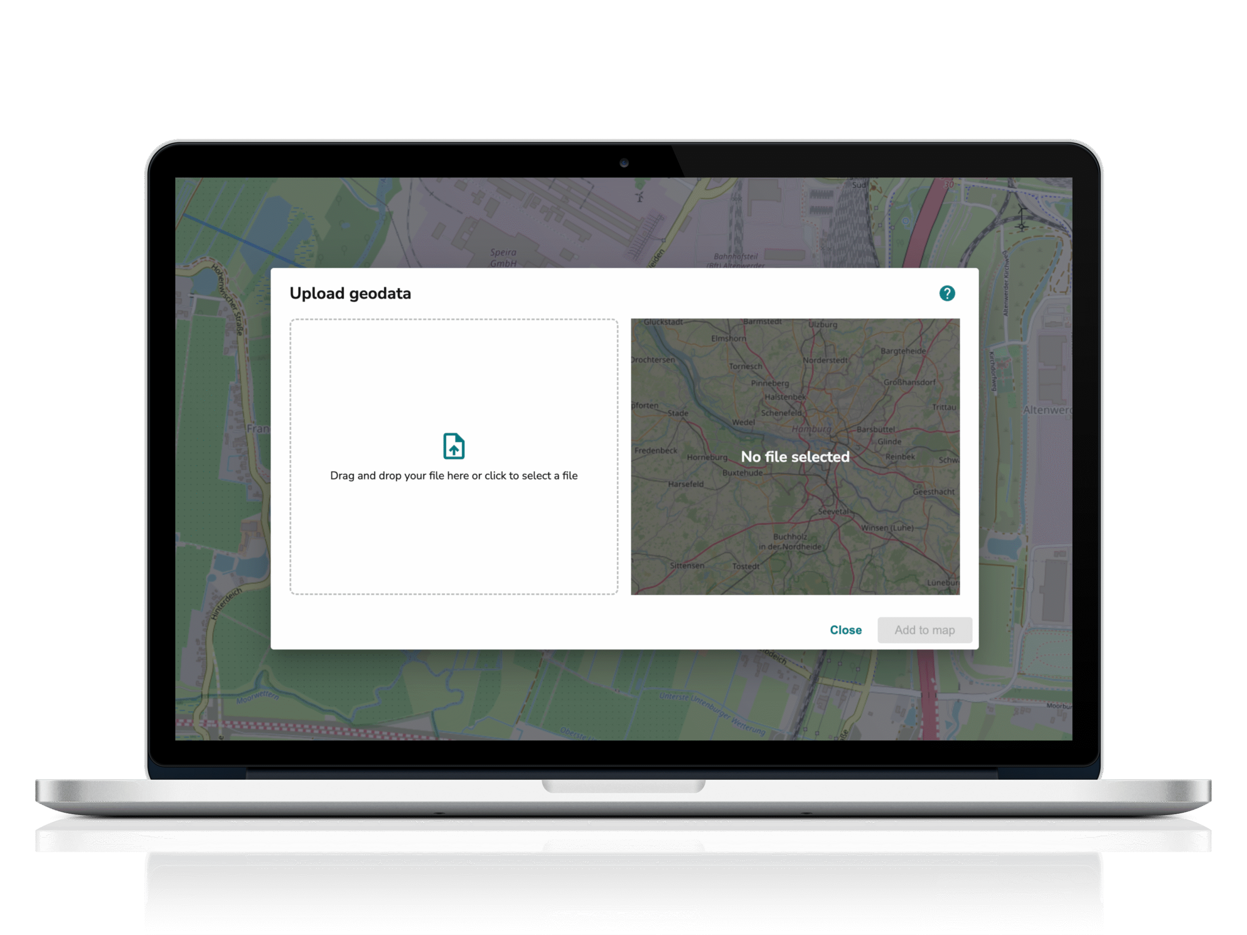
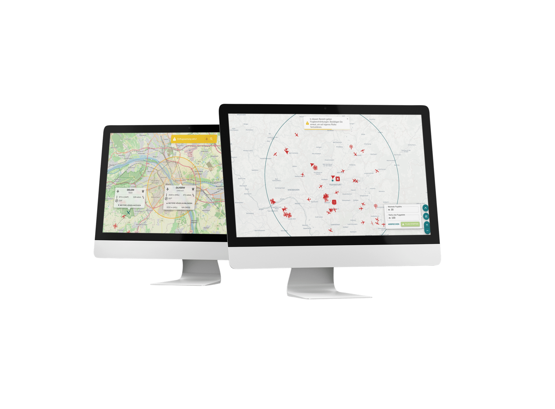
Set the center of your reception area flexibly: automatically via GPS on your end device, manually on the map or by searching for an address using free text. This allows you to monitor a targeted radius of up to 50 km.
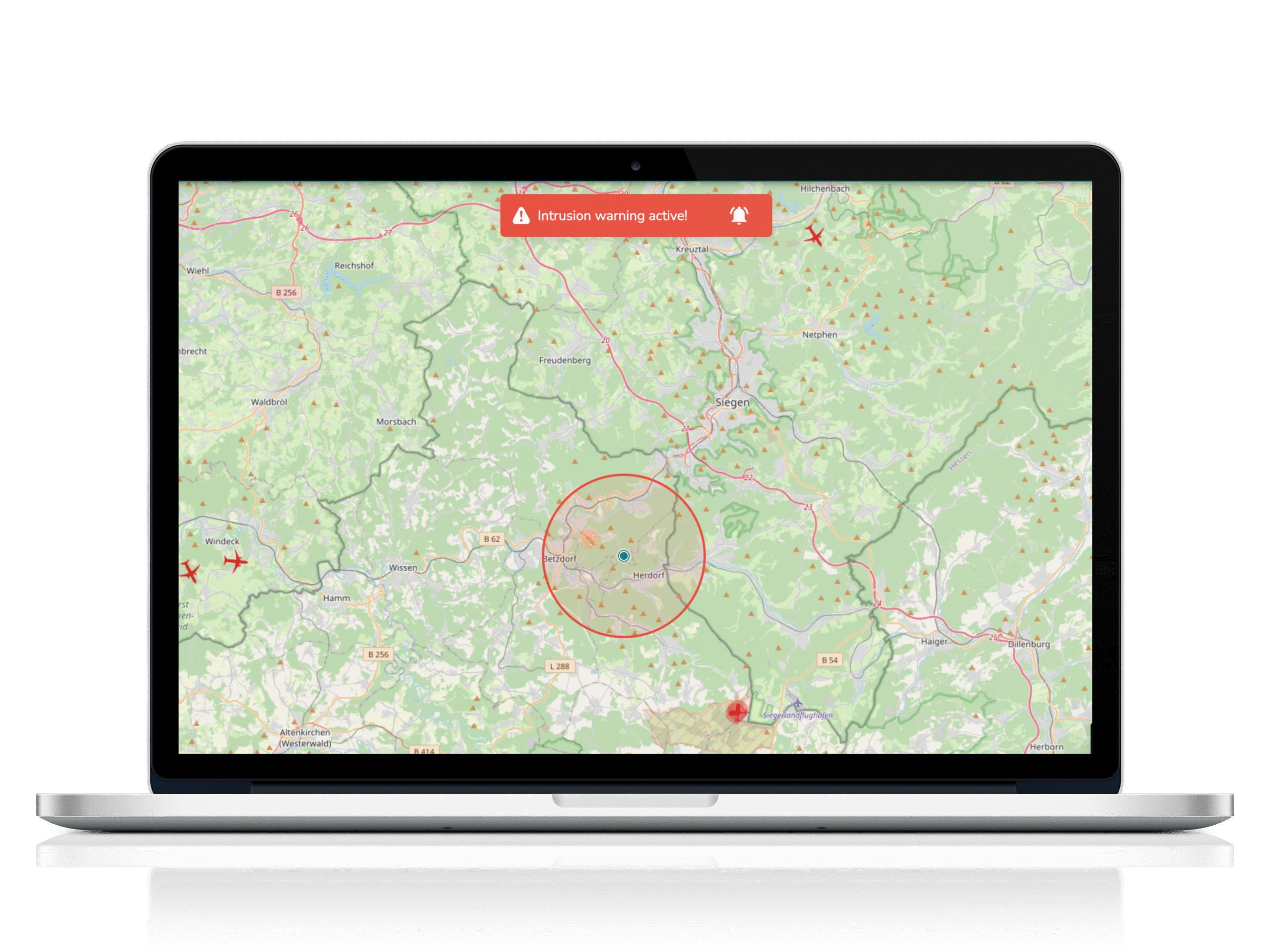
Track individual aircraft, specify whether the warnings should be based on the current location or a target, and exclude specific flying objects from approach warnings if required. For maximum safety and perfect adaptation to your operational situation.
-
BVLOS operation - compliant and reliable implementation
TraX fulfills the TMPR requirements for risk class ARC-C and creates the basis for approvable BVLOS missions in the Specific Category. With reliable airspace surveillance and full EASA compliance, you can operate safely beyond visual range at all times.
-
Settings & display - everything according to your specifications
Customize TraX Pro to suit your individual requirements. The user-friendly settings allow you to specify which display units are used, which colors your icons have and which content appears in tooltips and pop-ups.
Activate or deactivate advanced features as required, define permanent vectors and determine their length in seconds (AIR) or minutes (AIS). Set your altitude preferences and filters to see only the aircraft relevant to you.
Choose between German and English and use TraX Pro optimally on both desktop and mobile devices - for full control and a perfect overview, wherever you are working.
-
Detect & Avoid - react immediately, act safely
With TraX Pro, you are always optimally warned: thanks to Intrusion Alerting, you can recognize early on when an aircraft is approaching your area of operation. Activate visual warnings directly on the map and supplement them with audio alerts so that no critical event goes unnoticed.
Customize the warning mode and the size of the warning cylinder exactly to your operating conditions. You can also specify that the display remains permanently switched on so that you can see all the information at a glance at all times.
This means you always remain alert and can react in good time - for maximum safety in every application.
-
Tools & miscellaneous - practical helpers for your operations
The integrated tools in TraX Pro give you even more options: Measure distances directly on the map and retrieve the coordinates of any position quickly and easily. This allows you to plan and document your operations even more precisely - and always have all relevant data under control.
How TraX Pro works:
Our competences
Awarded several times
Multiple awards in the areas of safety, traffic and innovation.
Practice
tested
Flown more than 12,000 km of route beyond visual line of sight (BVLOS).
Full Service
Solutions
Droniq enables efficient and safe drone operations for BOS & industry.
Real
Experts
More than 100 years of know-how in aviation & telecommunications.