20% promotional discount with the voucher code DQ4ACADEMY24 on
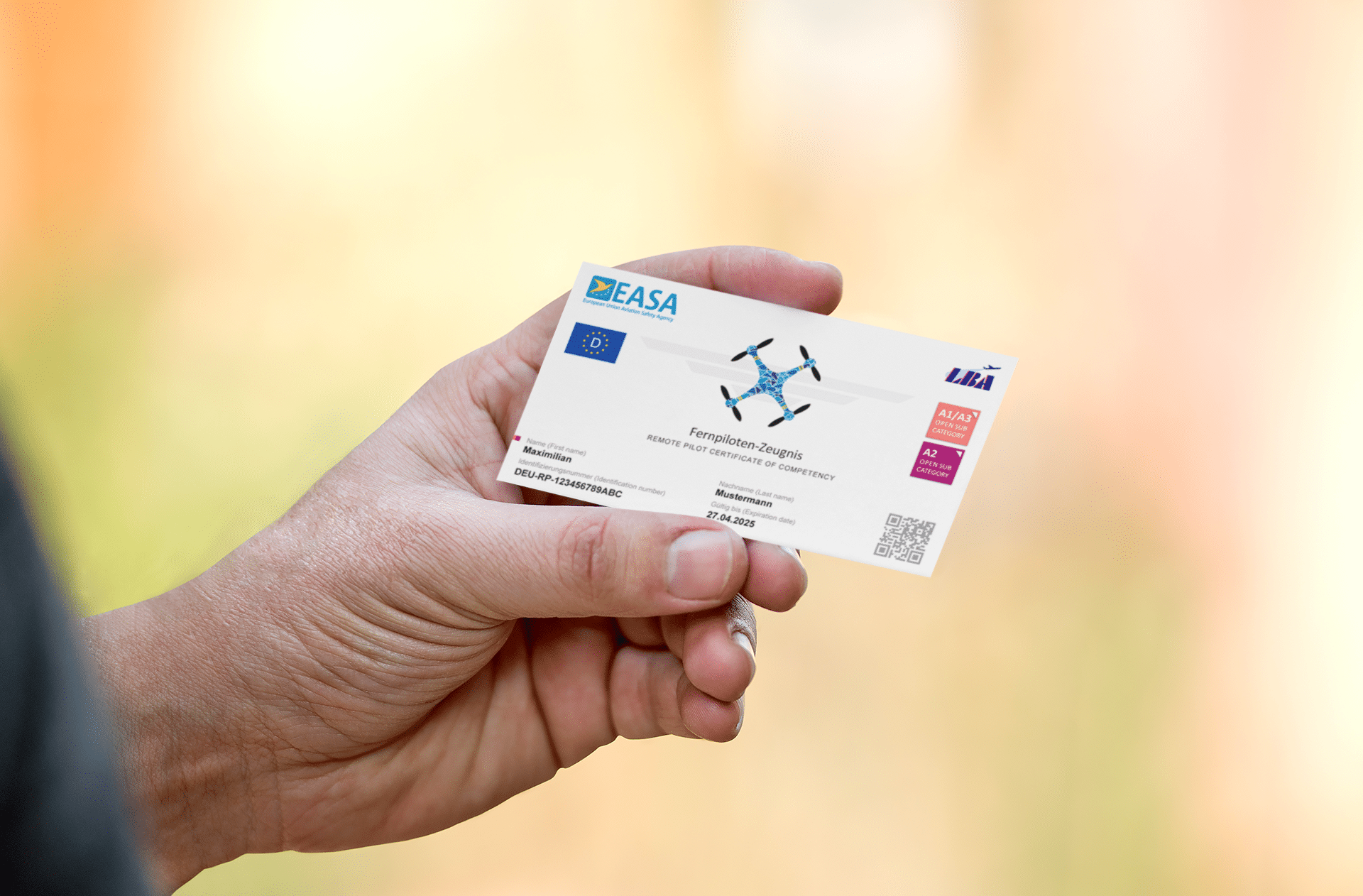
Remote pilot certificate A2 & BOS knowledge for remote pilots


FAQ
Make your choice
Company
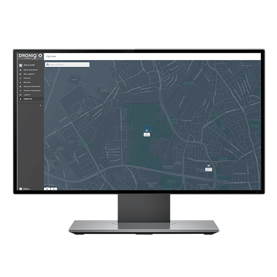
What is Droniq?
Droniq sees itself as the leading digital platform for unmanned aviation, enabling meaningful professional drone flights safely and in compliance with applicable regulations. To this end, Droniq GmbH combines the aviation expertise of DFS with the mobile communications expertise of Telekom. With its UAS Traffic Management System (UTM) based on innovative mobile communications technology, Droniq offers a solution that safely and sustainably integrates drones into the airspace and enables flights beyond visual range.
Who is behind Droniq?
With the joint venture Droniq GmbH, a joint company between DFS and Telekom was established at the beginning of 2019. The business objective is to provide, market and sell services for drones and other unmanned aerial vehicles in Europe. On the part of DFS, the subsidiary DFS International Business Services GmbH (DFS IBS) holds 51 percent of the shares, while Deutsche Telekom has a 49 percent stake via its company Telekom Innovation Pool GmbH.
Since January 1, 2019, the Managing Director of Droniq GmbH has been Jan-Eric Putze, previously Managing Director of R. Eisenschmidt GmbH. Also managing director on the part of Telekom is Ralph Schepp, previously Vice President for Technology Innovation at Telekom AG.
Jan-Eric Putze is a banker, commercial pilot and flight instructor and joined DFS as a consultant in 2007. In 2014, he moved to R. Eisenschmidt GmbH, where he has held the management position since 2016.
Ralph Schepp holds a degree in business administration and has worked in the IT and telecommunications industry for more than 15 years. Within Deutsche Telekom AG, he most recently headed the Technology and Spectrum Strategy units for the Group.
Droniq GmbH is based at the Europaturm in Frankfurt (address: Ginnheimer Stadtweg 88, 60431 Frankfurt).
Which shareholders support the company?
DFS and Deutsche Telekom launched the Connected Drones research project in September 2016. The aim was to integrate unmanned aircraft systems (UAS) safely and efficiently in ground-based airspace using mobile communications. Various tests were conducted to prove that unmanned aircraft can be located and monitored via the mobile communications network even beyond the range of vision of the pilot in control. DFS developed a UAS Traffic Management System (UTM) to display and process the position data of the aircraft. This is based on the PHOENIX air traffic control system, which is used worldwide in the air traffic control sector. DFS is considered a pioneer in Europe in the field of UTM development. "Connected Drones" was also awarded the 2018 Mobility Prize. The project was successfully completed with the foundation of Droniq GmbH on December 17, 2018.
The DFS Deutsche Flugsicherung GmbH is a federally owned company organised under private law, which ensures safe and punctual flight operations with its approximately 5,400 employees (as of 31 December 2018). The approximately 2,000 air traffic controllers guide up to 10,000 flights through German airspace every day, or about three million a year. This makes Germany the busiest country in Europe. The company operates control centers in Langen, Bremen, Karlsruhe and Munich, as well as towers at the 16 international commercial airports in Germany.
The Deutsche Telekom AG is one of the world's leading integrated telecommunications companies with around 178 million mobile customers, 28 million fixed-network lines, and 20 million broadband lines. It offers fixed-network/broadband, mobile communications, Internet, and Internet TV products and services for consumers, and information and communications technology solutions for corporate and business customers. Deutsche Telekom is represented in more than 50 countries. In the 2018 financial year, it generated revenue of EUR 75.7 billion with around 216,000 employees worldwide - around 66 percent of this outside Germany. (as of Dec. 31, 2018)
Droniq App
If you have any specific questions or suggestions regarding the Droniq app, please do not hesitate to contact us at feedback@droniq.de.
General questions
Why do I need the Droniq app?
The Droniq app, whose predecessor was the DFS drone app, makes drone flying in Germany safer and easier. The Droniq app helps remote pilots to comply with applicable laws and regulations when planning and executing flights and not to endanger anyone unnecessarily.
Who is the app suitable for?
The Droniq app was developed for hobby and recreational pilots. However, additional functions, such as the logbook function, make it an ideal tool for safe drone flight for professional pilots as well.
For users with their own account: What functions does the Droniq app offer?
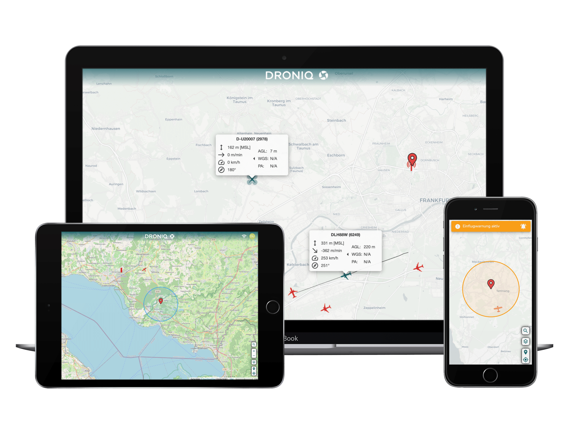
The Droniq app supports remote pilots in safe and easy flight planning as well as flight execution. Remote pilots planning a flight can use the Droniq app to check in real time whether an airspace is free for drone flight, is subject to restrictions or is closed. In addition to airspace-relevant data, the map displays typical infrastructure such as hospitals, police stations, etc., and warns if the distance is too short.
Further map information can be shown and hidden user-defined. The logbook function clearly displays flights that have already been carried out. In addition, the Droniq app is compliant with the new EU regulation and takes into account the associated regulations and requirements for drone flight.
Which functions of the Droniq app can I use without registering for them?
You can use the Droniq app to have the airspace validated or checked.
Do I necessarily need the Droniq app to fly drones?
No, drone flight is possible even without the Droniq app. However, the Droniq app helps you comply with applicable laws and regulations and not endanger anyone unnecessarily, making drone flights safer and easier to perform.
Does the Droniq app already refer to the new EU drone regulation?
The Droniq app is compliant with the new EU regulation and takes into account the accompanying regulations and requirements for drone flight.
Does the current EU regulation on which the Droniq app is based correspond to the final status?
The Droniq app complies with the current status of the EU regulation. This is currently being reviewed by the BMVI and, if necessary, extended by national rules. If changes are made regarding regulations and requirements for drone flight, we will include them in the Droniq App as soon as possible.
Which drones are listed in the Droniq app?
The Droniq app includes all popular drones and drone brands, but is continuously updated with new models.
In which countries can I use the Droniq app?
The App and the information and results to be output by it are intended and programmed by Droniq exclusively for use in the Federal Republic of Germany.
Questions about the user account / registration
How do I set up an account?
When you start the Droniq app for the first time, you will be offered to create an account right at the beginning. If you want to create an account later, you have to click on "My account" in the menu. From here you will be redirected to the registration.
Can I use the Droniq app with only one account?
No. You can also use the Droniq app without an account. However, not all functions are available to you in this case.
How can I delete my account?
Please write an email to feedback@droniq.de with the subject "Delete app account". In the email, please include your registration name and the email address used for registration. We will then delete your account. After the account has been deleted, you will receive an email from our support team.
I receive the message "Failed: An error occurred during registration. If you are already registered, you have received an email with an activation link." What do I need to do?
First of all, please check if the registration mail has landed in your spam folder. If this is not the case, we would like to ask you to reset your password. Please go to the option "Reset password" and enter a new password.
If this does not help, it may be a very individual problem. In this case, please send us an email to feedback@droniq.de with information about your phone model, operating system and whether adblockers are installed. We will take a look at the situation and get back to you as soon as possible.
Questions about ads in the Droniq app
The entire map is displayed in light red. Does this mean that drone flights are not allowed in this area?
No. The display only means that you are in an airport control zone. Drone flights are possible in this zone, provided that the current flight regulations are adhered to. It should be noted that the maximum flight altitude in civil control zones is 50 meters. In military control zones, flight is generally not permitted.
Red circles are displayed in the map view. What do they mean?
The counties delineate an area with a radius of 1.5 kilometers around an airfield. In this area, private or commercial drone use is generally prohibited.
How do I know what specifications to consider when planning a flight?
Information on the individual presets is available via the "Flight allowed"/"Flight prohibited" display in the main window. Tap on these to access the presets overview.
Flight specifications that are complied with within the current flight planning are displayed in green. Guidelines that the user violates and due to which the flight is not displayed as green are marked in red. Shown in orange are general instructions for the remote pilot to follow.
The user can obtain further information by additionally tapping on the symbols. Here, too, the individual subheadings are clustered in green (currently observed), orange (must generally be observed) and red (violation of the rules).
For some flights, the app shows me "Flight permitted" with a green background, and for other flights it shows "Attention" in orange. What is the difference here?
In both of the above cases, the user is allowed to fly with the drone. If there are no restrictions for the flight, the validation is displayed in green.
If the remote pilot still has to pay attention to additional aspects during the flight, such as obstacles, the flight permission is displayed in orange. Tapping the display takes the user to the specifications overview. The symbols listed here and colored in orange refer to what the remote pilot must pay attention to during the current flight. For further information on the listed information, the user only has to tap the symbols individually.
What do the tiles displayed in green, orange and red refer to?
The tiles inform the remote pilot about specifications that must be adhered to during his flight. Flight requirements that he already complies with are displayed in green. Guidelines that the user violates and due to which the flight is not displayed as green are marked in red. Shown in orange are general instructions for the remote pilot to follow.
Example: Tile colors
In the flight parameters there are, among others, the choices "Open-A1", "Open-A2", "Open-A3" and "Limited open category". What is meant by this?
Via this display you specify in which category you start with the drone. The categories are based on the new EU Drone Regulation, which provides detailed information on the category in which remote pilots are allowed to fly, with a view to the planned flights and the drones used.
For more information on the classes, visit our EU Drone Regulation website.
What kind of background maps are available in the Droniq app and how can they be selected?
The Droniq app offers the background maps "Standard", "Dark" and "Satellite". The user can access the selection via the corresponding layer symbol. This is located in the upper right corner of the map display.
Is it possible to customize the map display in terms of the airspaces displayed?
Yes, the Droniq app has several display options (including controlled airspace and restricted airspace). The display options are activated by default in the Droniq app, but can also be switched off individually for a better overview. You can access the selection via the map icon. This is located in the upper right corner of the main window of the Droniq app.
Why does the language selection not work properly?
We are already aware of the error and are working on fixing it. For a short-term fix, please switch to "English" in the language selection briefly and then select "German" again.
Questions about the implementation of a flight
What do I need to do to prepare a flight and validate the flight space?
First, use the app's map function to select the area where you want the drone to fly. Using the search function (indicated by a magnifying glass icon), you can also enter the exact location where the flight should start. To narrow down the area as precisely as possible, the app offers several drawing functions via radius, polygon or free route in the menu displayed below the map.
The menu below the map also lists other parameters that must be specified for flight validation. These include the maximum altitude planned for the flight, the planned flight duration, the drone used and the category planned for the flight.
Once all parameters have been entered, the app checks whether a flight is possible in the selected area. After a short time, the user receives feedback as to whether the flight is permitted (green display) or prohibited (red display). In the event that the flight can take place, but the remote pilot has to take into account specifications for his flight, the information "Attention" is displayed in orange.
How do I start a flight?
When you have received the feedback that the planned flight is allowed and you want to start flying, press the "Fly now" display window. This is displayed in the Droniq app on the main screen, at the bottom of the map.
What happens when I start a flight?
The airspace used by the remote pilot will be visible in the app for the period of his flight and other users will be warned regarding an ongoing flight.
Step by step guide to using the Droniq app
1. registration
To use the Droniq app for flight planning and flight execution, you need a user account. A corresponding registration is offered at the first start of the Droniq App, but can also be done in the menu (icon with three dots in the lower area of the main window) under the option "My Account".
2. drone registration
For flight planning, you must specify which drone you are flying with. A first query takes place during registration. The registration of multiple drones is also possible. The drones can be viewed, adjusted and expanded at any time under the pilot icon and the "Configurations" tab.
Is it possible to register a self-made drone?
Yes, it is possible! Under "Select brand" you can select your own brands (e.g. self-built).
Is the corresponding class automatically displayed after registering the drone?
No. You must register your drone and then manually select the corresponding class. You can find more about the classes here.
3. flight planning - planning departure point
Flight planning takes place via the main window of the Droniq app. Using the map section shown here, you can select the planned position for the drone flight with the touch of a finger. As soon as you tap the map, a circle appears around the tapped point. The circle indicates the current radius in which you can fly the drone. You can adjust the radius at any time.
In the main window, all you have to do is go to the drawing function shown in the bottom menu. This is located below the drone selection. If you prefer to define the area to be flown over by hand, the corresponding drawing functions are available here.
4. flight planning - setting the other parameters
After selecting the planned flight area, set the other parameters required for the flight. These are located in the lower display of the main window. The parameters include the maximum flight altitude, the planned flight duration and the flight class you are in. In addition, please select the drone with which you want to perform the flight.
5. flight validation
After all parameters have been entered, the app checks whether the drone flight is permitted or whether it violates regulations. If the flight is approved, the red background "Flight prohibited" on the main screen changes to the green background "Flight permitted" or the orange background "Caution".
The "Flight enabled" display indicates that you can fly the drone without restrictions within the scope of the current flight. The "Attention" display indicates that you must consider some points within the scope of the flight. Tap the "Attention" indicator with your finger to go to the specifications overview. The information to be considered within the scope of the current flight is listed in orange. Tap on one of the symbols to obtain further information.
6. change of flight planning
You can change the flight at any time during the planning process using the available parameters. The Droniq app then checks whether the flight can take place in compliance with all regulations.
7. start flight
After you have been given permission to fly, press the "Fly now" or "Attention" display. You will then be asked again whether you want to take off as part of the "Take-off" information. You start the flight by tapping "Yes".
The app then switches to the flight screen and shows you only the current map area. In the upper area of the cell phone display, a time display gives you an indication of how long you have been flying.
8. land drone
You end the flight by pressing the "Land" button on the flight screen. This is located at the bottom of the screen.
9. flight evaluation
When you finish the flight, you will automatically enter the evaluation screen. Here you get information about departure, landing and flight time. In addition, you can rate the flight using the smileys displayed. Furthermore, you can give the flight an operation name and enter additional information about the flight under the menu item "Description". The records end up in your logbook.
10. compare previous flights
To do this, call up your logbook via the main menu. All flights performed are listed here.
Questions about data, data use and liability
What data do I have to provide to register in the Droniq app?
For registration, the e-mail address and the first and last name of the user are required. Other information, such as the address, is optional.
Is there any other data necessary for using the Droniq app?
Further data is required to register drones in the Droniq app. Here, too, only a few details are required. This is limited to the drone brand, the series of the drone and its take-off weight. Other information, such as the serial number, is optional.
What kind of data is stored when using the Droniq app?
If permitted, the GPS position of the user is used to determine his current location. In addition, data is only stored as part of the installation, for example, the version of the operating system.
What happens to the collected data?
The data will be used to continuously improve the Droniq app in terms of functionality to further increase the safety of remote pilots using it.
Who stores my data?
The data is stored by DFS Deutsche Flugsicherung GmbH, one of the two mothers of Droniq GmbH.
Is the data stored in Germany?
Yes. The servers for data storage of DFS Deutsche Flugsicherung GmbH are located in Langen near Frankfurt.
What happens if the Droniq app tells me I'm allowed to fly the drone when I'm actually not?
The pilot of an unmanned aerial vehicle is responsible for the operation of his unmanned aerial vehicle. Droniq GmbH therefore assumes no liability for incorrect validations. The information required for the function of the app is compiled by Droniq GmbH to the best of its knowledge and belief. For more information, please refer to the Droniq App user agreements, chapter 7.
Questions about the installation of the app, system requirements, updates and costs
For which systems is the app available and where can I get it?
The Droniq app is available for iOS and Android devices. It can be obtained from the Apple App Store and the Google PlayStore.
What are the minimum system requirements for using the Droniq app?
If the Droniq app is used via an Apple device, the user needs at least iOS 8.0 or higher. For Android devices, the user needs at least Android 4.4.
I have completed the registration, but I do not receive a confirmation email. What do I need to do?
The confirmation email will be sent to the email address you provided during registration. Please check your spam folder if the email does not appear in your inbox. If there is no email here either, please contact our support.
I used to use the DFS drone app and agreed to migrate my data to the Droniq app. When will this take place? Will there be a time delay between the installation and the migration of my data?
No, there will not be a time delay. The migration of the data will take place at the launch of the app. As soon as you log in to the app, your previous data should be migrated into it as well.
Will there be regular updates for the Droniq app?
The Droniq app is continuously improved and enhanced with new features as part of updates. You are also welcome to make suggestions via the feedback function.
Are there any costs associated with using the Droniq app?
The Droniq app can be downloaded free of charge from the Apple App Store and the Google Play Store. The only costs incurred are the usual data transfer costs for the use of apps.
Are there plans for a paid version of the Droniq app?
In the future, there will be a chargeable Pro version, especially for BVLOS flights, which will also include a live air situation. We will keep you informed about this.
UTM service
What does the UTM service offer?
Droniq offers a service package for drone flights beyond visual range in compliance with regulations. To this end, we provide Germany's first fully operational UAS Traffic Management System (UTM) to integrate drones safely and efficiently into the airspace.
What are the possible applications?
Droniq's UTM can be used by the following customers:
- Commercial tax
- Controllers flying out of sight (e.g., for route inspections, pipeline flights, etc.).
- Authorities and organizations with security tasks (BOS) such as fire departments, police forces and rescue teams or their operations managers and/or control centers (e.g., for rescue operations)
- Authorities that use the UTM to issue ascent permits in digital form, but can also define no-fly zones themselves (e.g. during major events).
- Users from the general aviation environment, for whom an air situation display down to the ground is of interest.
What is special about Droniq's offer?
For all phases of flight (pre-flight, in-flight and post-flight phase), the UTM provides authoritative services for the safe operation of UAS in airspace.
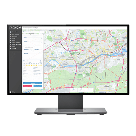
In the pre-flight phase, the operator can register in the UTM, plan his mission and cross-check it (Are no-fly zones / airspace restrictions present? Are there other registered aircraft movements? Do I need an ascent permit or a SORA?).
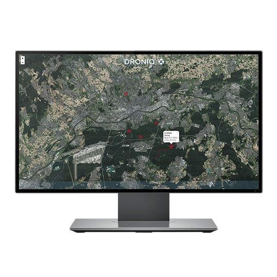
In the in-flight phase, the operator can track his drone in real time and observe other aircraft in a combined aerial situation display, including those outside the user's line of sight (manned as well as unmanned registered in the UTM). He also receives real-time data such as photos or videos as needed.
The UTM components of the post-flight phase help with the evaluation and follow-up of the flight (e.g. maintenance of the logbook, incident management, battery management).
How much does the UTM service cost and how quickly is it available?
There are various performance-based pricing models that vary depending on the flight project (data volume required, length of flight route, frequency of flights, hardware required). The entry-level price for the UTM service is 125 euros per user per month. This UTM usage license is billed annually or semi-annually.
The HOD is sold with a lifetime FLARM® license. The sales price still includes data connectivity for the first year from the date of purchase. From the second year on, an annual service fee of 80,- Euro per device is charged, which includes firmware updates. Depending on the order quantity, there are discounts on the list sales price of 2,300 euros per device.
Commercial and public customers can also rent the HOD for a limited time for test projects. Especially for regular operations and BVLOS flights it makes sense to install the device permanently in your aircraft. Please contact us so that we can offer you a solution tailored to your needs!
How fast is the UTM service available?
Delivery times vary and depend on the desired service package and the maturity of your project. If it is a standard order (1 UTM access and 1 HOD), we can usually provide software and hardware within a few days in Germany.
What hardware does the UTM service include?
The UTM service includes on the one hand the HOD. This is delivered together with a power bank for independent power supply, all necessary antennas and material for mounting on the aircraft. You will also receive comprehensive information on how to attach the HOD to the aircraft and the optimal alignment of the antennas.
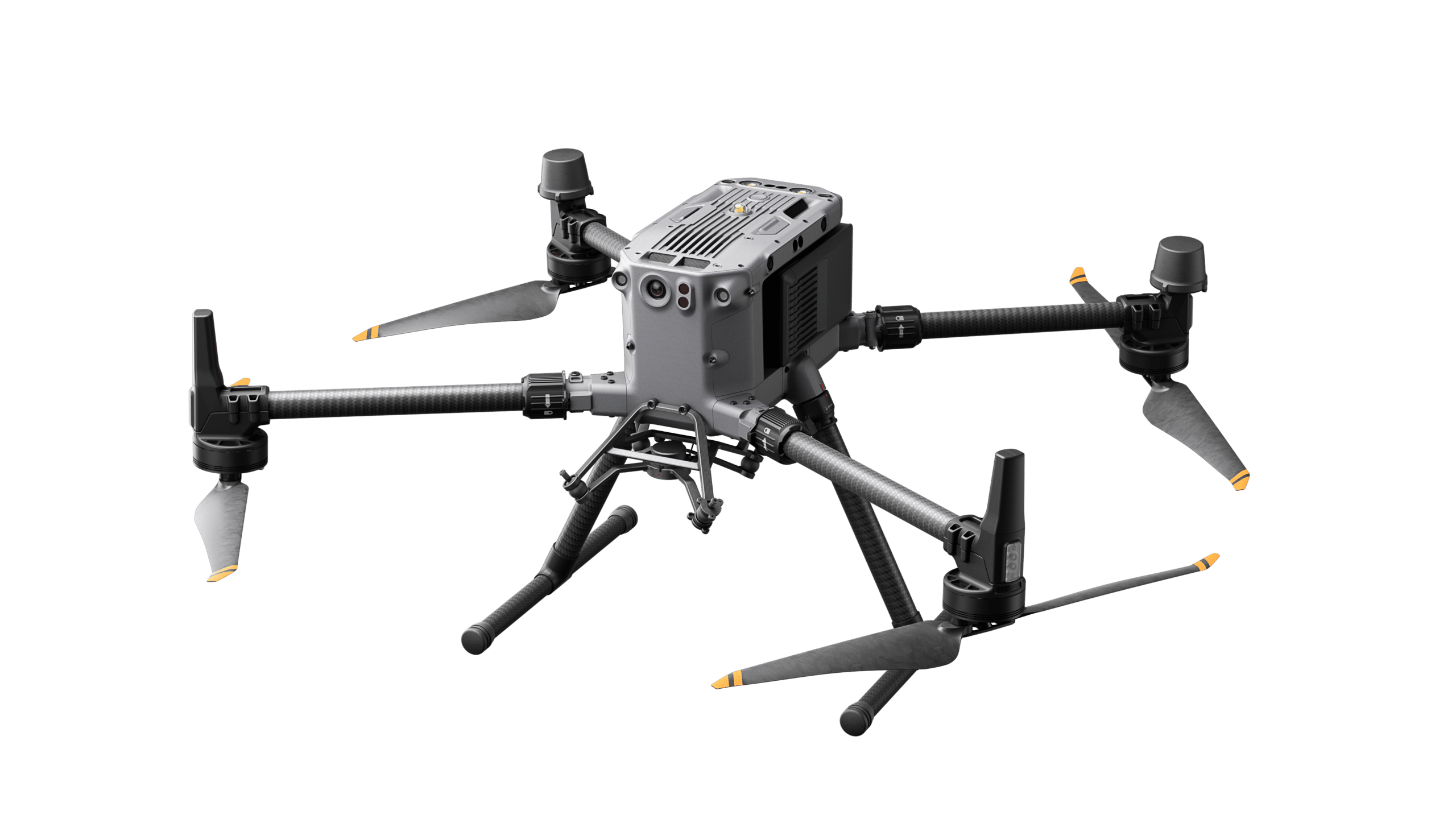
What is the HOD and when do I need it?
The Hook-on-Device (HOD) is a device for transmitting own position data for UAS. The HOD can be attached to any aircraft due to its low weight. It consists of an LTE modem with integrated SIM card and transmits its current GNSS position via LTE to the UAS Traffic Management System (UTM) of DFS Deutsche Flugsicherung. The device is capable of detecting FLARM® and ADS-B signals from surrounding air traffic and sending this to the UTM in addition to its own position. The own position as well as relevant air traffic in the vicinity are displayed to the remote pilot in a web-based way via the UTM tracker. At the same time, the HOD transmits its position via FLARM®. In this way, the aircraft is also visible to other road users in the vicinity who use FLARM®. The HOD can be used especially for flights beyond visual range of sight (BVLOS). This means that the pilot always has an up-to-date picture of all aircraft movements in the vicinity of his aircraft. However, the use of a HOD is also useful for flights in a smaller radius, but which take place in an urban area or an area with a lot of air traffic (e.g. near an airport), to ensure safe flight operations.
What is the GBSAS and when do I need it?
The mobile traffic receiving station (Ground-Based Situational Awareness System, GBSAS) is used to support UAS operations and provides the user with an aerial situation picture in the area around the mission site. The mobile station receives FLARM® and ADS-B (Automatic Dependent Surveillance - Broadcast) signals transmitted by gliders, helicopters, powered aircraft or other air traffic participants in the airspace. These signals are fed via LTE into the UAS Traffic Management System (UTM) of DFS Deutsche Flugsicherung. With UTM web access from Droniq, the remote pilot can view all data in its entirety. This provides the UAS controller with a permanent up-to-date display of the air traffic in the vicinity of his UAS operation. Particularly for UAS flights beyond the controller's line of sight (BVLOS), the system supports airspace observation and avoidance of other aircraft. When operating in conjunction with a Droniq Hook-on-Device, the redundant communication of LTE and FLARM® increases safety for the user. A GBSAS can be purchased mobile or stationary from Droniq. The mobile devices have an independent power supply and can be placed along a flight path, for example. The stationary devices are weatherproof and require an external power supply. Their use makes sense if a specific area is to be flown permanently in BVLOS operation.
Who is developing the UTM?
Droniq's service is developed by its own staff, and experts from DFS and Telekom are also available to answer questions about UTM development or mobile connectivity. The UTM is being developed primarily by DFS and the Belgian software company Unifly.
Where is the UTM service already in use?
The HOD and UTM service is already being used by various customers in the energy supply, chemical or construction industries. Likewise, it has been used in various research projects on drone flight. Learn more on our page "Droniq Inside
Training & Examination
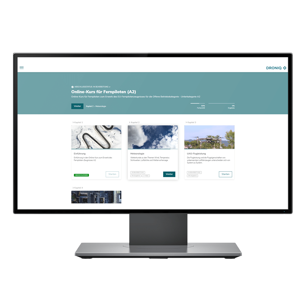
Why do I need the online training?
Droniq's online training provides you with optimal support in preparing for the remote pilot certificate. Regardless of time and place, you can work through the learning content and consolidate your knowledge.
How does the online training work?
After you have booked the online training from Droniq, you will receive the access data to the Online Academy in an e-mail. Here you can work through the learning content at your own pace and in your own time. At the end of each topic there is a short summary to test whether the learning material is correct. After all learning content has been worked through, the customer can check his knowledge himself using sample questions from the topics relevant to the exam.
How soon can I book an exam and where does it take place?
Droniq currently offers the exams for the drone driver's license as a face-to-face exam at the company's premises in Frankfurt and other locations in Germany. As a rule, exam dates take place several times a month. If you would like to register for an exam, you can view and book the current exam dates here.
How much does a drone license cost?
The exam for the drone licence costs 149 euros (incl. VAT). We recommend the exam in combination with the online training for a total of 198.40 euros (incl. VAT).
As a company, how can I qualify my drone controllers?
Droniq offers special package solutions for companies and larger groups. Companies from all business sectors can book practical training, face-to-face courses, online training as well as face-to-face exams with Droniq that are tailored exactly to their needs. In addition, Droniq offers special courses for organizations entrusted with the defense against hazards and security tasks, such as BOS forces (Behörden und Organisationen mit Sicherheitsaufgaben). The courses can be held at Droniq or at your own premises. Just contact us!
Are there special offers for BOS forces (authorities and organizations with security tasks)?
Drone pilots from the BOS sector (authorities and organisations with security tasks) such as the police, fire brigade and rescue service are exempt from many legal regulations that apply to commercial drone pilots if they use drones as part of their operation. Nevertheless, it is advisable to train the emergency services uniformly for drone operation. For this purpose, Droniq offers various package solutions as well as the online training BOS Basic Knowledge , which are based on the recommendations of the Federal Office for Civil Protection and Disaster Assistance (BKK).
How does the practical training work?
The practical training usually lasts one day. The first step is flight planning. This includes the aeronautical assessment of the ascent site, a NOTAM and weather briefing, a briefing on the practical flight exercises and short familiarization flights in a simulator. This is followed by flight preparation: the ascent site must be secured and the aircraft prepared. Then the participants practice practical flight exercises such as take-off & lift-off, climb or hover flight and the descent of certain flight patterns such as a prone figure eight. In a final proficiency test, the Droniq experts check the participants' learning success.
Do I need my own drone for the hands-on training?
Droniq has its own fleet of drones, in which the most common models are represented. This can be used for practical training, and it is of course also possible to bring your own aircraft.
Consulting & Expert opinion
What laws are relevant to drone flight?
The legal regulations for the operation of drones are governed by the German Air Traffic Regulations (LuftVO). The regulation was promulgated in the Federal Law Gazette on April 6, 2017 and came into force on April 7. It regulates the marking obligation, proof of knowledge as well as the operation of drones that requires a permit or is prohibited. More information can be found on the website of the BMVI (Federal Ministry of Transport and Digital Infrastructure).
When do I need an ascent permit?
For drone operation in prohibited zones or at certain altitudes, the controller usually requires an ascent permit from the responsible state aviation authority. Whether an ascent permit is required and which state aviation authority must be contacted for this can be queried via the DFS Drone App. This app is available free of charge in the Apple and Google app stores. The app answers the question "Where can I fly?" and is easy to use. Interactive map material from official sources and DFS shows for each location in Germany which rules must be observed there. For example, the app provides information about areas and facilities that may not be flown over or may only be flown over with restrictions (e.g. airports, hospitals, industrial and energy facilities or nature reserves). In addition, the app provides an overview of flights already made with a logbook function. You can find more information on the DFS website
For which questions does Droniq provide support?
First, Droniq experts check which requirements - such as an ascent permit - apply to your planned UAS flight. If a permit is required, we next check whether a separate risk analysis (SORA, from Specific Operations Risk Assessment) and a Concept of Operations (ConOps) need to be submitted prior to the application. If this is not necessary, we will work with you to complete the application.
If a SORA or ConOps is required for your flight, we will assist you in its preparation based on your individual prior knowledge and requirements. Additionally, we can train and qualify you for future applications if desired. If required, we can subsequently assist you with the selection of drones, technology and personnel, as well as obtaining air traffic control clearance from air traffic control, mission planning or other communication with authorities.
What is a SORA and when do I need it?
SORA (Specific Operations Risk Assessment) is a risk assessment for the use of UAS. SORA is used as a multi-stage risk assessment process and is intended to improve safety through the use of drones. Risk management is used to identify and mitigate hazards to people on the ground, other air traffic, and critical infrastructure. The SORA considers criteria such as area of operation, airspace, aircraft used, purpose of operation, and knowledge of the controller. A SORA is required when a general permit or simplified procedure is not possible for the proposed drone flight.
What is a ConOps and when do I need it?
The ConOps (Concept of Operations), also called mission description or operator concept, is a component of the SORA and includes, among other things, information about the organization, the controllers, the UAS, and a brief operational description. The scope of the ConOps is derived from the calculation of the risk classes from the SORA and is required if a SORA is required for drone flight.
How much does it cost to consult Droniq?
For our consulting management we work with a daily rate starting from 1.500,- Euro for our experts, which is charged depending on the effort.
How quickly is the advice from Droniq available?
Our consulting management is usually available within 14 days of order confirmation. This depends on the respective consulting scope and the availability of our experts.
When do I need an aeronautical or technical report?
If you have prepared a SORA and ConOps yourself for the application for a climb permit, the responsible aviation authority may request an expert opinion as to whether your assessments and described procedures reflect the planned operation. Our trained appraisers will prepare their appraisal for your project neutrally and independently and advise you on any problems that may arise in order to realize your project.
Are your appraisers publicly appointed?
No, our experts are not publicly appointed. We primarily prepare expert opinions under private law, but are gladly available to courts.
Do you also prepare appraisals?
No, we are specialized in aviation law appraisals and the risk of operating unmanned aerial vehicles. Therefore, we currently do not offer value assessments for e.g. insurance companies.
Drone Leasing
What terms are offered when leasing a drone?
Leasing for drones is possible for 24 or 36 months. The lease term is extended by another 12 months if not cancelled in time (6 months) by the end date.
Who can use the leasing offer?
Drone leasing is intended exclusively for commercial customers. Ideally, the lessee should have been active in the market for at least 24 months. Sufficient creditworthiness is a prerequisite.
Who is the contractual partner in drone leasing?
Droniq GmbH supports you in the right selection of the drone, prepares the offer and acts as an intermediary in the leasing. The leasing contract itself is concluded with DLL Group (lessor), our leasing partner. The delivery of the drone takes place via Droniq.
Can the lease term be shortened or extended? What notice periods must be observed?
Early contract termination is possible at any time upon repurchase at the current residual value of the drone. An extension is also possible after the end of the term. Lease contracts that are not terminated in due time at the end date (6 months) are automatically extended by another 12 months.
Is there a purchase option after or even within the leasing period?
At the end of the leasing period, the lessee has the option to purchase the drone for its residual value. Furthermore, there is the possibility to redeem the drone during the leasing period.
Is damage covered under the lease or is there a protection package?
There is an electronics insurance that can be optionally selected when the leasing object is contracted, so that in the event of damage, a simple settlement is possible at any time. The insurance partner for the electronics insurance is HDI Versicherung AG.
Where may the leased drone be flown?
The use of the leased drone is generally only permitted in Germany. Deviating locations (in other EU countries) must be requested and approved by the lessor. Permanent use outside the EU is not possible.
What is the condition of the delivered leasing drone?
Only new equipment is delivered to lessees.