20% promotional discount with the voucher code DQ4ACADEMY24 on
Remote Pilot Certificate A2 & BOS Knowledge for Remote Pilots

Traffic management for drones

Mobile Ground Station

Mobile ground-based air situational awareness (MGS) system

Traffic management for drones

Mobile Ground Station

Mobile ground-based air situational awareness (MGS) system

The Mobile Ground Station is a mobile traffic receiving station and is used in combination with the HOD4track Germany and a UTM license to support UAS remote pilots flying beyond visual line of sight (BVLOS).

Do you have questions about the product? Contact form
Tel. +49 69 509 547 400 | Mail. info@droniq. de
Do you have questions about the product? Contact form
Tel. +49 69 509 547 400 | Mail. info@droniq. de

Product features

Sale possible only to traders
Dimensions
130 x 175 x 45 mm
Protection class
IP67
Operating temperature
-30°C to 40°C
Power supply
USB, mobile power supply
Connectivity
Mobile communications
Antennas
GNSS, LTE, FLARM, ADS-B
Technology
LTE 4G Cat1
Shipping weight
25,00 kg

Advantages

  • Easily and quickly installed for airspace surveillance.
  • Receives ADS-B and FLARM signals from surrounding air traffic such as gliders, helicopters, powered aircraft.
  • Certified to IP67 protection class.
  • Compact and modular design.
  • Self-sufficient use due to long battery life.

Intended use

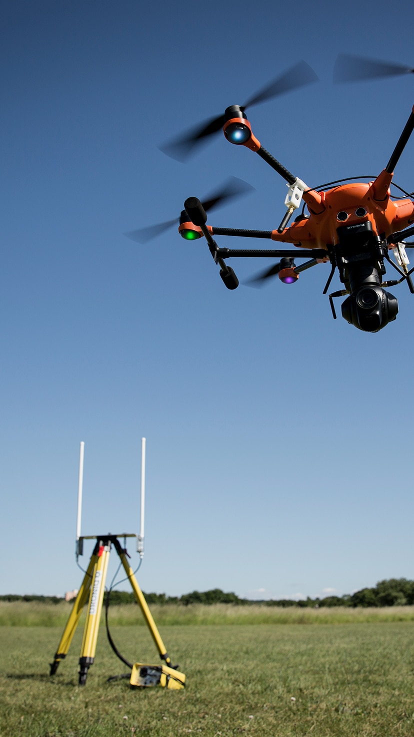
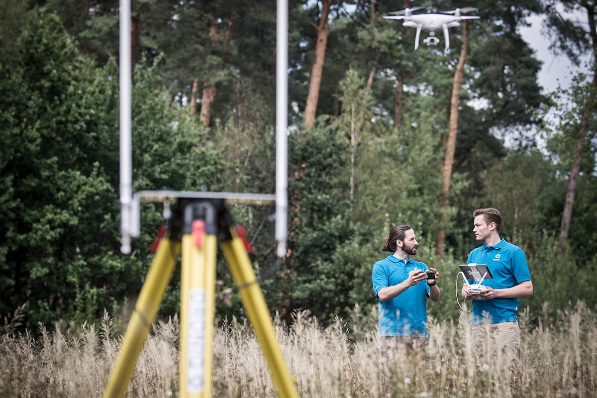
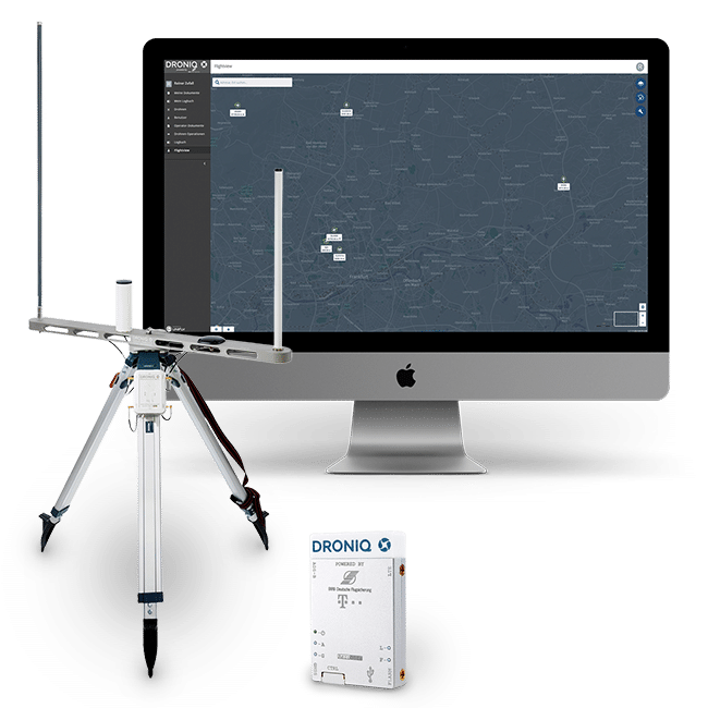
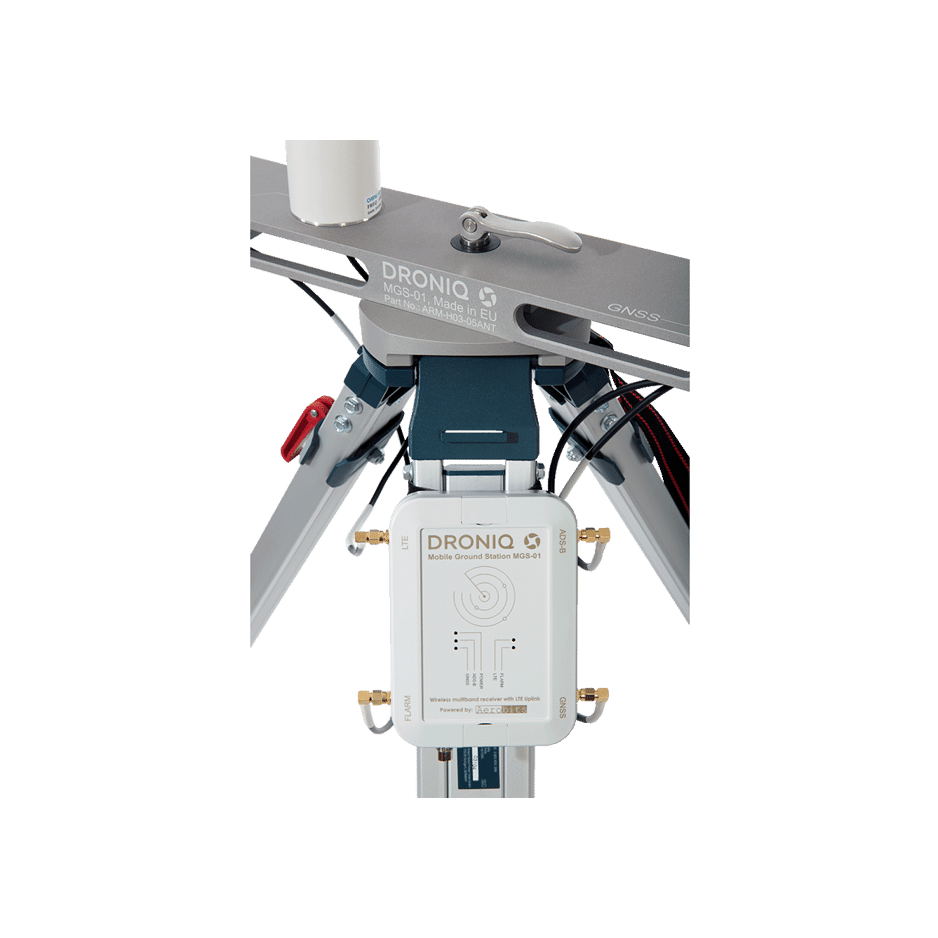
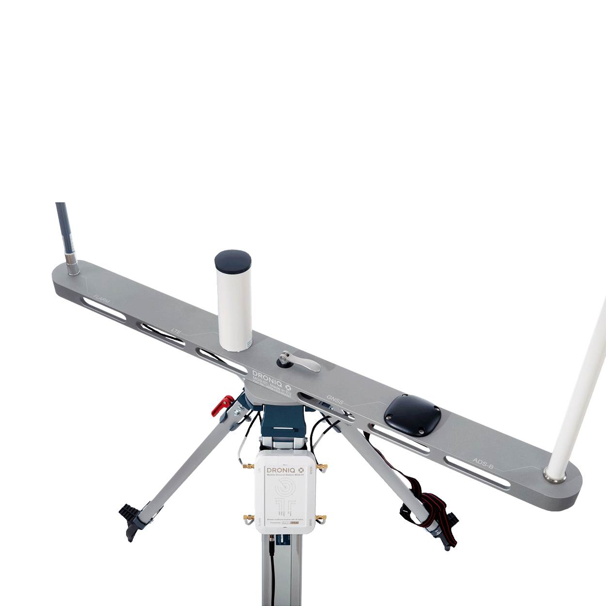
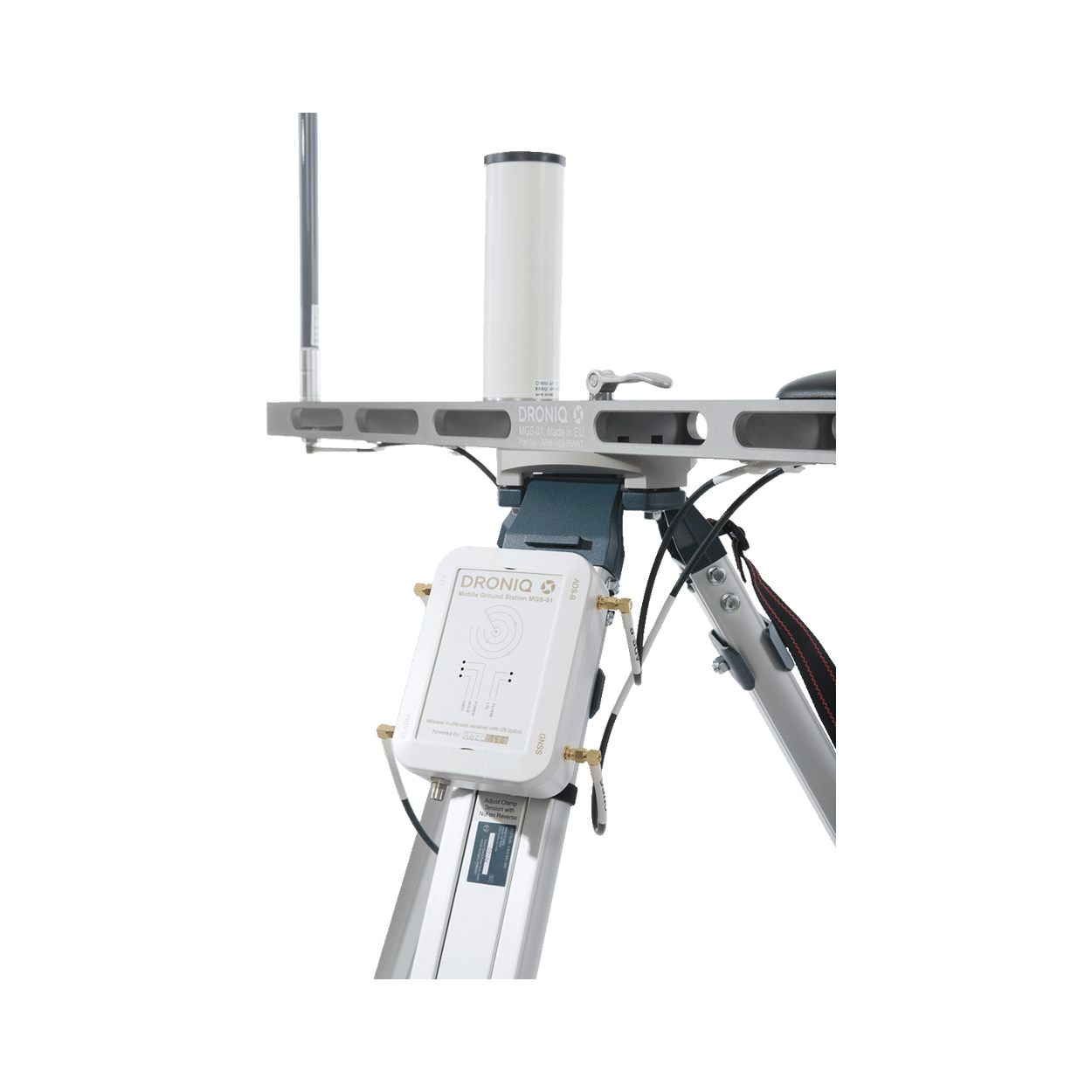
The Mobile Ground Station (MGS for short) is a mobile traffic receiving station and is used in combination with HOD4track Germany and a UTM license (UTM Trackviewer, UTMpro or UTMagent) to support UAS remote pilots flying beyond visual line of sight (BVLOS).

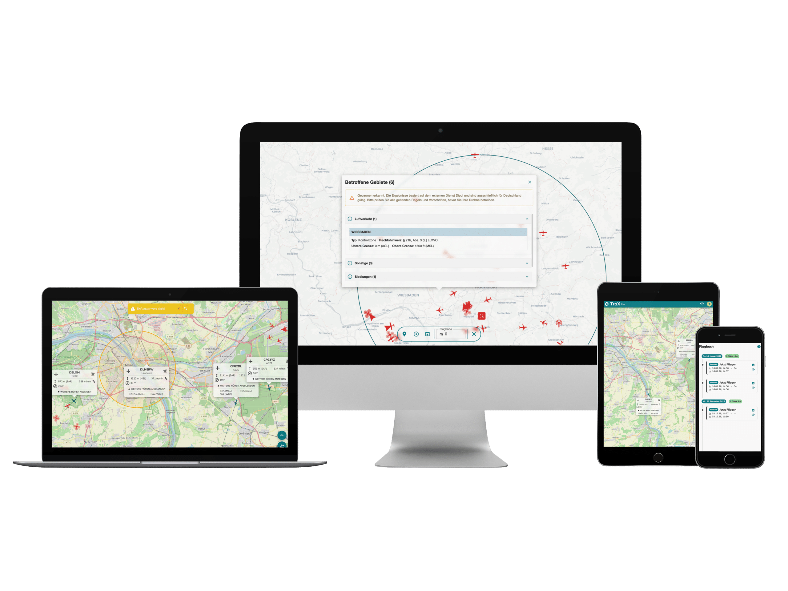
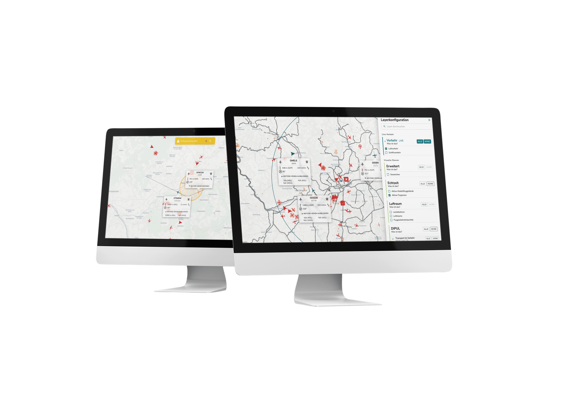
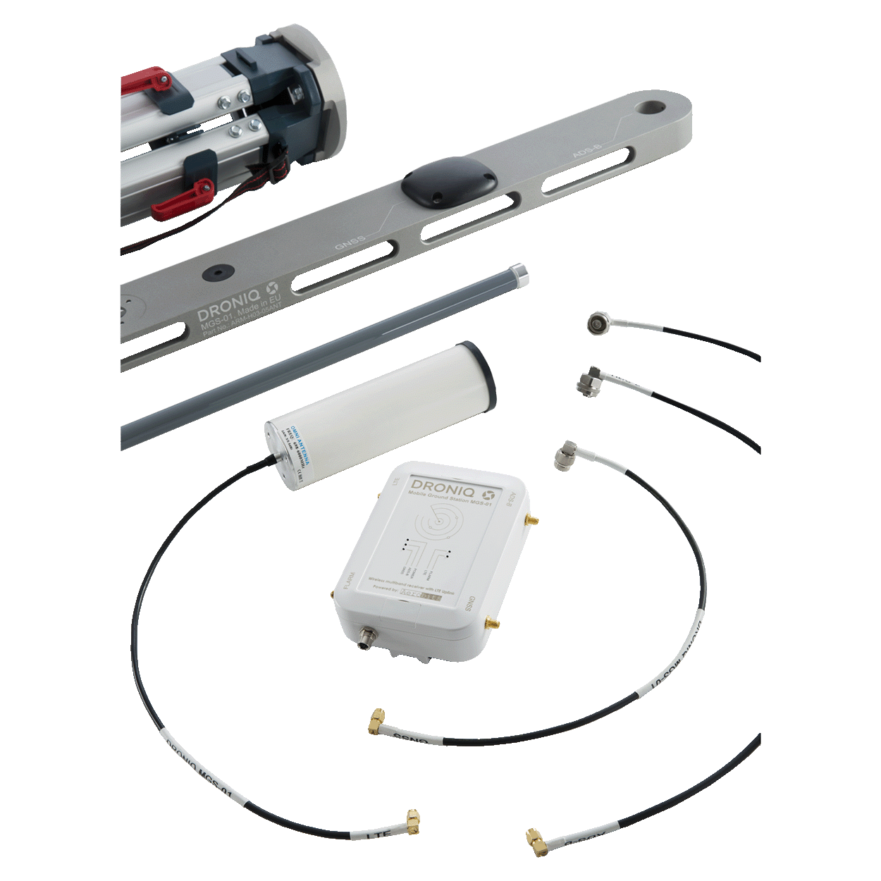
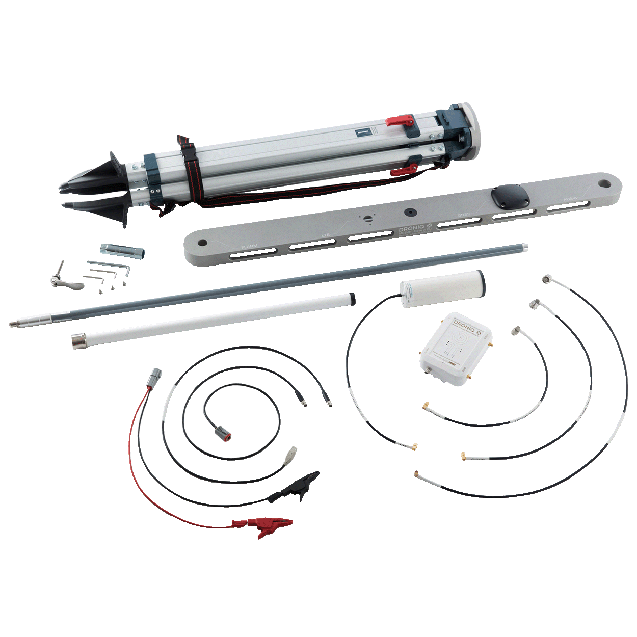
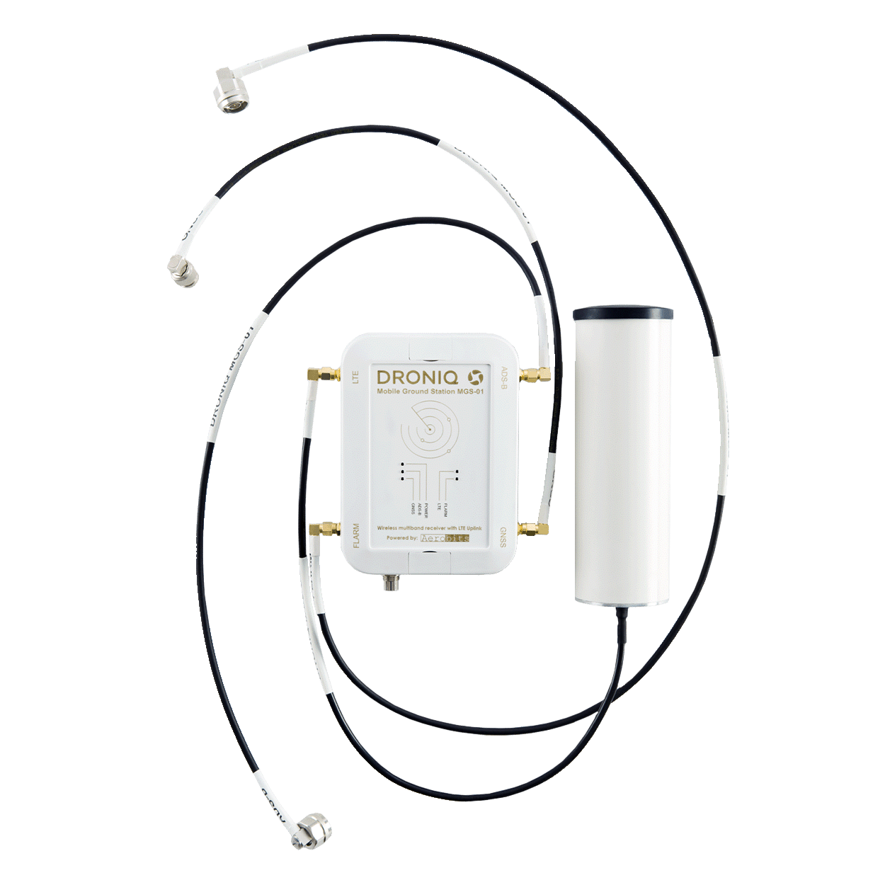
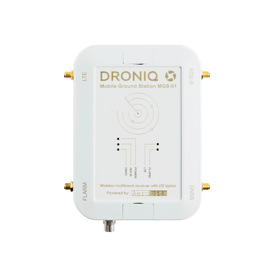
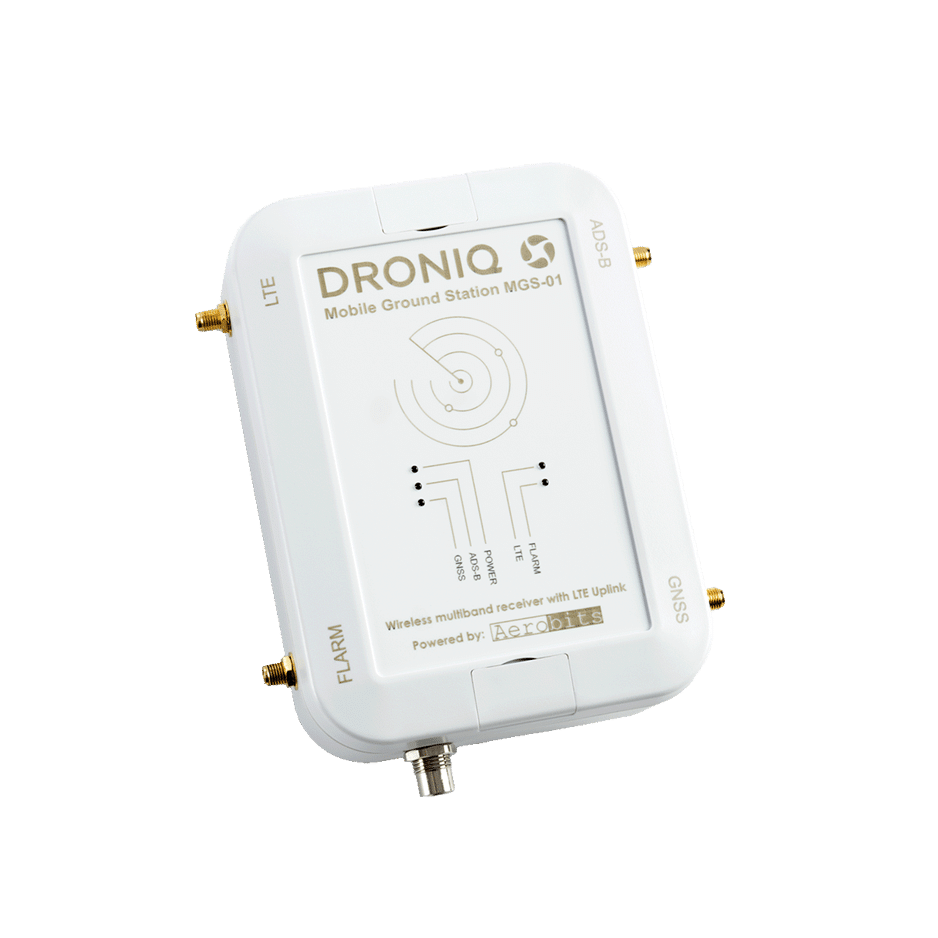
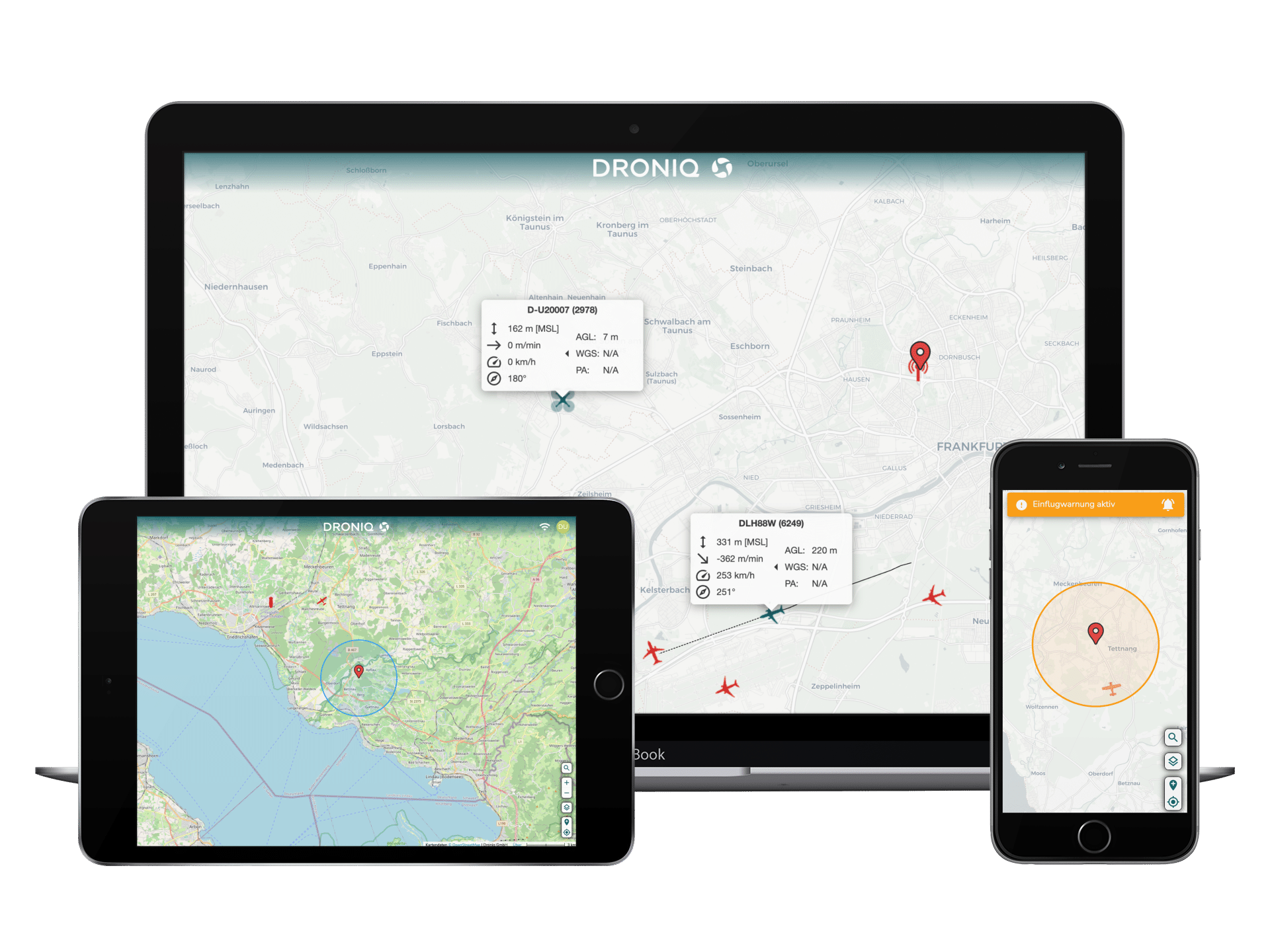
As a sensor for air traffic data, it receives ADS-B and FLARM signals from surrounding air traffic participants (e.g. gliders, helicopters, powered aircraft). These signals are fed via LTE into the Droniq UTM (UAS Traffic Management) system, where they are analyzed with other data sources. In addition, the MGS sends its own position to the Droniq UTM and is also visible there. With a Droniq UTM web access, the pilot can display all traffic data available in the UTM in a merged form: in this way, the MGS completes the air situation display of the UAS pilot.

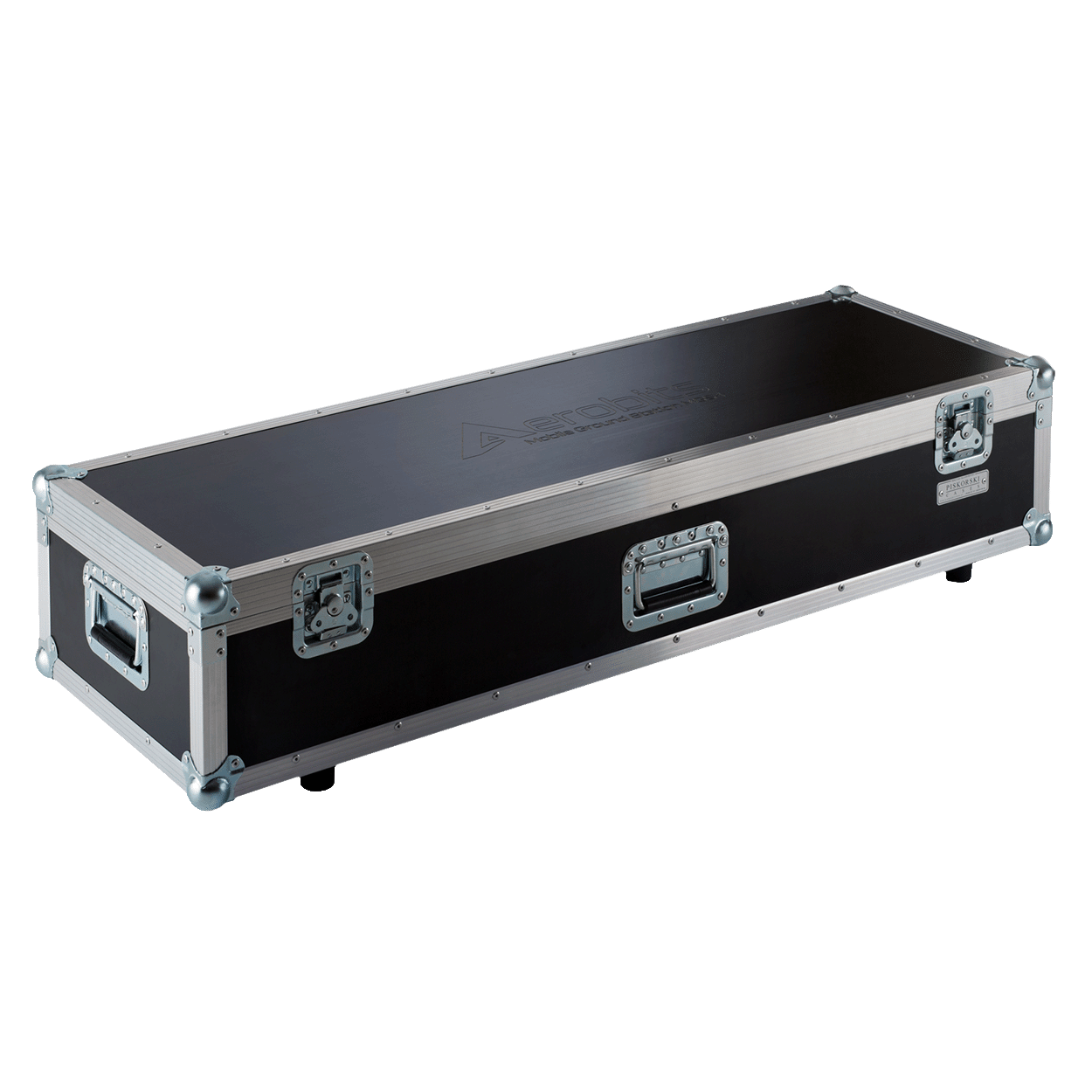
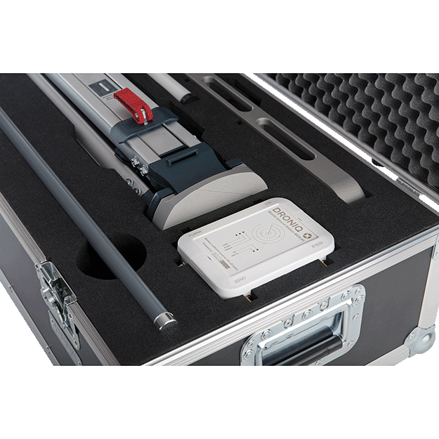
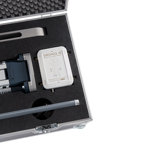
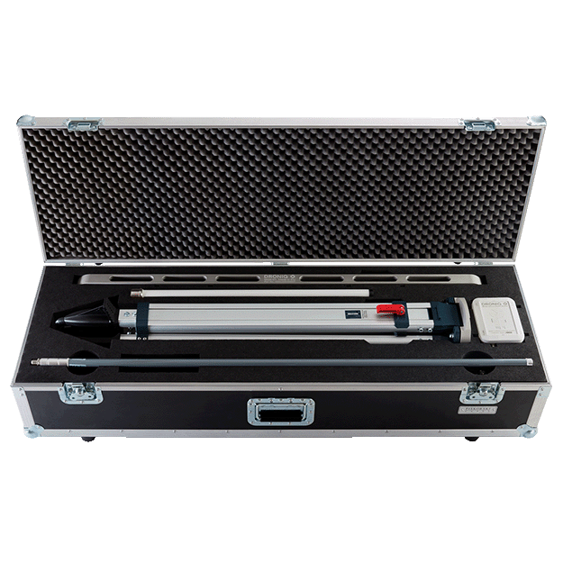
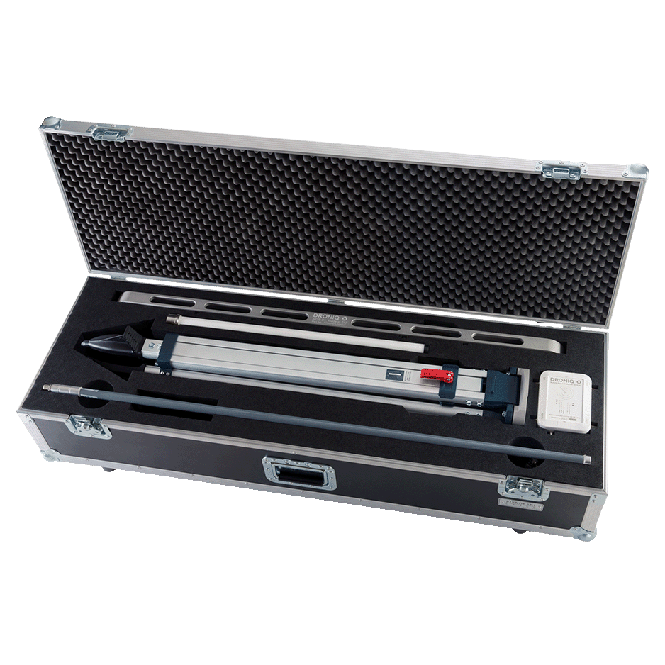
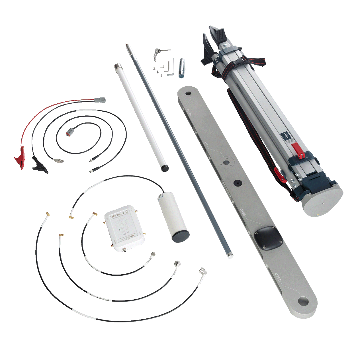
Due to the compact, modular design (tripod, antenna boom, receiver) and the IP67 certification, the MGS can be operated quickly at a wide variety of locations. The power supply, for example via a power bank, further contributes to autonomous use.

Scope of delivery

  • MGS including connectivity
  • FLARM, ADS-B and LTE antenna
  • Antenna boom with GNSS antenna
  • Tripod
  • 3x antenna cable
  • Power supply cable with alligator clips
  • USB cable
  • LTE connectivity capable
  • Lifetime FLARM license
  • High quality carrying case

Note
We would like to inform you that the Mobile Ground Station (MGS) product is intended for commercial users only.

Technical data

HardwareMobile Ground StationOmnidirectional Ground StationFixed Ground Station
Antennas and alignmentGNSS: clear view to the sky
LTE, FLARM & ADS-B: vertical to boom
GNSS: Clear view of the sky
Do not cover top of OGS
FLARM & ADS-B: vertical on mounting arm
GNSS: Clear view of the sky
Attach antenna housing vertically
WeightReceiver: 0.5 kg
Flightcase: 16 kg
2 kg13 kg
DimensionsReceiver: 130 x 175 x 45 mm
Flightcase: 1270 x 420 x 240 mm
272 x 276 x 96 mm129 x 29 x 13.4 cm
Operating temperature-30°C to +40°C-30°C to +40°C-30°C to +40°C
CertificationIP67IP67IP67
ConnectivityMobile Ground StationOmnidirectional Ground StationFixed Ground Station
TechnologyLTE 4G Cat1LTE 4G Cat1LTE 4G Cat1
ConnectivityMGS is shipped with connectivity. The product is delivered ready for use in Germany.
Germany. On request, we offer solutions for use in other countries.
countries.
OGS is shipped with connectivity. The product is delivered ready for use in Germany.
Germany. On request, we offer solutions for use in other countries.
countries.
FGS is shipped with connectivity. The product is delivered ready for use in Germany.
Germany. On request, we offer solutions for use in other countries.
countries.
SensorsMobile Ground StationOmnidirectional Ground StationFixed Ground Station
GNSSSystems: Multi-Constellation (GPS, GALILEO, GLONASS, EGNOS)
Precision: CEP
Systems: multi-constellation (GPS, GALILEO, GLONASS, EGNOS)
Precision: at 2.5 m CEP
Systems: multi-constellation (GPS, GALILEO, GLONASS, EGNOS)
Precision: at 2.5 m CEP
FLARM ReceiverFrequency: 868 MHz
Sensitivity: -130 dBm
Range: About 40 km (depending on positioning)
License: Lifetime FLARM license
Frequency: 868 MHz
Sensitivity: -110 dBm
Range: About 40 km (depending on positioning)
License: Lifetime FLARM license
Frequency: 868 MHz
Range: About 70 km (depending on positioning)
License: Lifetime FLARM license
ADS-B ReceiverFrequency: 1090 MHz
Sensitivity: -90 dBm
Range: About 400 km (depending on positioning)
Frequency: 1090 MHz
Sensitivity: -90 dBm
Range: About 600 km (depending on positioning)
Frequency: 1090 MHz
Range: About 600 km (depending on positioning)
Antenna characteristicsOmnidirectionalOmnidirectional120° sector horizontal
Power supplyMobile Ground StationOmnidirectional Ground StationFixed Ground Station
SourceUSB, mobile power supplyPower cable or USB (no parallel operation)Power cable
Power consumption1,5 W1,5 W1,5 W
VoltageUSB: 5 V - 12 Vpower cord: 100 - 240 V AC
USB: 5 V - 12 V
Power cord: 100 - 240 V AC
CurrentUSB: 2 AUSB: 2 A-
InstallationMobile Ground StationOmnidirectional Ground StationFixed Ground Station
Max. Wind speed-125 mph125 mph
Wind load-148 lbf @ 125 mph148 lbf @ 125 mph
VISIBLE IN THE AIRSPACE!

Droniq makes drones visible and therefore makes ground-based airspace safer. Find out how it works here.

Droniq's core offering is a drone traffic management system (UTM). It shows the remote pilot a combined air situation picture of manned and unmanned air traffic for safe and efficient drone operations beyond visual line of sight (BVLOS). For this purpose, Droniq provides you with the required hardware and software consisting of the following components:

  • LTE transponder for locating the aircraft
  • Web-based UTM system for displaying aircraft movements
  • Soil sensor system

Mobile Ground Station

Mobile system for ground-based air situational awareness. Easily and quickly installed for airspace surveillance. Self-sufficient use due to long battery life.

Learn more

UTM

The UTM TrackViewer is a web application for real-time display of aircraft movements in a defined area over Germany. All relevant aircraft movements are displayed in the lower airspace. Through multi-sensor data fusion, data sources such as primary/secondary radar, ADS-B, FLARM or HOD4track are captured.

Learn more

HOD4track

LTE transponder for visualization of unmanned aerial objects. Easily and quickly mountable on almost any drone. Meets requirements for issuing BVLOS operating permits for UAS.

Learn more

Product Features

  • ADS-B & FLARM Receiver

    Receives ADS-B (Automatic Dependant Surveillane - Broadcast) and FLARM (Flight Alarm) signals from surrounding air traffic such as gliders, helicopters, powered aircraft.

  • LTE connectivity

    ADS-B and FLARM signals are sent via LTE to Droniq's drone traffic management system (UTM), where they are fused with other data sources. 

  • Droniq UTM Integration

    The Mobile Ground Station sends its own position to the Droniq UTM and thus becomes visible. With an access to the UTM system, all traffic data available in the UTM is displayed fused to the remote pilots. This completes the UAS pilot's aerial view.

  • Compact and quickly ready for use

    The traffic station is quickly ready for use due to its compact design consisting of a tripod, antenna boom and receiver.

  • Autonomous use

    The power supply via a powerbank, for example, contributes to autonomous use.

Questions about the product?

Fill out the form. We will call you back or contact you by email.

"*" indicates required fields

Contact

GET ADVICE FROM
UTM EXPERTS ADVISE

André Voigt, Senior Sales Manager
Phone +49 69 509 547 400 | vertrieb@droniq.de