40% discount from 6.5.-31.05.2023: Save almost 100 € on the A2 Remote Pilot Certificate!

To the action

Transponder & Anti-Collision

HOD4track Germany, V3

LTE transponder for visualization of unmanned aerial objects

Transponder & Anti-Collision

HOD4track Germany, V3

LTE transponder for visualization of unmanned aerial objects

The HOD4track is an LTE transponder that makes unmanned aerial objects visible to other airspace participants (helicopters or UAS). The drone tracker meets all requirements for issuing BVLOS operating permits for UAS.

1.486,31 € incl. VAT.
1.249,00 € net
plus shipping costs
Delivery time: 5-7 working days
Do you have questions about the product? Contact form
Tel. +49 69 509 547 400 | Mail. info@droniq. de
1.486,31 € incl. VAT.
1.249,00 € net
plus shipping costs
Delivery time: 5-7 working days
Do you have questions about the product? Contact form
Tel. +49 69 509 547 400 | Mail. info@droniq. de

Product features

Sale possible only to traders
Weight
159 gram
Dimensions
58 x 38 x 9.5 mm
Operating temperature
10° to 40° C
Operating time
6 hours
Power supply
Powerbank
Connectivity
Mobile communications
Antennas
GNSS, LTE, FLARM, ADS-B
Technology
LTE 4G Cat1
Notice period
3 months
Subscription
plus 80 EUR net p.a. "TrackConnect" service fee

Advantages

  • Micro LTE transponder integrates unmanned aerial systems into the airspace.
  • HOD4track can be attached to almost any UAS due to its light weight and size.
  • Meets all requirements for issuing BVLOS operating permits for UAS.
  • Transmission of position data (GNSS position and barometric altitude) via LTE to the UTM.
  • Detection of surrounding air traffic by FLARM and ADS-B including transmission to the UTM.
  • Includes lifetime FLARM license and firmware updates.

Application area

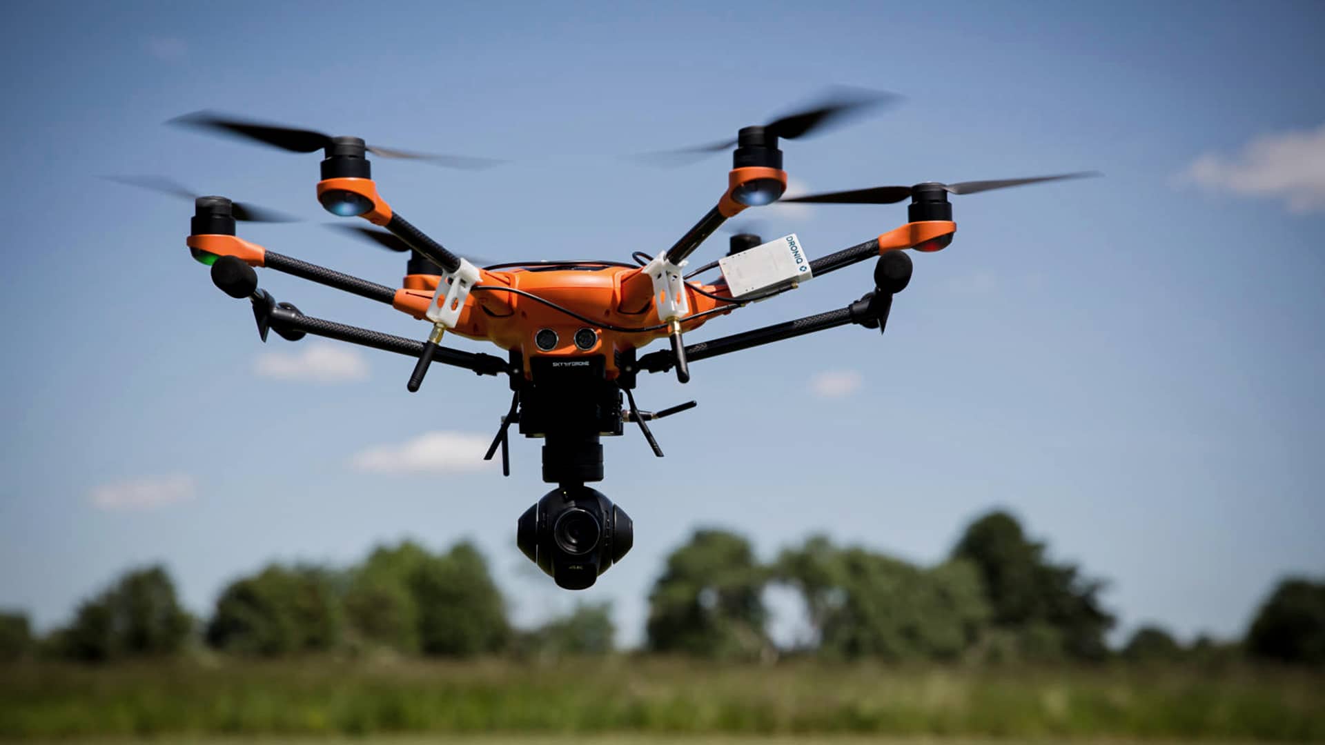
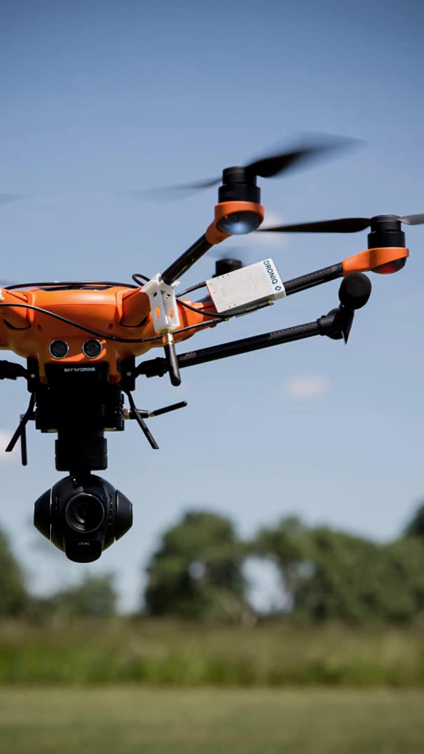
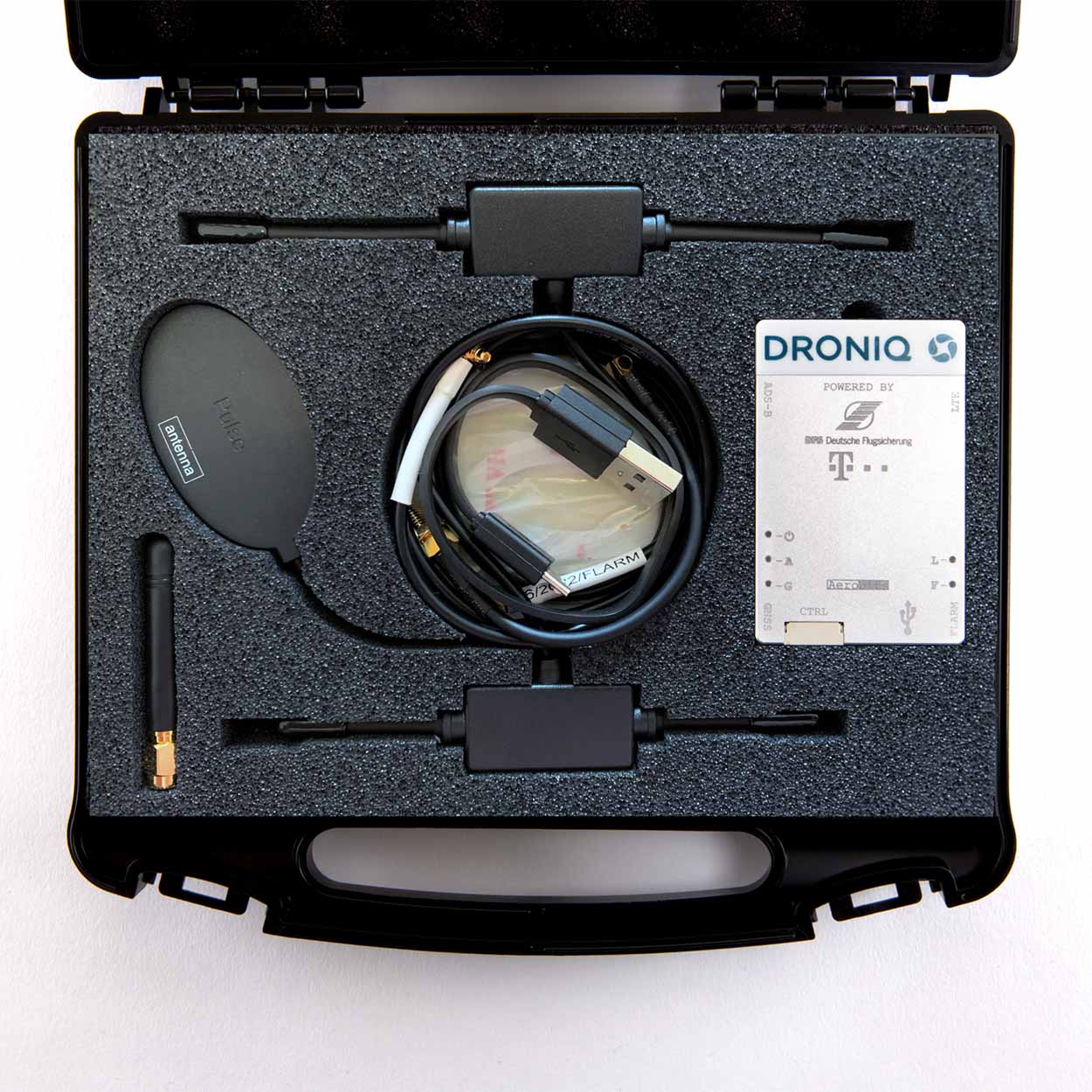
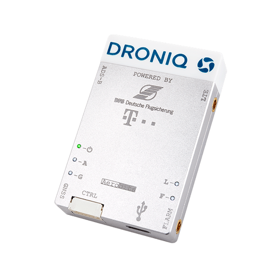
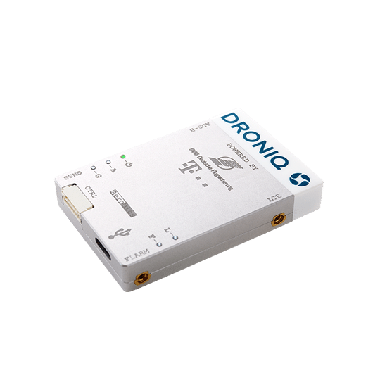
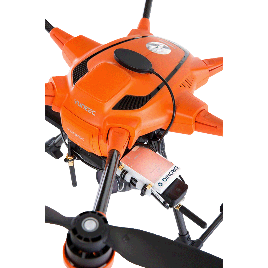
The HOD4track micro LTE transponder (HOD: Hook-on-Device) is used to transmit its own position data for UAS and other aircraft (e.g. helicopters), making any aircraft visible. The HOD4track meets all requirements for issuing BVLOS operating permits for UAS.

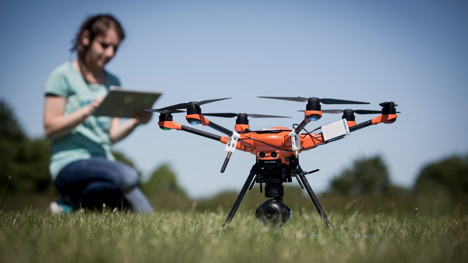
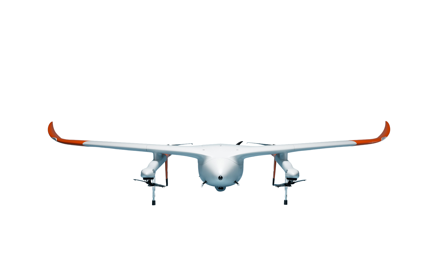
Due to its light weight and size, the matchbox sized HOD4track can be attached to any unmanned aircraft as well as gliders, helicopters and powered aircraft.

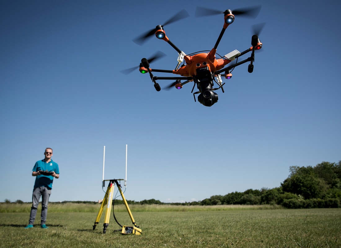
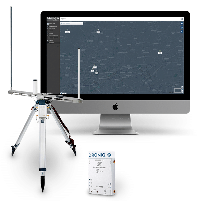
Specially designed for VLL (very low level) airspace, it transmits its own position via LTE. In addition, the HOD4track receives FLARM and ADS-B signals from surrounding air traffic, outputs the traffic data locally via MAVLINK and sends it to the UAS Traffic Management System (UTM) of DFS Deutsche Flugsicherung GmbH in addition to its own position.

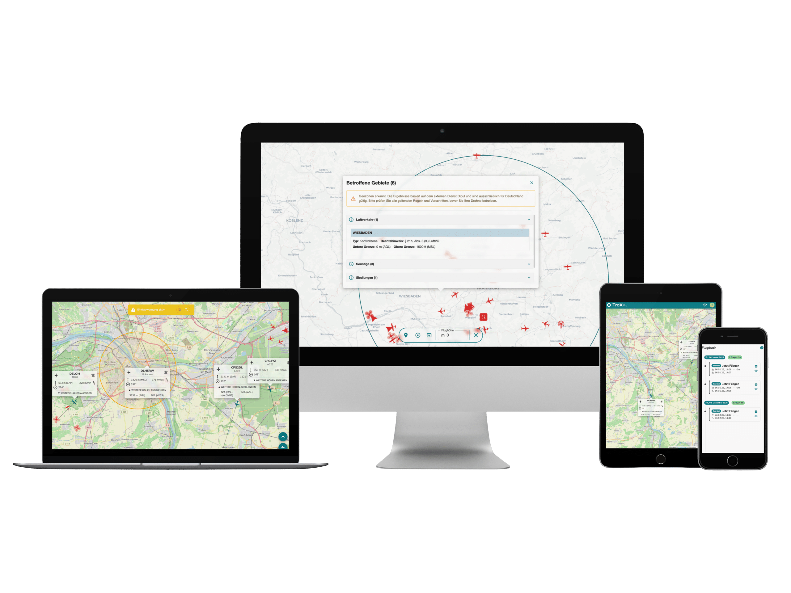
With access to the web-based UTM system, the pilot can view the current air situation at any time, fused from manned and unmanned air traffic data.

Scope of delivery

  • HOD4track (V3) incl. connectivity
  • GNSS, LTE, FLARM and ADS-B antenna
  • Antenna cable
  • Powerbank (3600 mAh)
  • Micro USB cable
  • FLARM license
  • LTE connectivity
  • Mounting Kit

Service flat rate in subscription:
As part of the hardware purchase, a "TrackConnect" service fee of 80.00 EUR net per year is due, which will be invoiced for one year with the 1st of the following month. The Hod4track is delivered with connectivity for the German airspace. On request, we are happy to offer solutions for use in other countries.

Necessary addition:
For full deployment, in addition to the HOD4track hardware, paid access to our UTMpro is required so that the user has the ability to plan or conduct operations. In UTMpro, the user can administer personal data, plan missions in the federal territory and validate them against possible interdictions. After publishing the mission, he can see live traffic around his mission. Furthermore, the UTM system offers the user a collision warning between unmanned flying objects as well as to manned aviation. When entering prohibited areas as well as leaving the mission area, the UTMpro issues a warning. This takes place in interaction with the HOD4track, making drones visible.


Technical data

AntennasHOD4track
Antenna alignment (reception/radiation)GNSS: Free view to the sky (lettering "Pulse" pointing upwards),
LTE: free view towards the ground,
FLARM: vertical,
ADS-B: vertical,
All antenna connectors: MMC
FLARM transceiverFrequency: 868 MHz
Lifetime FLARM license
ADS-B/ ReceiverFrequency: 1090 MHz receiver
Power supplyHOD4track
Operating timeWith a fully charged powerbank (capacity: 3600 mAh), the operating time is approximately 6 hours. Operation of the HOD4track is also possible via an internal power supply (JST 6-pin) of the UAS.
Voltage5 - 12 Volt
Current2 amps
Energy consumption<600 mAh
External (power) connection6pin JST (power and data) or Micro USB (power and data), MMCX (antennas)
ConnectivityHOD4track
TechnologyLTE 4G Cat1
SIM cardThe HOD4track is supplied with a Droniq SIM card approved for use in German airspace on the Deutsche Telekom AG network.
HardwareHOD4track
Weight35 g without antennas,
84 g with antennas,
95 g with USB cable and antennas,
5 g powerbank,
159 g HOD4track with all antennas and powerbank
Dimensions58 x 38 x 9.5 mm
Operating temperature+ 10° to +40° Celsius
Intended useThe HOD4track is intended for outdoor use, but is not waterproof. Therefore, it should not be used for drone tracking in the rain.
VISIBLE IN THE AIRSPACE!

Droniq makes drones visible and therefore makes ground-based airspace safer. Find out how it works here.

Droniq's core offering is a drone traffic management system (UTM). It shows the remote pilot a combined air situation picture of manned and unmanned air traffic for safe and efficient drone operations beyond visual line of sight (BVLOS). For this purpose, Droniq provides you with the required hardware and software consisting of the following components:

  • LTE transponder for locating the aircraft
  • Web-based UTM system for displaying aircraft movements
  • Soil sensor system

Mobile Ground Station

Mobile system for ground-based air situational awareness. Easily and quickly installed for airspace surveillance. Self-sufficient use due to long battery life.

Learn more

UTM

The UTM TrackViewer is a web application for real-time display of aircraft movements in a defined area over Germany. All relevant aircraft movements are displayed in the lower airspace. Through multi-sensor data fusion, data sources such as primary/secondary radar, ADS-B, FLARM or HOD4track are captured.

Learn more

HOD4track

LTE transponder for visualization of unmanned aerial objects. Easily and quickly mountable on almost any drone. Meets requirements for issuing BVLOS operating permits for UAS.

Learn more

Product-
Features
HOD4TRACK
VIDEOTUTORIAL
Play video

Questions about the product?

Fill out the form. We will call you back or contact you by email.

"*" indicates required fields

Contact

GET ADVICE FROM
UTM EXPERTS ADVISE

André Voigt, Senior Sales Manager
Phone +49 69 509 547 400 | vertrieb@droniq.de