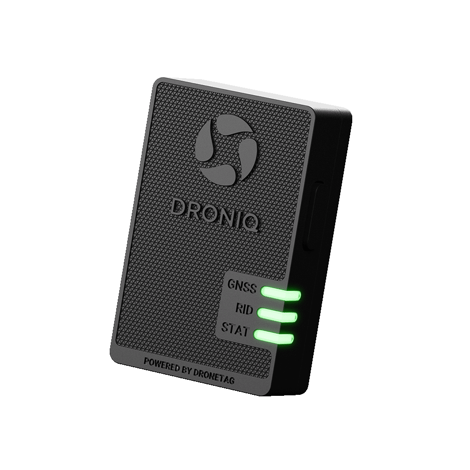
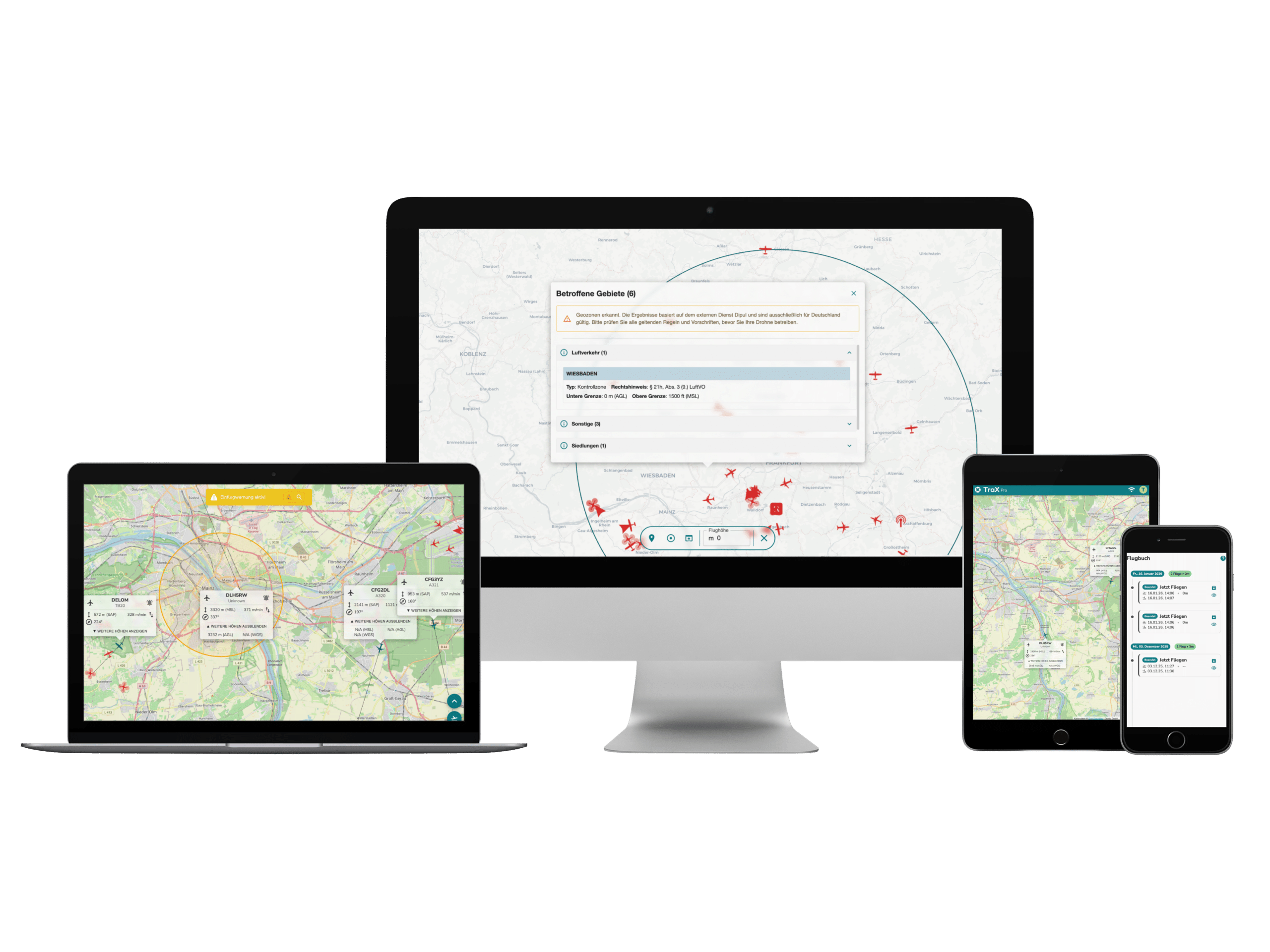
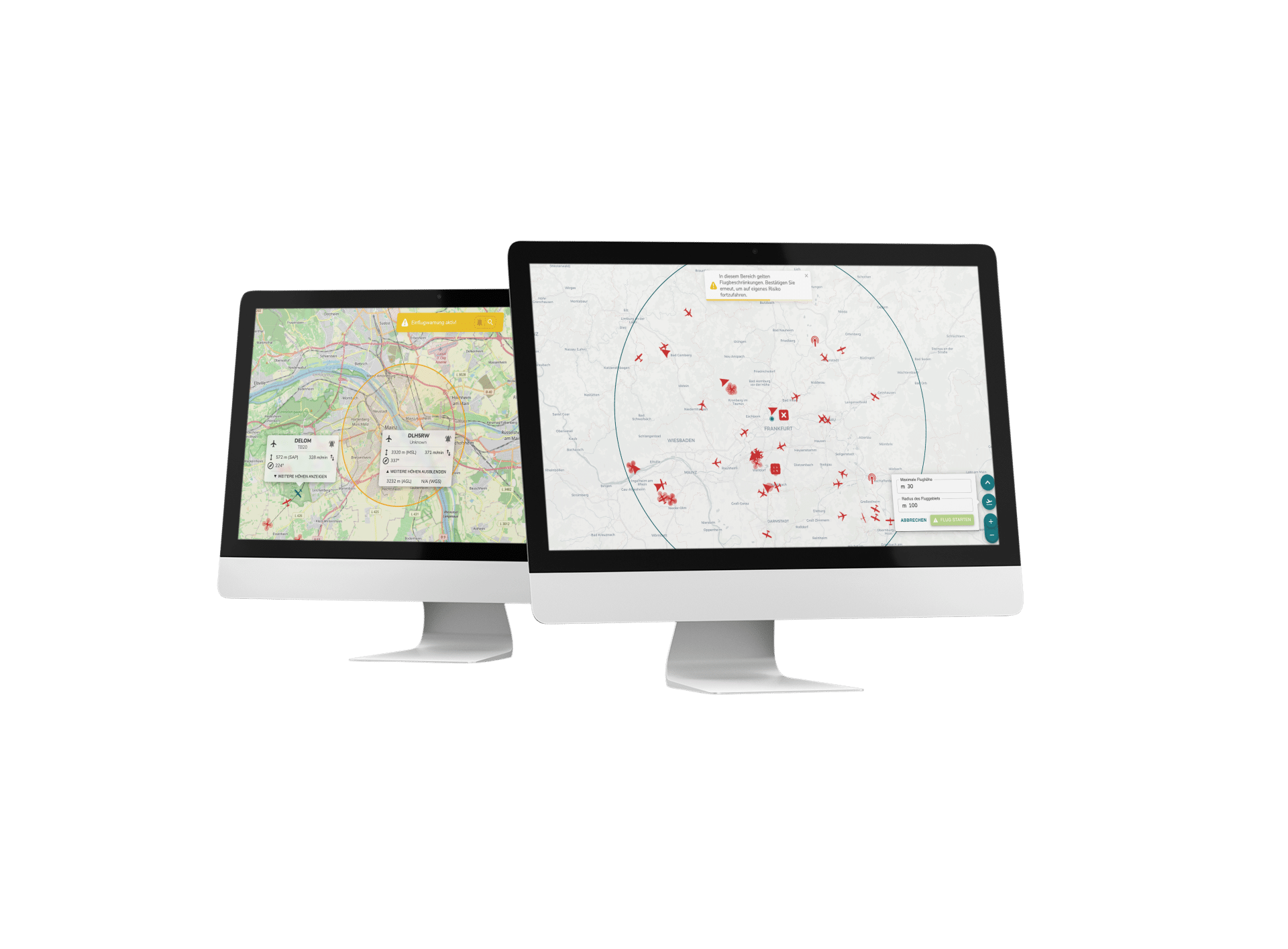
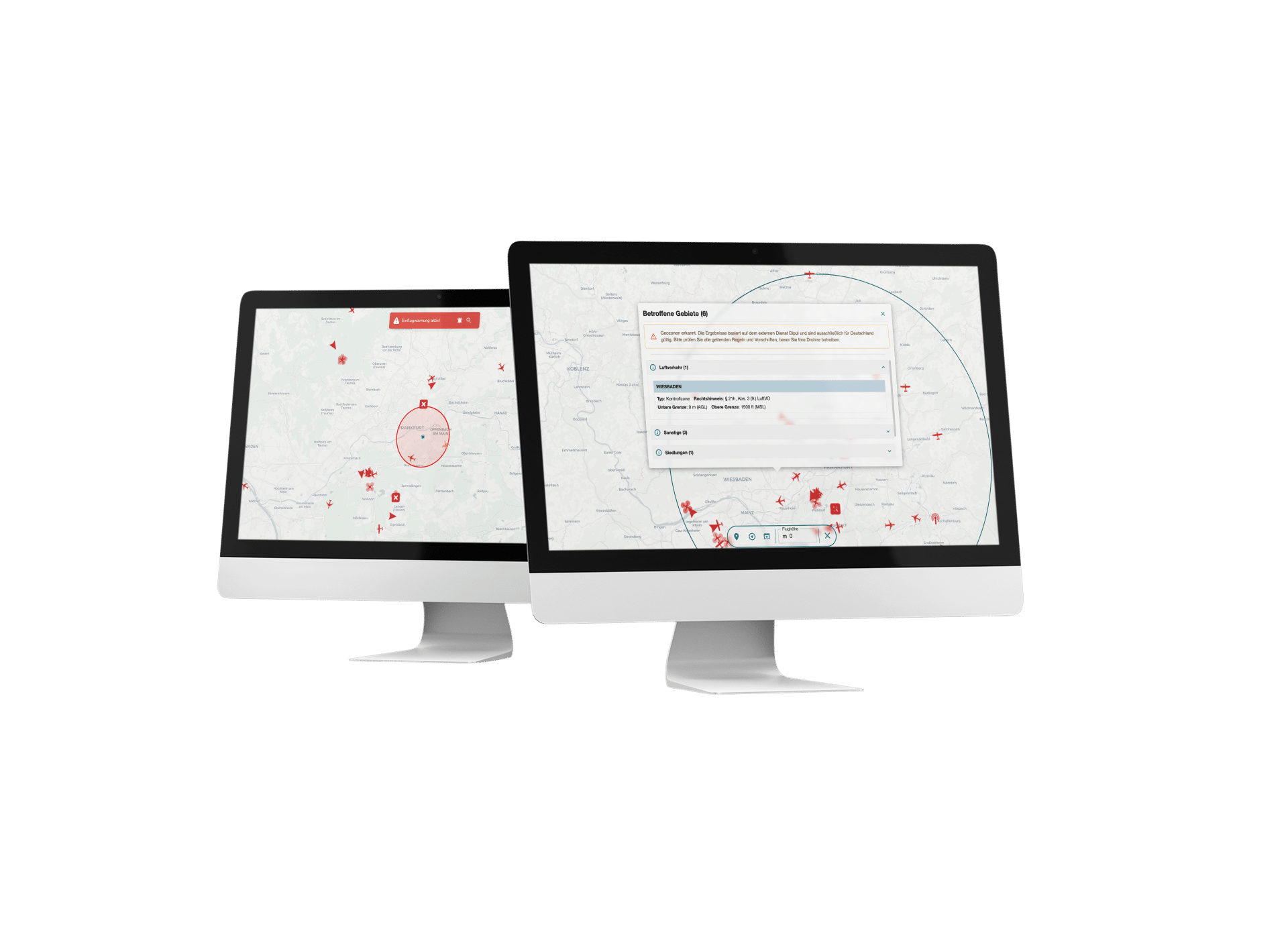
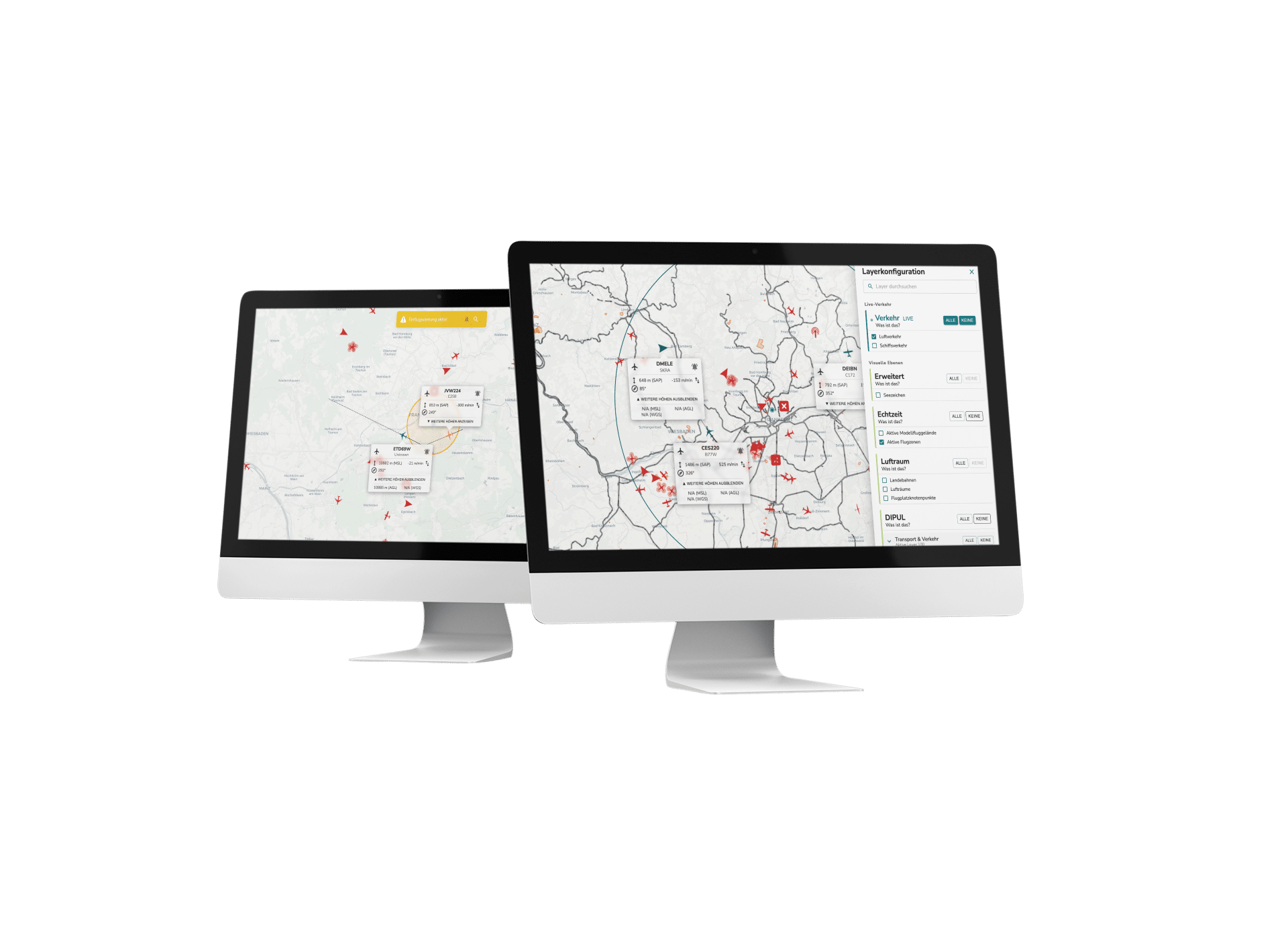
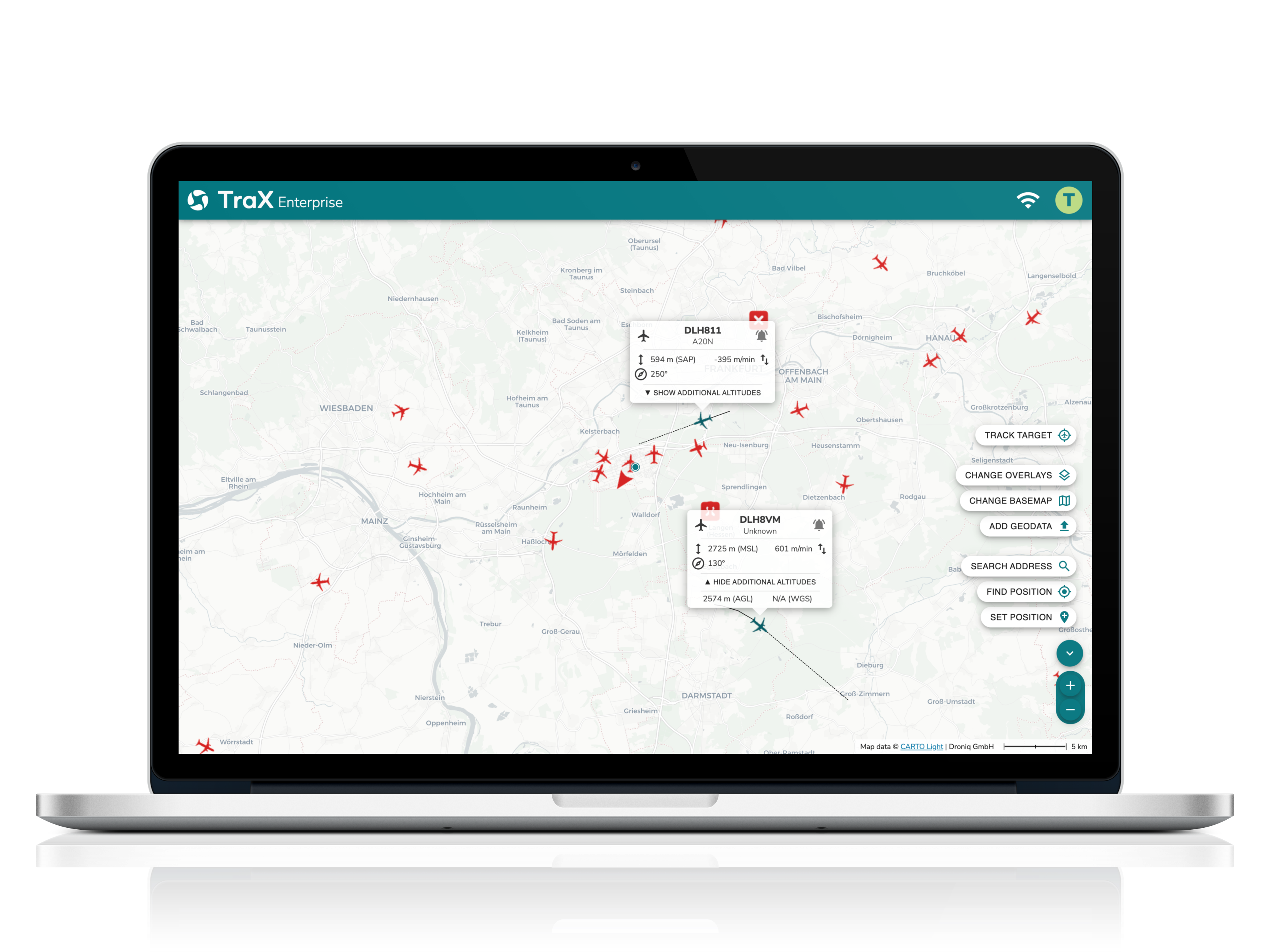
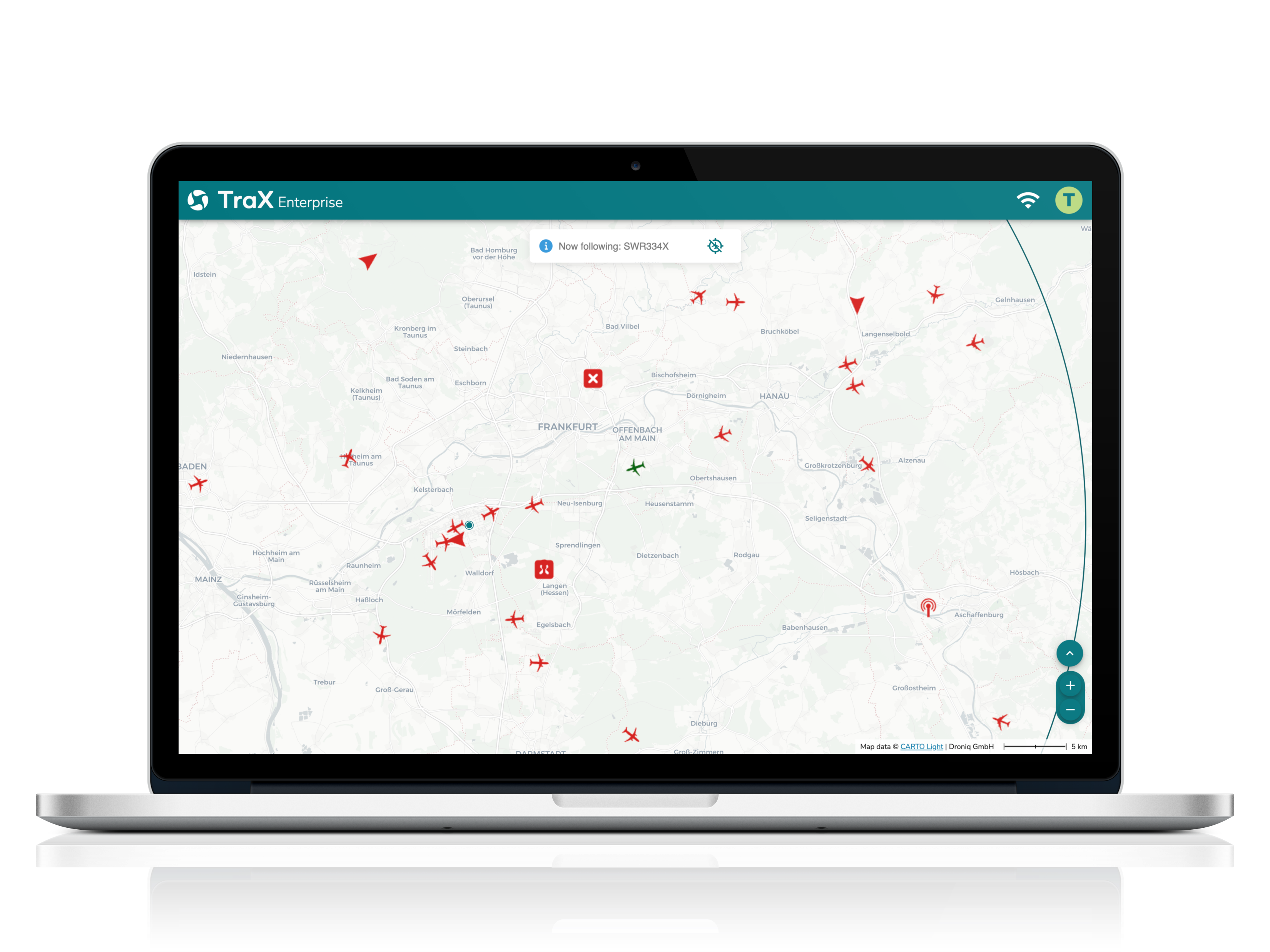
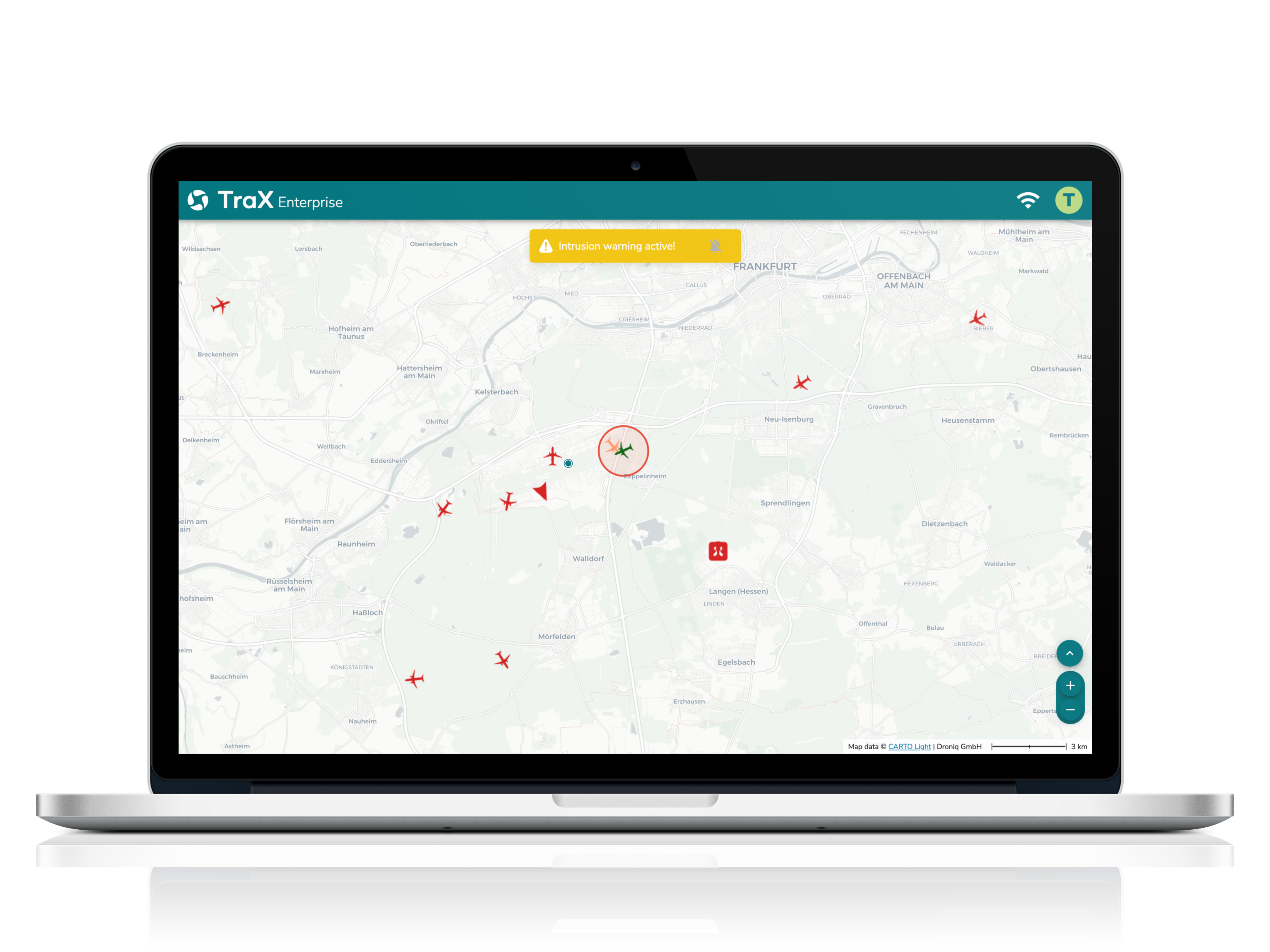
With TraX Enterprise, you always have an eye on the airspace: thanks to precise drone detection via Direct Remote ID and sensor fusion (RADAR, ADS-B, FLARM, UAS remote identification), you can detect unmanned aerial objects in real time – reliably and TMPR-compliant for ARC-C operations. Visual and acoustic detect-and-avoid signals support your operational teams in making quick decisions. You can see the air situation and flight validation in real time and can now also document your flights in the TraX logbook – all bundled in one tool.
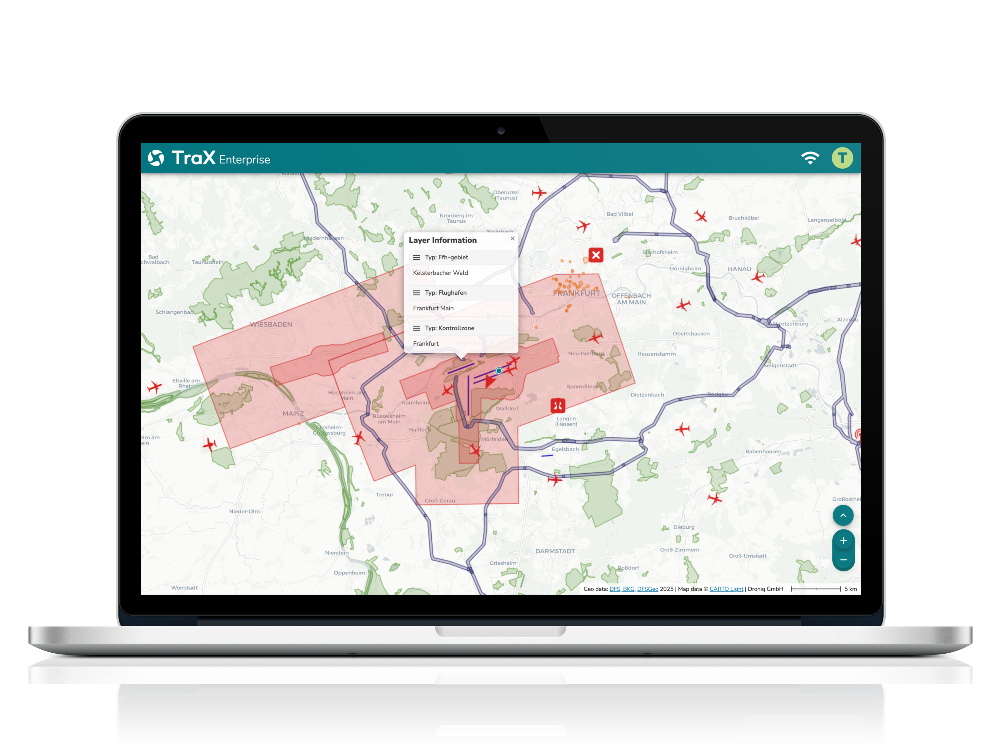
Whether for the police, border guards, energy suppliers or local authorities - TraX Enterprise offers a scalable platform for secure real-time airspace surveillance that can be individually adapted to your requirements. Integrated features such as geoserver connection, drone tracking and remote ID integration ensure maximum efficiency, legal certainty and situational awareness.