


Intended use DJI Matrice 4D Standalone
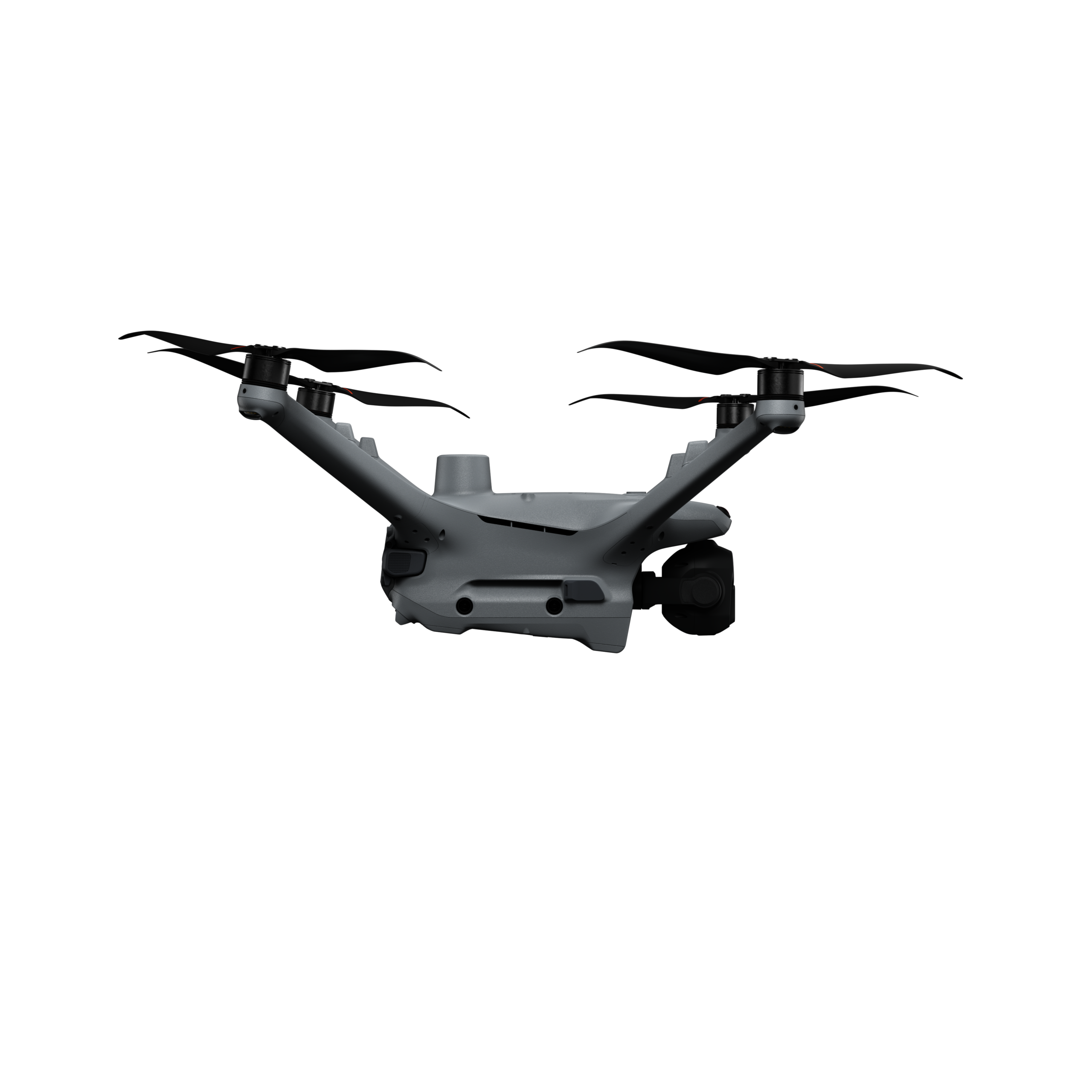
The DJI Matrice 4D is a sophisticated drone designed for precise and demanding applications. With its robust construction and advanced camera technology, it is particularly suitable for:
-
Professional mapping: Thanks to its high-resolution cameras and laser rangefinder, the Matrice 4D can be used for precise geodetic mapping and 3D modeling, ideal for topography, architecture and construction projects.
-
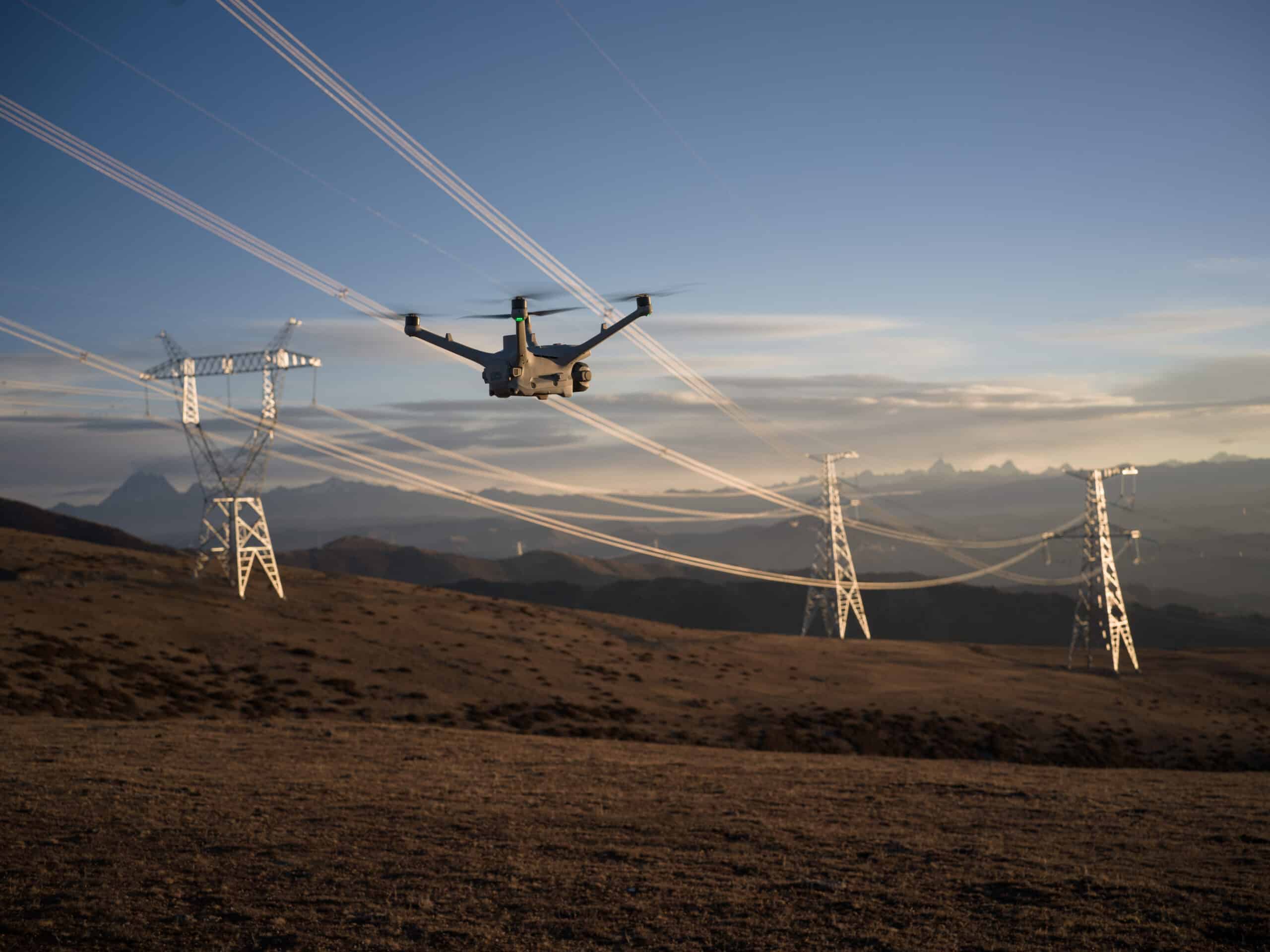
Surface inspections: With its various cameras (wide-angle, telephoto and medium telephoto), the Matrice 4D is ideal for inspecting surfaces such as roofs, bridges and power lines for defects, cracks or other anomalies.
-
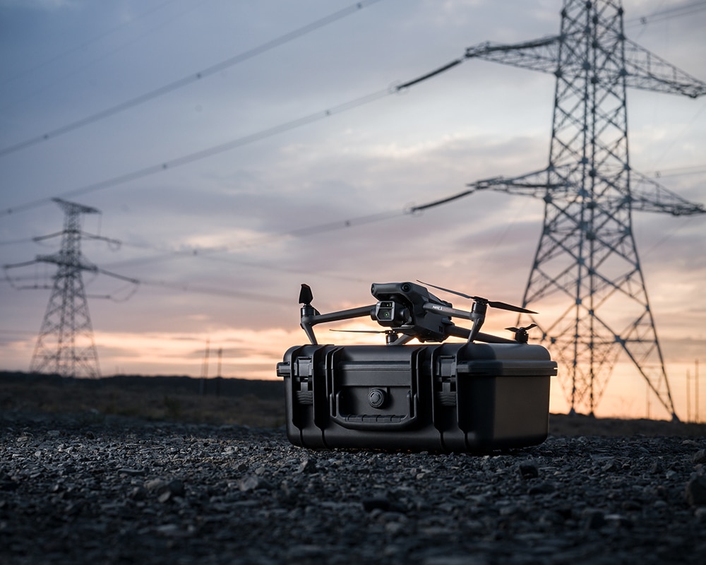
Industrial inspections: Their ability to work in challenging environments and in low light makes them perfect for inspections in substations, factories or in the energy industry.
-
Public safety and emergency operations: With its advanced features, such as precise obstacle avoidance and the ability to operate in difficult lighting conditions, the Matrice 4D is a valuable tool in emergency operations or for monitoring public safety structures.
With its versatility and excellent performance in professional tasks, the Matrice 4D meets all requirements for high-precision inspections and measurements in demanding environments.
Scope of delivery DJI Matrice 4D
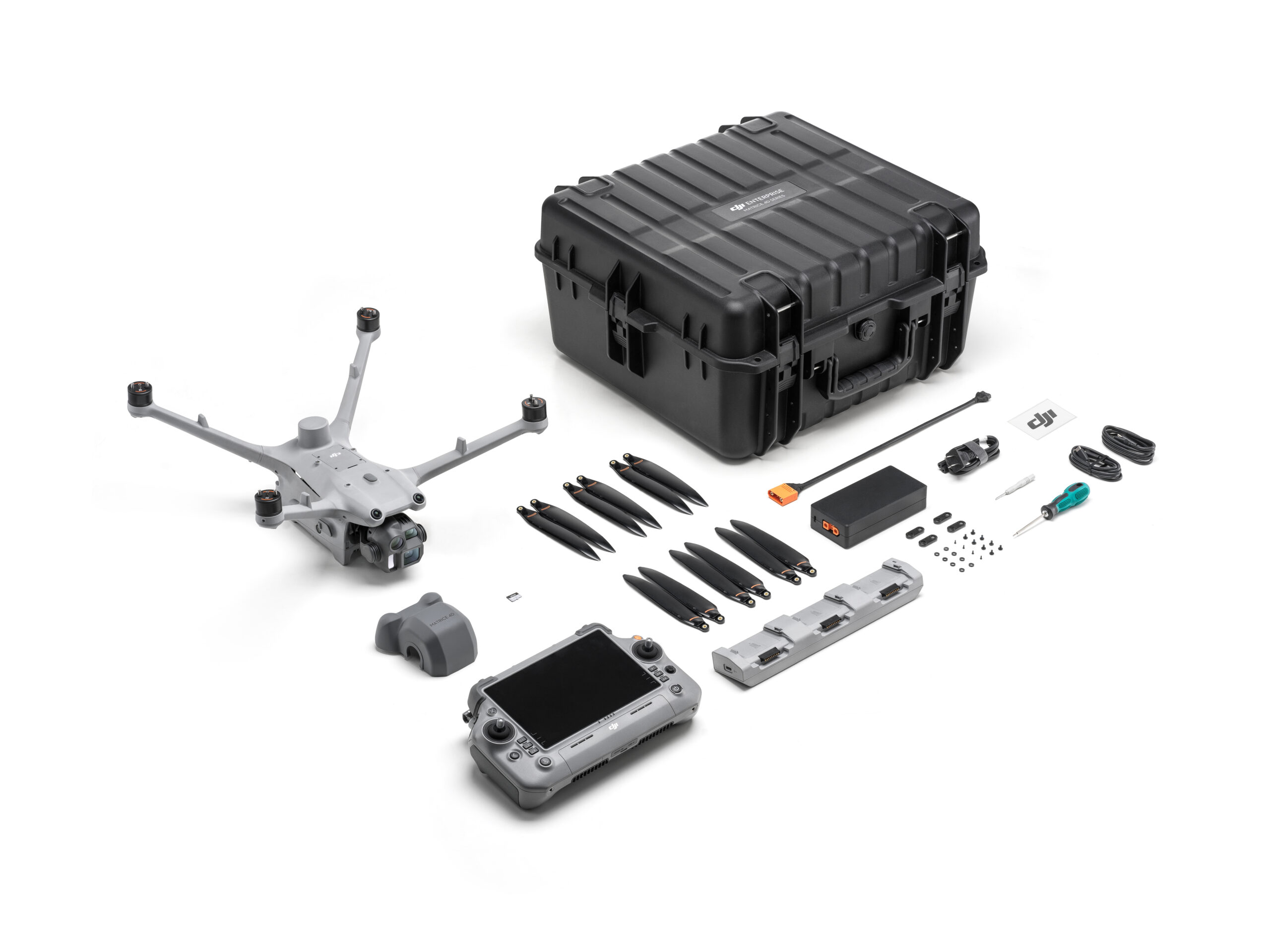
- 1x DJI Matrice 4D aircraft
- 1x DJI Matrice 4 Series - Gimbal protection
- 3x DJI Matrice 4 Series - Propeller (pair)
- 1x DJI Matrice 4 series - charging station
- 1x DJI Matrice 4 series - transport case
- 1x AC cable for 240W power supply unit
- 1x DJI RC Plus 2 Enterprise remote control
- 1x DJI Flight Termination System
- incl. 1 year DJI Care Enterprise Plus
- incl. transport case strap
- Optional: plus batteries
Note: The Matrice M4D can be flown in the special category.
Technical data
| Aircraft | DJI Matrice M4D | DJI Matrice M4TD |
|---|---|---|
| Weight (incl. two batteries) | 1850 g This value includes the weight of the battery, propellers and a microSD card, but not third-party payloads. The actual weight may vary due to different batch materials and external factors. | 1850 g This value includes the weight of the battery, propellers and a microSD card, but not third-party payloads. The actual weight may vary due to different batch materials and external factors. |
| Max. Take-off weight | 2090 g | 2090 g |
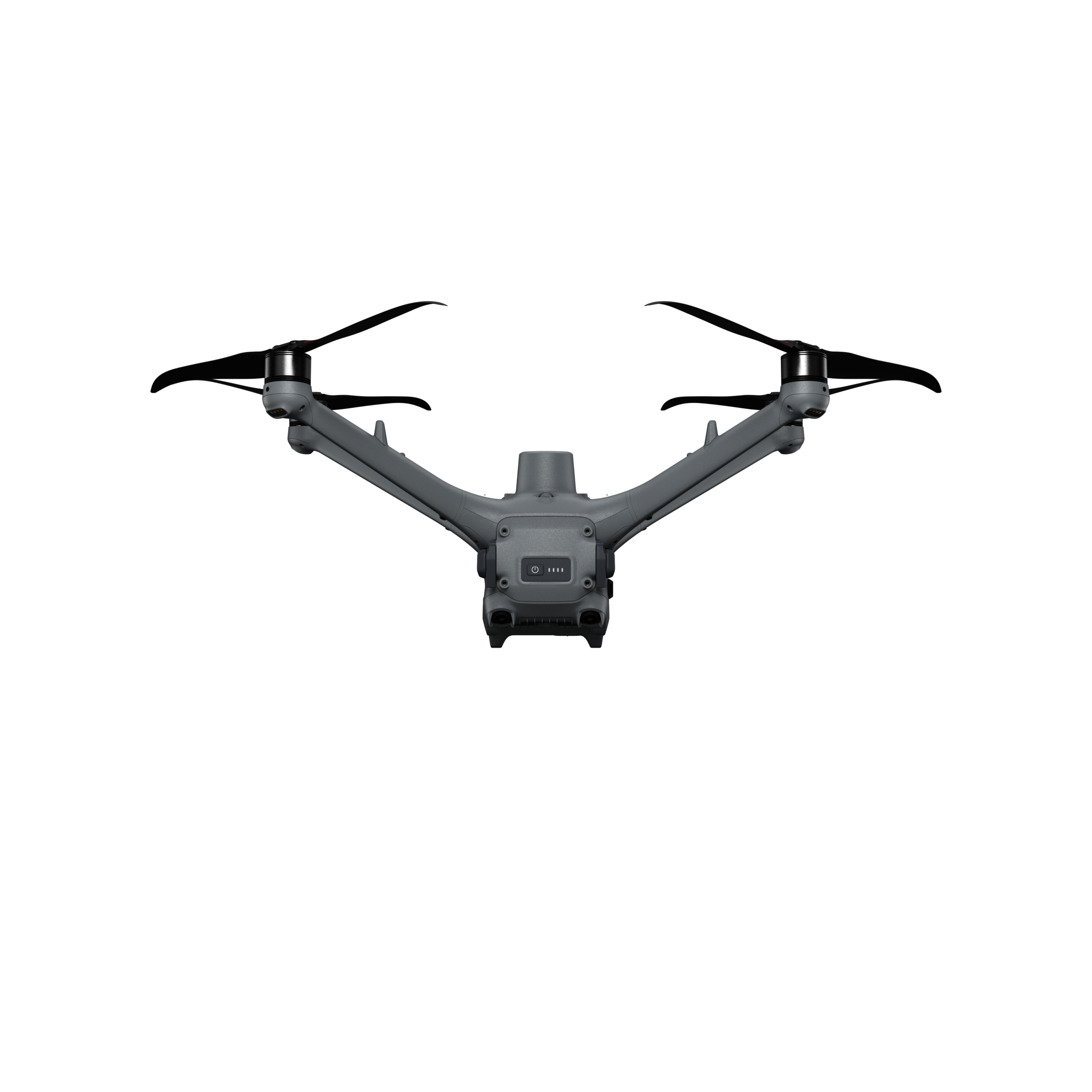
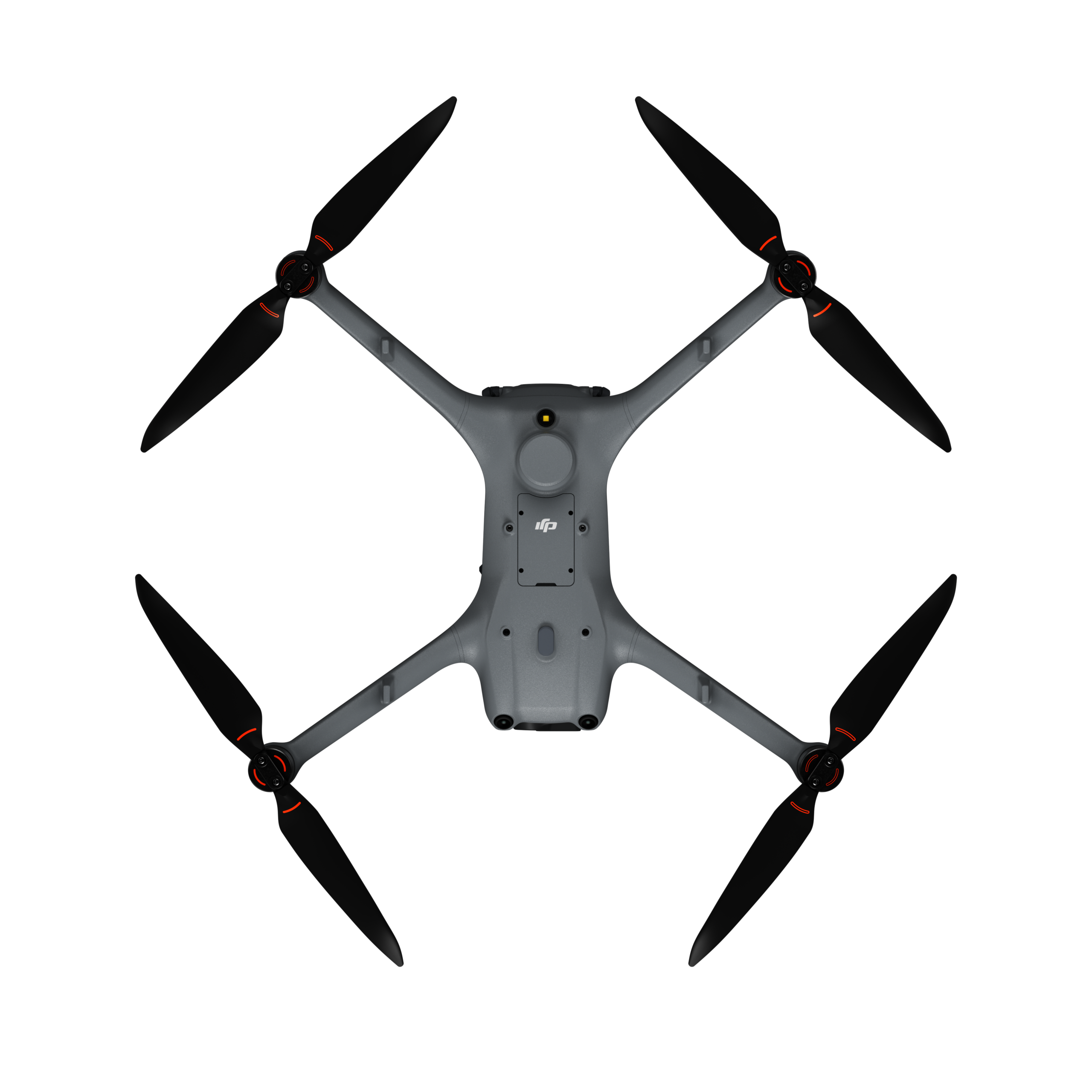
| Dimensions | 377.7 × 416.2 × 212.5 mm (L × W × H, without propeller) | 377.7 × 416.2 × 212.5 mm (L × W × H, without propeller) |
| Diagonal length | Diagonal center distance: 498.5 mm Wheelbase between the left and right front engines: 383.0 mm Wheelbase between the left and right rear engines: 343.0 mm Wheelbase front to rear: 341.6 mm | Diagonal center distance: 498.5 mm Wheelbase between the left and right front engines: 383.0 mm Wheelbase between the left and right rear engines: 343.0 mm Wheelbase front to rear: 341.6 mm |
| Max. Climbing speed | 6 m/s (normal mode) 10 m/s (sport mode) | 6 m/s (normal mode) 10 m/s (sport mode) |
| Max. Sink rate | 6 m/s (normal mode) 8 m/s (Sport mode) | 6 m/s (normal mode) 8 m/s (Sport mode) |
| Maximum speed (at NHN, with no wind) | Normal mode, with obstacle detection activated: 15 m/s flying forwards, 12 m/s flying backwards, 10 m/s flying sideways Sport mode: 21 m/s flying forwards, 19 m/s flying backwards, 15 m/s flying sideways When used with the DJI Dock, only normal mode is supported. | Normal mode, with obstacle detection activated: 15 m/s flying forwards, 12 m/s flying backwards, 10 m/s flying sideways Sport mode: 21 m/s flying forwards, 19 m/s flying backwards, 15 m/s flying sideways When used with the DJI Dock, only normal mode is supported. |
| Max. Wind resistance | During operation: 12 m/s During take-off/landing: 12 m/s | During operation: 12 m/s During take-off/landing: 12 m/s |
| Max. Starting height | 6500 m | 6500 m |
| Max. Flight time | 54 minutes Tested in a controlled environment. The specific test conditions are as follows: Forward flight at a constant speed of 12 m/s in a windless laboratory environment at a height of 20 meters above sea level, in photo mode (without taking photos during flight), with obstacle avoidance turned off and a battery level of 100% to 0%. Actual results may vary depending on environment, usage and firmware version. | 54 minutes Tested in a controlled environment. The specific test conditions are as follows: Forward flight at a constant speed of 12 m/s in a windless laboratory environment at a height of 20 meters above sea level, in photo mode (without taking photos during flight), with obstacle avoidance turned off and a battery level of 100% to 0%. Actual results may vary depending on environment, usage and firmware version. |
| Max. Suspend time | 47 minutes Measured with DJI Matrice 4D series drones in a windless environment hovering 20 meters above sea level with a battery level of 100% to 0%. Actual results may vary depending on environment, usage and firmware version. | 47 minutes Measured with DJI Matrice 4D series drones in a windless environment hovering 20 meters above sea level with a battery level of 100% to 0%. Actual results may vary depending on environment, usage and firmware version. |
| Max. Operating radius | 10 km Measured at approx. 25 °C with a battery level of 15 % of the spare battery, a windless environment, a round trip speed of approx. 15 m/s and a hovering flight of 18 minutes. Actual results may vary depending on environment, use and firmware version. | 10 km Measured at approx. 25 °C with a battery level of 15 % of the spare battery, a windless environment, a round trip speed of approx. 15 m/s and a hovering flight of 18 minutes. Actual results may vary depending on environment, use and firmware version. |
| Max. Flight distance | 43 km Measured with a Matrice 4D/4TD flying at a constant speed of 16 m/s in a windless environment at 20 meters above sea level and a battery level of 100 % to 0 %. Actual results may vary depending on environment, usage and firmware version. | 43 km Measured with a Matrice 4D/4TD flying at a constant speed of 16 m/s in a windless environment at 20 meters above sea level and a battery level of 100 % to 0 %. Actual results may vary depending on environment, usage and firmware version. |
| Max. Pitch angle | 25° (normal mode) 30° (sport mode) | 25° (normal mode) 30° (sport mode) |
| Max. Angular velocity | 200°/s | 200°/s |
| Global navigation satellite system | GPS + BeiDou + Galileo + QZSS + GLONASS (QZSS and GLONASS are only supported if the RTK module is activated). | GPS + BeiDou + Galileo + QZSS + GLONASS (QZSS and GLONASS are only supported if the RTK module is activated). |
| Hovering accuracy (windless or windy) | Vertical: ±0.1 m (with visual positioning) ±0.5 m (with GNSS positioning) ±0.1 m (with RTK positioning) Horizontal: ±0.3 m (with line-of-sight positioning) ±0.5 m (with GNSS positioning) ±0.1 m (with RTK positioning) | Vertical: ±0.1 m (with visual positioning) ±0.5 m (with GNSS positioning) ±0.1 m (with RTK positioning) Horizontal: ±0.3 m (with line-of-sight positioning) ±0.5 m (with GNSS positioning) ±0.1 m (with RTK positioning) |
| Operating temperature | -20 °C to 50 °C | -20 °C to 50 °C |
| Protection class | IP55 | IP55 |
| Motor model | 2611 | 2611 |
| Propeller type | 1364F foldable, low-noise anti-ice propeller | 1364F foldable, low-noise anti-ice propeller |
| RTK module | Integrated in the aircraft | Integrated in the aircraft |
| Signal lamp | Integrated in the aircraft | Integrated in the aircraft |
| Cameras | DJI Matrice M4D | DJI Matrice M4DT |
|---|---|---|
| Image sensor | Wide-angle camera: 4/3 CMOS, effective pixels: 20 MP Medium telephoto camera: 1/1.3-inch CMOS, effective pixels: 48 MP Telephoto camera: 1/1.5-inch CMOS, Effective pixels: 48 MP | Wide-angle camera: 1/1.3-inch CMOS, effective pixels: 48 MP Medium telephoto camera: 1/1.3-inch CMOS, effective pixels: 48 MP Telephoto camera: 1/1.5-inch CMOS, Effective pixels: 48 MP |
| Lens (wide-angle camera) | Field of view: 84 Equivalent focal length: 24 mm Aperture: f/2.8 to f/11 Focus: 1 m to ∞ | Field of view: 82° Equivalent focal length: 24 mm Aperture: f/1.7 Focus: 1 m to ∞ |
| Lens (medium telephoto camera) | Field of view: 35° Equivalent focal length: 70 mm Aperture: f/2.8 Focus: 3 m to ∞ | Field of view: 35° Equivalent focal length: 70 mm Aperture: f/2.8 Focus: 3 m to ∞ |
| Lens (telephoto camera) | Field of view: 15° Equivalent focal length: 168 mm Aperture: f/2.8 Focus: 3 m to ∞ | Field of view: 15° Equivalent focal length: 168 mm Aperture: f/2.8 Focus: 3 m to ∞ |
| Lens dehumidification | Wide-angle, medium telephoto and telephoto cameras all support defogging of the lenses | Wide-angle, medium telephoto and telephoto cameras all support defogging of the lenses |
| ISO | Normal mode: ISO 100 to 25600 Night mode: Wide-angle camera: ISO 100 to 204800 Medium telephoto camera: ISO 100 to 409600 Telephoto camera: ISO 100 to 409600 | Normal mode: ISO 100 to 25600 Night mode: Wide-angle camera: ISO 100 to 409600 Medium telephoto camera: ISO 100 to 409600 Telephoto camera: ISO 100 to 819200 |
| Shutter speed | Wide-angle camera: Electronic shutter: 2 to 1/8000 s Mechanical shutter: 2 to 1/2000 s Medium telephoto camera: 2 to 1/8000 s Telephoto camera: 2 to 1/8000 s | 2 to 1/8000 s |
| Max. Image size | Wide-angle camera: 5280 × 3956 Medium telephoto camera: 8064 × 6048 Telephoto camera: 8192 × 6144 | Wide-angle camera: 8064 × 6048 Medium telephoto camera: 8064 × 6048 Telephoto camera: 8192 × 6144 |
| Minimum photo interval | 0,5 s | 0,7 s |
| Photo modes | Wide-angle camera: Single shot: 20 MP Interval: 20 MP JPEG: 0.5/0.7/1/2/3/5/7/10/15/20/30/60 s JPEG + RAW: 2/3/5/7/10/15/20/30/60 s Intelligent capture: 20 MP Panorama: 20 MP (RAW capture); 100 MP (composite image) Medium telephoto camera: Single shot: 12 MP, 48 MP Interval: 12 MP, 48 MP JPEG: 0.5/0.7/1/2/3/5/7/10/15/20/30/60 s Intelligent recording: 12 MP Telephoto camera: Single shot: 12 MP, 48 MP Interval: 12 MP, 48 MP JPEG: 0.5/0.7/1/2/3/5/7/10/15/20/30/60 s Intelligent recording: 12 MP | Wide-angle camera: Single shot: 12 MP, 48 MP Interval: 12 MP, 48 MP JPEG: 0.7/1/2/3/5/7/10/15/20/30/60 s Intelligent recording: 12 MP Panorama: 12 MP (RAW capture); 100 MP (composite image) Medium telephoto camera: Single shot: 12 MP, 48 MP Interval: 12 MP, 48 MP JPEG: 0.7/1/2/3/5/7/10/15/20/30/60 s Intelligent recording: 12 MP Telephoto camera: Single shot: 12 MP, 48 MP Interval: 12 MP, 48 MP JPEG: 0.7/1/2/3/5/7/10/15/20/30/60 s Smart Capture: 12 MP |
| Video codec and resolution | Video codec: H.264, H.265 Encoding strategy: CBR, VBR Resolution: 4K: 3840 × 2160 at 30 fps FHD: 1920 × 1080 at 30 fps | Video codec: H.264, H.265 Encoding strategy: CBR, VBR Resolution: 4K: 3840 × 2160 at 30 fps FHD: 1920 × 1080 at 30 fps |
| Video bitrate | H264: 60 MBit/s H265: 40 MBit/s | H264: 60 MBit/s H265: 40 MBit/s |
| Supported file systems | exFAT | exFAT |
| Photo format | Wide-angle camera: JPEG/DNG (RAW) Medium telephoto camera: JPEG Telephoto camera: JPEG | JPEG |
| Video format | MP4 (MPEG-4 AVC / H.264) | MP4 (MPEG-4 AVC / H.264) |
| Digital zoom | Telephoto camera: 16× (112 × hybrid zoom) | Telephoto camera: 16× (112 × hybrid zoom) |
| NIR auxiliary lighting | DJI Matrice M4D | DJI Matrice M4TD |
|---|---|---|
| Infrared lighting | - | Field of vision: 5.7°±0.3° |
| Laser module | DJI Matrice M4D | DJI Matrice M4TD |
|---|---|---|
| Laser distance measurement | Normal incidence range: 1800 m (1 Hz) with a target reflectance of 20%* Oblique incidence range (1:5 oblique distance): 600 m (1 Hz) Blind zone: 1 m Accuracy of distance measurement: 1 m to 3 m: system error < 0.3 m, random error < 0.1 m for 1σ Other distances: ±(0.2+0.0015D) (target distance in meters) * Performance may be impaired in rain or fog. | Normal incidence range: 1800 m (1 Hz) with a target reflectance of 20%* Oblique incidence range (1:5 oblique distance): 600 m (1 Hz) Blind zone: 1 m Accuracy of distance measurement: 1 m to 3 m: system error < 0.3 m, random error < 0.1 m for 1σ Other distances: ±(0.2+0.0015D) (target distance in meters) * Performance may be impaired in rain or fog. |
| Thermal imaging camera | DJI Matrice M4D | DJI Matrice M4DT |
|---|---|---|
| Thermal imaging sensor | - | Uncooled VOx microbolometer Do NOT expose the lenses of the infrared camera to strong energy sources such as the sun, lava or laser beams. Otherwise the camera sensor may be permanently damaged. |
| Resolution | - | 640 × 512 |
| Pixel pitch | - | 12 μm |
| Frame rate | - | 30 Hz |
| Lens | - | Diagonal field of view: 45° Equivalent focal length: 53 mm Aperture: f/1.0 Focus: 5 m to ∞ |
| Sensitivity | - | ≤ 50 mk at F1.0 |
| Temperature measurement method | - | Spot measurement, range measurement |
| Temperature measuring range | - | -20 °C to 150 °C (high gain mode) 0° to 500 °C (low amplification mode) |
| Pallet | - | White hot/Black hot/Tint/Iron red/Hot iron/Arctic/Medical/Fulgurite/Rainbow 1/Rainbow 2 |
| Photo format | - | JPEG (8-bit) R-JPEG (16 bit) |
| Video resolution | - | 1280×1024 at 30fps (UHR infrared image function activated, night scene mode not activated) Other conditions: 640 × 512 at 30 fps |
| Video bitrate | - | 6.5 Mbit/s (H.264 640 × 512 at 30 fps) 5 Mbit/s (H.265 640 × 512 at 30 fps) 12 Mbit/s (H.264 1280 × 1024 at 30 fps) 8 Mbit/s (H.265 1280 × 1024 at 30 fps) |
| Video format | - | MP4 |
| Photo modes | - | Single shot Normal mode: 640 × 512 CLOCK infrared image mode: 1280 × 1024 Interval Normal mode: 640 × 512, 0.7/1/2/3/5/7/10/15/20/30/60 s CLOCK infrared image mode: 1280 × 1024, 0.7/1/2/3/5/7/10/15/20/30/60 s |
| Digital zoom | - | 28-fold |
| Infrared wavelength | - | 8 to 14 μm |
| Infrared temperature measurement accuracy | - | High gain: ±2 °C or ±2 %, whichever is greater Low gain: ±5 °C or ±3 %, whichever is greater |
| Gimbal | DJI Matrice M4D | DJI Matrice M4TD |
|---|---|---|
| Stabilization | Mechanical 3-axis gimbal suspension (tilt, roll, swivel) | Mechanical 3-axis gimbal suspension (tilt, roll, swivel) |
| Mechanical area | Tilt: -140° to +50° Roll: -52° to +52° Pan: -65° to +65° | Tilt: -140° to +113° Roll: -52° to +52° Pan: -65° to +65° |
| Controllable range | Tilt: -90° to +35° Pan: Not controllable | Tilt: -90° to +90°* Pan: Not controllable * If the gimbal of the DJI Matrice 4TD tilts upwards at an angle between +70° and +90°, the wide-angle camera, the medium telephoto camera and the infrared thermal camera are covered by the drone body. |
| Max. Control speed (tilt) | 100°/s | 100°/s |
| Angular vibration range | ±0,005° | ±0,005° |
| Recognition | DJI Matrice M4D | DJI Matrice M4TD |
|---|---|---|
| Recognition system | Omnidirectional dual vision sensors, supplemented by a 3D infrared sensor on the underside of the aircraft. | Omnidirectional dual vision sensors, supplemented by a 3D infrared sensor on the underside of the aircraft. |
| To the front | Measuring range: 0.5 m to 20 m Detection range: 0.5 m to 200 m Effective detection speed: Airspeed ≤ 15 m/s Field of vision: Horizontal: 95°, vertical: 90° | Measuring range: 0.5 m to 20 m Detection range: 0.5 m to 200 m Effective detection speed: Airspeed ≤ 15 m/s Field of vision: Horizontal: 95°, vertical: 90° |
| To the rear | Measuring range: 0.5 m to 20 m Effective detection speed: Airspeed ≤ 12 m/s Field of vision: Horizontal: 95°, vertical: 90° | Measuring range: 0.5 m to 20 m Effective detection speed: Airspeed ≤ 12 m/s Field of vision: Horizontal: 95°, vertical: 90° |
| Lateral | Measuring range: 0.5 m to 16 m Effective detection speed: Airspeed ≤10 m/s Field of vision: Horizontal: 90°, vertical: 90° | Measuring range: 0.5 m to 16 m Effective detection speed: Airspeed ≤10 m/s Field of vision: Horizontal: 90°, vertical: 90° |
| To the top | Measuring range: 0.5 m to 20 m Effective detection speed: Airspeed ≤6 m/s Field of vision: 95° front and rear, 90° left and right | Measuring range: 0.5 m to 20 m Effective detection speed: Airspeed ≤6 m/s Field of vision: 95° front and rear, 90° left and right |
| Downwards | Measuring range: 0.5 m to 16 m Effective detection speed: Airspeed ≤6 m/s Field of vision: Front and rear 90°, left and right 95° | Measuring range: 0.5 m to 16 m Effective detection speed: Airspeed ≤6 m/s Field of vision: Front and rear 90°, left and right 95° |
| Operating environment | Front, rear, top and bottom: Surfaces with recognizable patterns under sufficient lighting conditions (lux > 0.1) Left and right: surface with diffuse reflectance > 20 % (e.g. walls, trees, people) and adequate lighting (lux > 6) | Front, rear, top and bottom: Surfaces with recognizable patterns under sufficient lighting conditions (lux > 0.1) Left and right: surface with diffuse reflectance > 20 % (e.g. walls, trees, people) and adequate lighting (lux > 6) |
| Video transmission | DJI Matrice M4D | DJI Matrice M4DT |
|---|---|---|
| Video transmission system | DJI O4+ Enterprise | DJI O4+ Enterprise |
| Live view quality | 720p/30fps, 1080p/30fps (with DJI RC Plus 2 Enterprise) 540p/30fps, 720p/30fps, 1080p/30fps (with DJI Dock 3 and DJI FlightHub 2) | 720p/30fps, 1080p/30fps (with DJI RC Plus 2 Enterprise) 540p/30fps, 720p/30fps, 1080p/30fps (with DJI Dock 3 and DJI FlightHub 2) |
| Operating frequency | 2.400 to 2.4835 GHz 5.150 to 5.250 GHz (CE: 5.170 to 5.250 GHz) 5.725 to 5.850 GHz The supported operating frequency bands and their corresponding availability vary by country/region. For further details, please refer to local laws and regulations. | 2.400 to 2.4835 GHz 5.150 to 5.250 GHz (CE: 5.170 to 5.250 GHz) 5.725 to 5.850 GHz The supported operating frequency bands and their corresponding availability vary by country/region. For further details, please refer to local laws and regulations. |
| Max. Transmission range (without obstacles and interference) | FCC: 25 km CE: 12 km SRRC: 12 km MIC: 12 km Measured in an outdoor environment without obstacles or interference. The above data shows the longest communication range for each standard for a flight in one direction, without return flight. During the flight, always pay attention to the return warning message in DJI FlightHub 2 or DJI Pilot App. | FCC: 25 km CE: 12 km SRRC: 12 km MIC: 12 km Measured in an outdoor environment without obstacles or interference. The above data shows the longest communication range for each standard for a flight in one direction, without return flight. During the flight, always pay attention to the return warning message in DJI FlightHub 2 or DJI Pilot App. |
| Max. Transmission range (without obstacles, with interference) | Strong interference (e.g. dense buildings, residential areas): 1.5 to 5 km Medium interference (suburban areas, city parks, etc.): 5 to 15 km Low interference (open spaces, remote areas, etc.): 15 to 25 km Data tested to FCC standards in unobstructed environments with typical interference. For reference only and does not guarantee actual flight distance. In environments with obstructions, it is recommended to install the D-RTK 3 relay (fixed installation version). | Strong interference (e.g. dense buildings, residential areas): 1.5 to 5 km Medium interference (suburban areas, city parks, etc.): 5 to 15 km Low interference (open spaces, remote areas, etc.): 15 to 25 km Data tested to FCC standards in unobstructed environments with typical interference. For reference only and does not guarantee actual flight distance. In environments with obstructions, it is recommended to install the D-RTK 3 relay (fixed installation version). |
| Max. Download speed | 20 MB/s (with DJI Dock 3) 20 MB/s (with DJI RC Plus 2 Enterprise) Measured in a lab environment with low interference in countries/regions that support both 2.4 GHz and 5.8 GHz. Download speeds may vary depending on actual conditions. | 20 MB/s (with DJI Dock 3) 20 MB/s (with DJI RC Plus 2 Enterprise) Measured in a lab environment with low interference in countries/regions that support both 2.4 GHz and 5.8 GHz. Download speeds may vary depending on actual conditions. |
| Lowest latency | The latency for video transmission from the aircraft to the dock is approximately 100 milliseconds (depending on the actual environmental conditions). The latency for the video transmission from the dock to the DJI FlightHub 2 is influenced by the actual network conditions and the configuration of the computer. | The latency for video transmission from the aircraft to the dock is approximately 100 milliseconds (depending on the actual environmental conditions). The latency for the video transmission from the dock to the DJI FlightHub 2 is influenced by the actual network conditions and the configuration of the computer. |
| Antennas | 8 antennas, 2T4R | 8 antennas, 2T4R |
| Radiated power (EIRP) | 2.4 GHz: < 33 dBm (FCC), < 20 dBm (CE/SRRC/MIC) 5.1 GHz (CE: 5.170 to 5.250 GHz): < 23 dBm (FCC/CE) 5.8 GHz: < 33 dBm (FCC/SRRC), < 14 dBm (CE) | 2.4 GHz: < 33 dBm (FCC), < 20 dBm (CE/SRRC/MIC) 5.1 GHz (CE: 5.170 to 5.250 GHz): < 23 dBm (FCC/CE) 5.8 GHz: < 33 dBm (FCC/SRRC), < 14 dBm (CE) |
| Other | Supports DJI mobile radio dongle 2 Sold separately. This service is not available in some countries and regions. Please contact your local dealer for details. | Supports DJI mobile radio dongle 2 Sold separately. This service is not available in some countries and regions. Please contact your local dealer for details. |
| Storage | DJI Matrice M4D | DJI Matrice M4DT |
|---|---|---|
| Supported memory cards | Lug device: U3/Class10/V30 or higher is supported. A list of recommended microSD cards can be found below. | Lug device: U3/Class10/V30 or higher is supported. A list of recommended microSD cards can be found below. |
| Recommended microSD cards | Lexar 1066x 64 GB U3 A2 V30 microSDXC Lexar 1066x 128 GB U3 A2 V30 microSDXC Lexar 1066x 256 GB U3 A2 V30 microSDXC Lexar 1066x 512 GB U3 A2 V30 microSDXC Kingston Canvas Go! Plus 64 GB U3 A2 V30 microSDXC Kingston Canvas Go! Plus 128 GB U3 A2 V30 microSDXC Kingston Canvas Go! Plus 256 GB U3 A2 V30 microSDXC Kingston Canvas Go! Plus 512 GB U3 A2 V30 microSDXC | Lexar 1066x 64 GB U3 A2 V30 microSDXC Lexar 1066x 128 GB U3 A2 V30 microSDXC Lexar 1066x 256 GB U3 A2 V30 microSDXC Lexar 1066x 512 GB U3 A2 V30 microSDXC Kingston Canvas Go! Plus 64 GB U3 A2 V30 microSDXC Kingston Canvas Go! Plus 128 GB U3 A2 V30 microSDXC Kingston Canvas Go! Plus 256 GB U3 A2 V30 microSDXC Kingston Canvas Go! Plus 512 GB U3 A2 V30 microSDXC |
| Battery | DJI Matrice M4D | DJI Matrice M4TD |
|---|---|---|
| Capacity | 6768 mAh | 6768 mAh |
| Standard voltage | 22,14 V | 22,14 V |
| Max. Charging voltage | 25,5 V | 25,5 V |
| Type | Li-Ion 6S | Li-Ion 6S |
| Chemical composition | LiNiMnCoO2 | LiNiMnCoO2 |
| Energy | 149.9 Wh | 149.9 Wh |
| Weight | 640 g | 640 g |
| Number of cycles | 400 | 400 |
| Loading temperature | 5 °C to 45 °C | 5 °C to 45 °C |
| Discharge rate | 4C | 4C |
| Max. Charging power | 1,8C | 1,8C |
| Low temperature charging | Supports charging at low temperatures thanks to the heating function | Supports charging at low temperatures thanks to the heating function |
| Power supply unit | DJI Matrice M4D | DJI Matrice M4TD |
|---|---|---|
| Input | 100 to 240 V (AC), 50/60 Hz, 3 A | 100 to 240 V (AC), 50/60 Hz, 3 A |
| Output power | 240 W | 240 W |
| Output | Total: 240 W maximum output power; USB-C port: 65 W maximum output power When charging via two ports simultaneously, the maximum output power of the USB-C port is 45 W. | Total: 240 W maximum output power; USB-C port: 65 W maximum output power When charging via two ports simultaneously, the maximum output power of the USB-C port is 45 W. |
| Battery charging station | DJI Matrice M4D | DJI Matrice M4TD |
|---|---|---|
| Input | SDC: 16.8 V to 25.5 V, 12.1 A | SDC: 16.8 V to 25.5 V, 12.1 A |
| Output | 240 W | 240 W |
| Rated power | 3 batteries are charged in succession Supports standard mode (100% battery level) and ready-to-fly mode (90% battery level) | 3 batteries are charged in succession Supports standard mode (100% battery level) and ready-to-fly mode (90% battery level) |
| Loading type | DJI Matrice 4D Series - Battery | DJI Matrice 4D Series - Battery |
| Loading temperature | 5 °C to 40 °C | 5 °C to 40 °C |
Frequently asked questions about commercial drone leasing:
What terms are offered when leasing a drone?
Leasing for drones is possible for 24 or 36 months. The lease term is extended by another 12 months if not cancelled in time (6 months) by the end date.
Who can use the leasing offer?
Drone leasing is intended exclusively for commercial customers. Ideally, the lessee should have been active in the market for at least 24 months. Sufficient creditworthiness is a prerequisite.
Who is the contractual partner in drone leasing?
Droniq GmbH supports you in the right selection of the drone, prepares the offer and acts as an intermediary in the leasing. The leasing contract itself is concluded with DLL Group (lessor), our leasing partner. The delivery of the drone takes place via Droniq.
Can the lease term be shortened or extended? What notice periods must be observed?
Early contract termination is possible at any time upon repurchase at the current residual value of the drone. An extension is also possible after the end of the term. Lease contracts that are not terminated in due time at the end date (6 months) are automatically extended by another 12 months.
Is there a purchase option after or even within the leasing period?
At the end of the leasing period, the lessee has the option to purchase the drone for its residual value. Furthermore, there is the possibility to redeem the drone during the leasing period.
Is damage covered under the lease or is there a protection package?
There is an electronics insurance that can be optionally selected when the leasing object is contracted, so that in the event of damage, a simple settlement is possible at any time. The insurance partner for the electronics insurance is HDI Versicherung AG.
Where may the leased drone be flown?
The use of the leased drone is generally only permitted in Germany. Deviating locations (in other EU countries) must be requested and approved by the lessor. Permanent use outside the EU is not possible.
What is the condition of the delivered leasing drone?
Only new equipment is delivered to lessees.
Information on product safety
Manufacturer:
DJI GmbH
Industriestrasse 12
97618 Niederlauer
Niederlauer, Germany
support.eu@dji.com
SZ DJI Technology Co.,Ltd
Lobby of T2, DJI Sky City, No. 53 Xianyuan Road, Xili Community, Xili Street, Nanshan District
518057 Shenzhen
Shenzhen, China
support@dji.com
Intermediaries:
Globe Flight GmbH
Borsigstrasse 7
93092 Barbing
Germany
info@globe-flight.de

WHO IS HELPED
THE MAVIC 3 ENTERPRISE?
Facts about the DJI Matrice 4D Standalone
Product features DJI Matrice 4D Standalone
-
 Longer flight time
With a full battery charge and at a speed of 15 m/s, the DJI Matrice 4D enables an outstanding flight time of up to 47 minutes. This represents a remarkable 37% increase in operating time and enables longer missions without interruption.
-
Robust protection
The enterprise drone is designed for use in extreme conditions and offers an impressive IP55 certification. This ensures reliable protection against dust and water, allowing the drones to function optimally even in the most demanding environments.
-
Obstacle detection for safe operation
The Matrice 4D is equipped with an advanced obstacle detection module that combines LiDAR and millimeter wave radar. This technology enables precise obstacle avoidance with an accuracy of 12 mm at speeds of up to 15 m/s and improves positioning in low light conditions. This guarantees a high level of operational safety, especially in demanding environments such as power grids and substations.
-
Optimum performance in low light
Thanks to four high-resolution fisheye lenses, visual positioning and obstacle detection is significantly improved, even in low light conditions. The new night mode enables full-color night vision. The Matrice 4TD goes one step further and offers black and white night vision thanks to the IR cut filter function as well as additional NIR auxiliary lighting that covers distances of up to 100 m. In addition, the Matrice 4TD infrared thermal imaging camera supports the UHR infrared imaging mode with a resolution of 1280 × 1024 for precise temperature measurements.
-
Precise inspection thanks to razor-sharp images
The Matrice 4D series is equipped with telephoto and mid-range cameras that capture details from a great distance. The medium telephoto camera detects cracks and pins from up to 10 meters, while the 48 MP telephoto camera captures sharp images of signs from 250 meters away. Thanks to gimbal stabilization, the image remains clear even at 10x zoom. The Matrice 4TD also allows the gimbal to be tilted by 80 degrees, ideal for inspecting the underside of bridges.
-
High-precision mapping and modeling
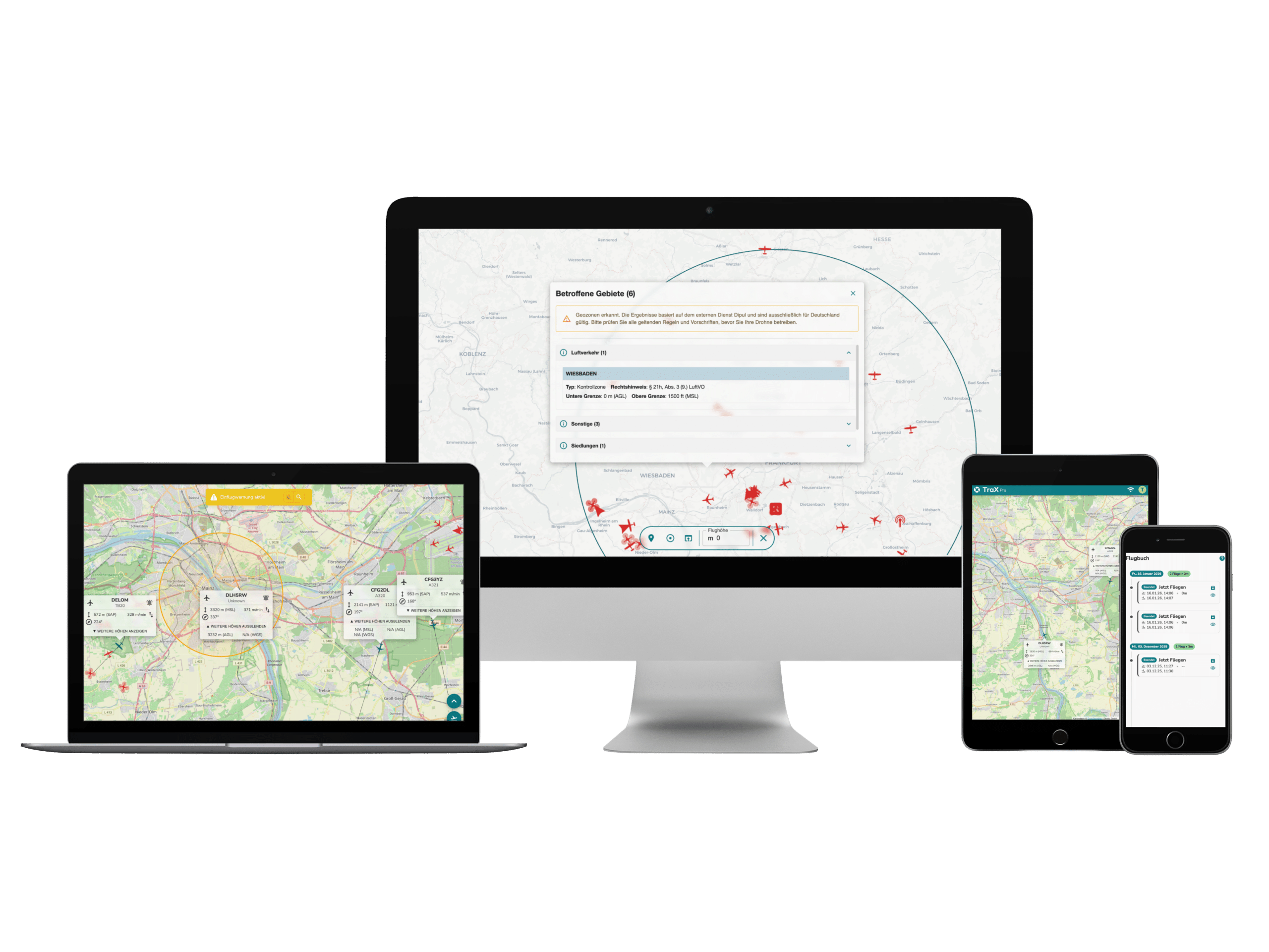
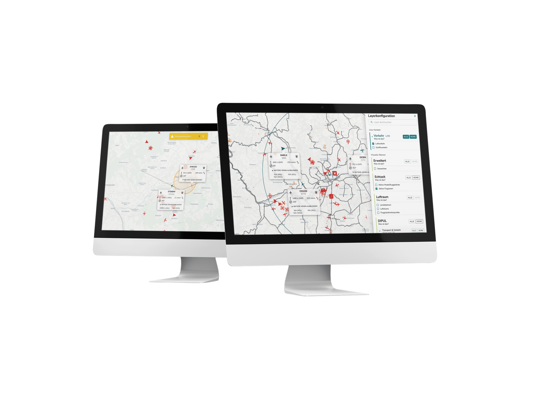
The DJI Matrice 4D is equipped with high-precision mapping functions with a new oblique image in five directions and orthophotography in three directions. With real-time terrain tracking, it fulfills various surveying requirements. The improved DJI FlightHub 2 software enables precise flight route planning, including options for intelligent 3D capture, geometric routes and slope routes. This increases efficiency and provides detailed modeling.
-
Seamless relay function for mountainous terrain
In conjunction with the DJI RC Plus 2 Enterprise, the DJI Matrice 4D can be operated independently and offers an innovative onboard relay function. One drone rises into the air and acts as a relay for another drone to increase the range. This function ensures stable video transmission, even without a 4G signal or in the presence of obstacles. It is ideal for search and rescue (SAR) missions and inspections in hard-to-reach, mountainous areas.
How the DJI Matrice 4D works with the DJI Dock 3...
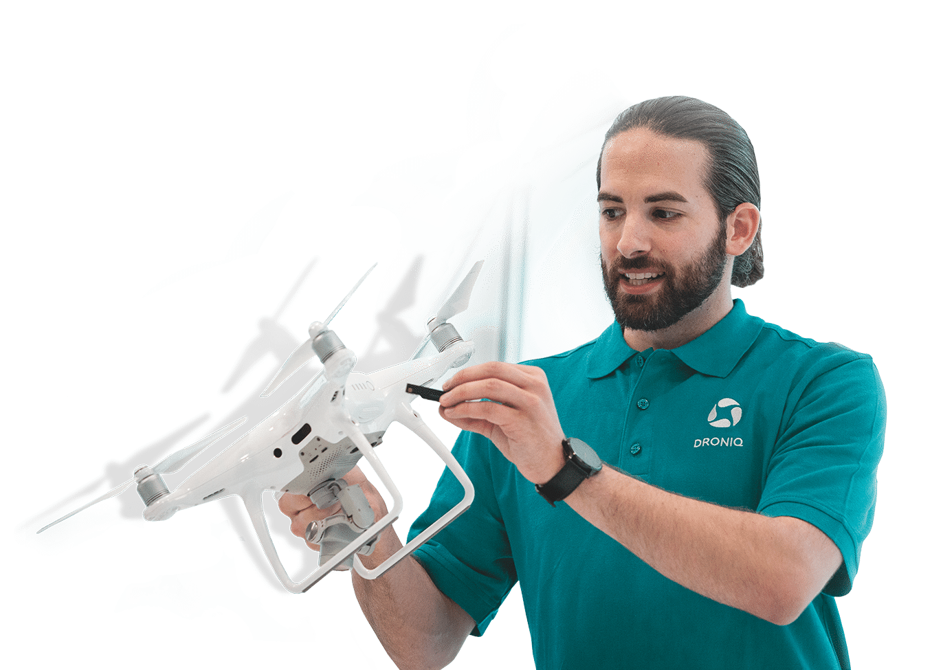
Our competences
Full Service
Solutions
Droniq supports BOS & industry in all phases of drone operations.
Real
Experts
More than 30 years of know-how in aviation & telecommunications.
Experienced
industry professionals
Specialized in BOS and industrial drones.
Quality
seal
Droniq is a certified DJI Enterprise dealer.