With TraX , Droniq is launching a new generation of drone apps for Germany—with a clear focus on safety, clarity, and visibility in the airspace.
For existing Droniq Maps users, this means: A new app, a new name—and a logical next step for today’s drone operations.
What is TraX?
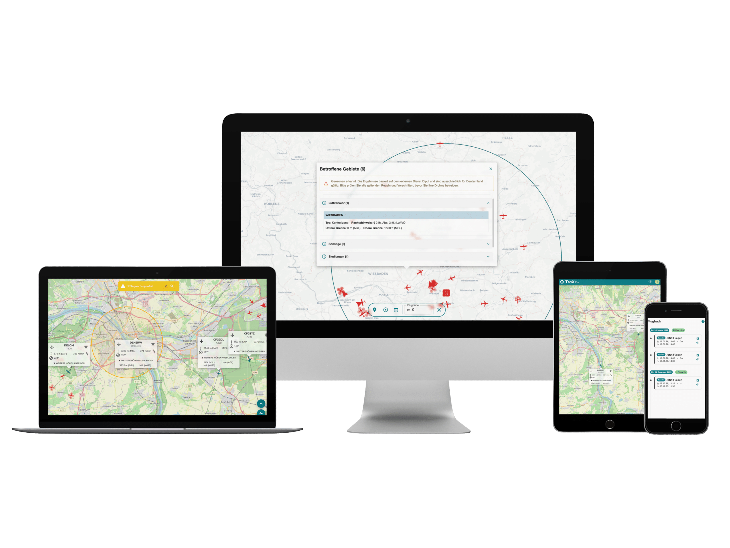
TraX is the drone app for Germany. It helps drone pilots safely plan drone flights, quickly validate them, and make their flights visible to others —providing a better overview of airspace.
Where you're allowed to fly—and what you need to keep in mind
What requirements and restrictions apply?
What's currently happening in the airspace around your flight
Why TraX?
Airspace is becoming more complex. At the same time, the requirements for safe and compliant drone flights are increasing.
TraX is exactly where it comes in—based on the principle of “see and be seen”:
Overview of Airspace
Quick flight validation
Greater visibility for drone flights
This provides a clear basis for decision-making—both before and during the drone flight.
An overview of the key features
Validation of Drone Flights Check directly on-site whether a flight is possible and what regulations apply. All relevant information is presented in a clear and easy-to-understand format.
Fly Now – Visibility in Airspace The "Fly Now" feature allows you to make your active flight area visible to other airspace users. This improves the shared situational awareness and contributes to greater safety in the airspace.
Live Air Situation* Keep an eye on the airspace around your operational area in real time.
Warnings and Alerts* Receive notifications about relevant developments in airspace—such as unexpected incoming flights. This allows you to respond promptly.
WeatherUse built-in weather information to make informed flight decisions.
Flight LogbookEasily and clearly document your drone flights—right in the app.
Geozones and Map Overlays All relevant geozones, active flight zones, and model airfields are displayed directly on the map.
With the transition to TraX , the previous app will be replaced.
Important to know:
The app is updated automatically or can be downloaded manually from the Google Play Store or Apple Store
A new, simplified registration process is required for TraX
Data from Droniq Maps is not imported
TraX can also be used without logging in, though with limited functionality
TraX: Better visibility. Greater safety.
TraX is designed to make drone operation easier, safer, and more transparent. Whether you’re a hobbyist or a professional user: With TraX provides a better understanding of airspace—and thus lays the foundation for safe drone flights.