20% promotional discount with the voucher code DQ4ACADEMY24 on
Remote pilot certificate A2 & BOS knowledge for remote pilots


Glossary
Definitions, abbreviations from unmanned aviation
-
A
-
B
-
C
-
D
-
E
-
F
-
G
-
H
-
I
-
J
-
K
-
L
-
M
-
N
-
O
-
P
-
R
-
S
-
T
-
U
-
V
-
W
-
X
-
Z
-
Autonomous operationAn operation in which the unmanned aircraft is in operation without the remote pilot being able to intervene
-
ATZ - Aerodrome Traffic ZoneAirfield traffic zone
-
ATTI - Attitude ModeOperating mode with DJI without GPS
-
ATM - Air Traffic ManagementAir Traffic Management (ATM) is the central task of air traffic control. The aim is to organize air traffic in the allocated airspace safely, smoothly and economically.
-
ARC - Air Risk ClassRisk class air
-
A-NPA - Advance Notice of Proposed AmendmentPreliminary draft European regulations
-
AMC - Acceptable Means of ComplianceAccepted detection methods
-
AltMoc - Alternative Means of ComplianceAlternative detection methods
-
AirspaceFrom the perspective of air traffic control, airspace is a three-dimensional space, interwoven with a network of flight paths and divided into different airspace classes, depending on the control services offered.
-
AIP - Aeronautical Information PublicationThe Aeronautical Information Publication (AIP) is a collection of aviation orders, information, and notices that are valid for an extended period of time.
It contains, among other things, a list of all airfields including airfield boundaries and contact details of air traffic control units.
-
AGL - Above Ground LevelHeight above ground
-
Operating description / ConOps operating conceptThe abbreviation ConOps stands for Concept of Operations. A concept of operations contains information on operations and describes procedures for safe UAS operation. The exact scope of the concept of operations depends on the risk category previously determined in the SORA. The ConOps is created by the operator of the UAS.
-
BOS - authorities and organizations with security tasksInstitutions that are entrusted with the defense against hazards fall under the collective term authorities and organizations with security tasks (BOS).
-
BVLOS - Beyond Visual Line of SightThe term stands for "beyond visual line of sight". Refers to drone operation beyond the visual line of sight of the remote pilot. For such operations, private and commercial users need a special permit from the responsible aviation authority. BOS forces are exempt from this requirement. They are exempt from the corresponding requirements in the event of an operation.
-
BMDV - Federal Ministry of Digital Affairs and TransportSupreme Aviation Authority for Civil Aviation Affairs
-
BLAG-UAS/FM - Federal-State Working Group UAS and Model AircraftThe Federal-Länder Working Group (BLAG) for "Unmanned Aerial Systems and Aeromodels" consists of the Federal Ministry of Transport (BMVI), the respective state aviation authorities (LLB) and DFS Deutsche Flugsicherung GmbH (DFS). Remote pilots can obtain information on the subject of drone flight from a joint website: https://www.dfs.de/dfs_homepage/de/Drohnenflug/Start/
-
BFU - Federal Bureau for Aircraft Accident InvestigationNational Civil Aviation Accident and Incident Investigation Center.
-
Unmanned aerial vehicle observerA person who is adjacent to the remote pilot and, through unassisted visual observation of the unmanned aircraft, assists the remote pilot in maintaining the unmanned aircraft in VLOS and safely conducting the flight.
-
Notified bodyExamination station (PStF) designated by the Luftfahrt-Bundesamt to conduct theory examinations for remote pilots according to UAS.OPEN.030(2)c) in Part A of the Annex to DVO (EU) 2019/947.
-
BDL - Federal Association of the German Air Transport Industry e. V.The BDL (Bundesverband der Deutschen Luftverkehrswirtschaft e. V.) is an association representing the interests of the German air transport industry.
-
BVLOS
Test est test
The term stands for "beyond visual line of sight". Refers to drone operation beyond the visual line of sight of the remote pilot. For such operations, private and commercial users require a special permit from the responsible aviation authority. BOS forces are exempt from this requirement. They are exempt from the corresponding requirements in the event of an operation.
-
C2 Link ServiceA communication service provided by a third party that ensures command and control between the unmanned aircraft and the control unit (CU).
-
CTR - Control ZoneControl zone at airports
-
ConOps - Concept of OperationsThe abbreviation ConOps stands for Concept of Operations. A concept of operations contains information on operations and describes procedures for safe UAS operation. The exact scope of the concept of operations depends on the risk category previously determined in the SORA. The ConOps is created by the operator of the UAS.
-
CISP (Common Information Service Provider)Provides the USSP with all relevant airspace and air traffic data for the provision of U-Space services.
-
CE markingA marking by which the manufacturer declares that the product complies with the applicable requirements set out in the Union harmonization legislation under which the affixing of the marking is required.
-
Certified Category - Category subject to approvalA UAS operating category as defined in Article 6 of the Implementing Regulation (EU) 2019/947.
-
Drones-as-a-Service (DaaS)
Drones as a Service (DaaS) is a concept in which drones and the associated infrastructure are offered as a service. Instead of owning and operating drones themselves, companies or individuals can use the services of specialized providers.
As part of DaaS, providers typically take on various tasks, including providing the drones, training operators, conducting flights, analyzing data and reporting. Customers can access a variety of services depending on their needs, including aerial photography, inspections, monitoring, mapping and much more.
This model offers companies the advantage of using drone technology without the associated costs and complexities. It also allows for flexible scaling depending on the requirements of a particular project or task. DaaS has the potential to improve efficiency and safety in various industries and open up new fields of application for drone technology.
-
Drone hangar
See Drone-in-a-Box System
-
Drone Garage
See Drone-in-a-Box System
-
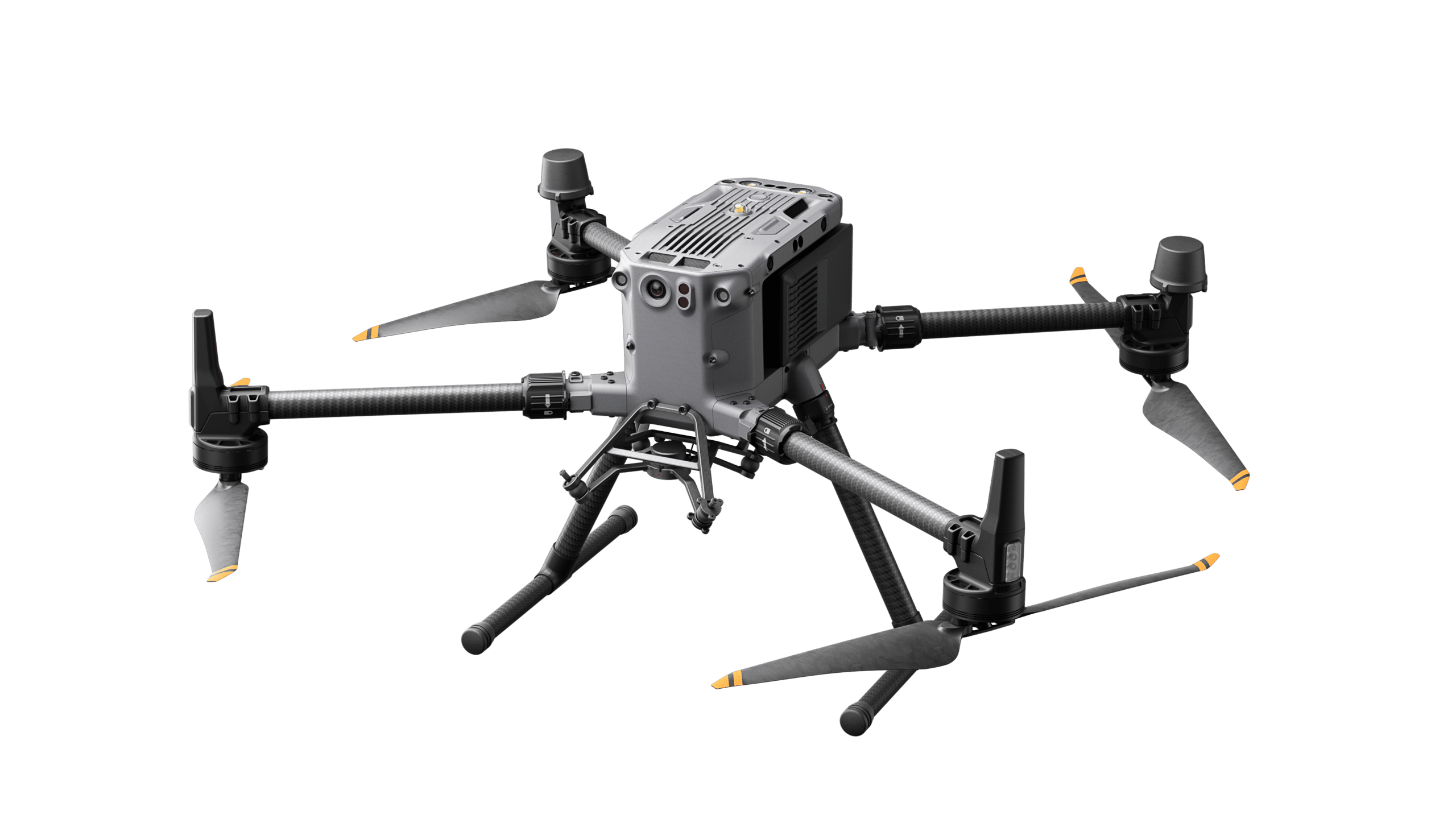
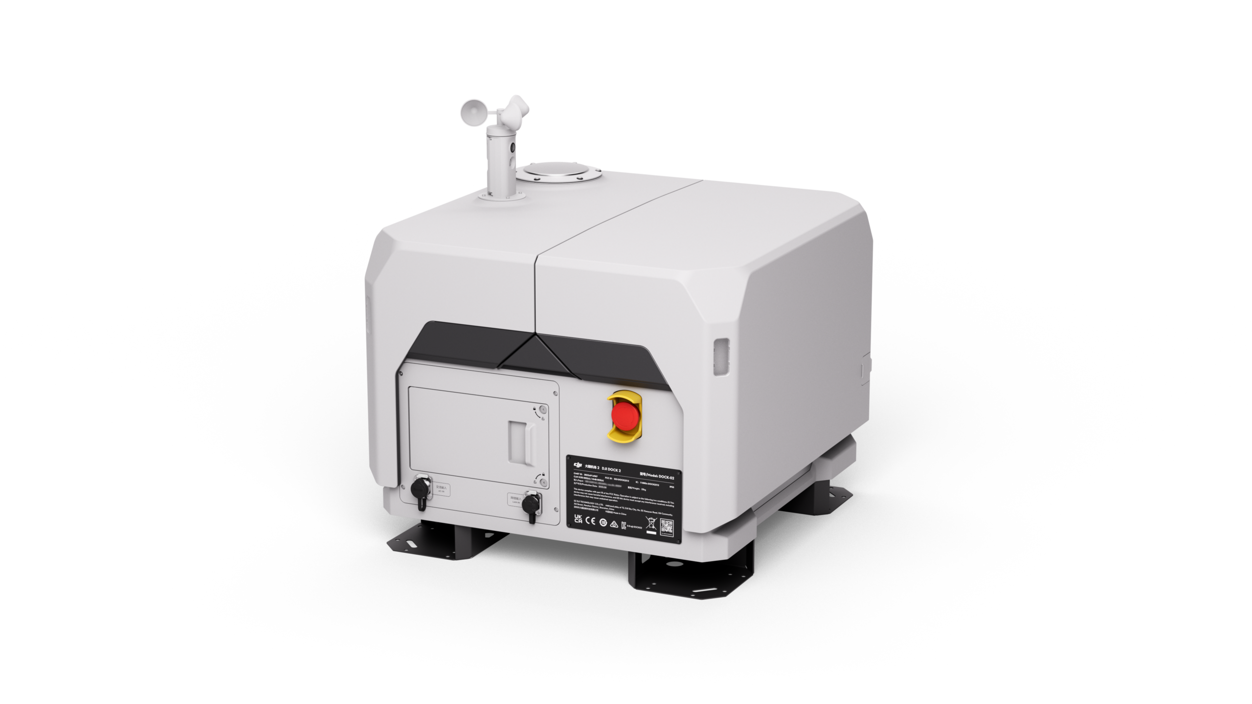
Drone-in-a-Box system (DIB)
A drone-in-a-box (DIB) system or drone garage / drone hangar is a highly automated drone system. It is used to perform autonomous drone flights beyond the pilot's line of sight (BVLOS). The drone is controlled via a control station. A pilot on site is no longer necessary. Since the drone is located in and protected by a box, missions can take place at any time and in almost any weather.
-
D&A - Detect & AvoidDetect & Avoid. A D&A system detects obstacles and avoids them independently.
-
DWD - German Weather ServiceThe DWD is a federal agency based in Offenbach am Main. Its main task is to monitor the climate in Germany and to warn of weather-related hazards. By providing basic weather information, the German Weather Service supports UAS of both meteorological flight preparation. The information includes ground wind forecasts as well as precipitation radar and lightning maps. For commercial drone operators, the DWD also offers a fee-based self-briefing system.
-
Direct remote identificationA system that provides for the local transmission of information about an unmanned aerial vehicle in operation, including identification of the unmanned aerial vehicle, so that such information can be retrieved without physical access to the unmanned aerial vehicle.
-
DAeC - German Aero ClubLargest air sports association in Germany.
-
EVLOS (Extended Visual Line of Sight)Operation in extended visibility: Either airspace observers provide an airspace observation or take over the control and are from now on new remote pilots.
-
ED-RThe abbreviation ED-R stands for restricted area. This refers to a defined airspace above the territory of a state in which aircraft flights are subject to temporary or permanent restrictions. Examples are airspaces over nuclear power plants or over the Berlin government district. Corresponding areas are defined to prevent threats to public safety and order. Whether a UAS is allowed to fly into an ED-R depends on the restriction. An unauthorized entry is a criminal offense.
-
EASA - European Aviation Safety AgencyEuropean Aviation Safety Agency is the aviation safety authority of the European Union. It was established on July 15, 2002, by decision of the European Council and has been based in Cologne since November 2004. Operations began on September 28, 2003, and it has been fully operational since 2006. EASA currently has about 400 employees.
-
FPV (First Person View)First person perspective
-
FlyawayUncontrolled drifting or flying away of a drone
-
Model aircraft club or associationAn organization legally established in a Member State for the purpose of conducting recreational flights, air shows, sporting activities or competitions with UAS.
-
Flight modelNational: Unmanned aircraft, including their control station, operated exclusively for sport and recreational purposes.
-
Flight logIn the flight logbook, the remote pilot documents his drone flights (electronically or in paper form). Among other things, it contains information about the date and time of the flight, the name of the remote pilot, the total duration of the mission on site, and the number of takeoffs and landings. The documentation is not mandatory in Germany. However, as part of an ascent permit or other exemption from operating bans, the operator of a drone may be required to keep a flight log in the ancillary provisions.
-
FLARMTraffic information and collision avoidance system for general aviation, light aircraft and drones.
-
Follow-me modeA mode of operation of a UAS in which the unmanned aircraft continuously follows the remote pilot within a predetermined radius.
-
Remote pilotA natural person who is responsible for the safe conduct of the flight of an unmanned aircraft, where the remote pilot:in either provides flight control manually or, if the unmanned aircraft is flying automatically, monitors its course and remains able to intervene and change course at any time.
-
Feet (feet, ft)English measure of length used in aviation to designate flight altitude. One foot is equal to 30.48 cm.
-
Airspace golfAirspace G (pronounced Luftraum Golf) is the lowest airspace in Germany.Its lower boundary begins on the ground and its upper boundary, in line with Airspace E above it, is usually 2,500 feet, or 762 meters. Airspace G is the only uncontrolled airspace in Germany. The ascent of a drone does not require air traffic control clearance by, for example, DFS. However, the use can be further restricted by other laws and regulations, e.g. regarding nature conservation.
-
GRC (Ground Risk Class)Soil risk class.
-
GPS (Global Position System)US Global Satellite System
-
GNSS (Global Navigation Satellite System)Collective term for global satellite systems.
-
GimbalCardanic suspension, Multi-axis stabilization device for the camera
-
Geo-sensitizationA function that, based on data provided by Member States, detects a potential airspace boundary violation and alerts remote pilots so that they can take immediate and effective action to prevent it.
-
Geo-awareness Service ProviderThe Geo-awareness Service is governed by Regulation (EU) 2019/945. It refers to UAS capabilities and the requirements for Member States when they decide to establish geographic zones or for UAS operators to follow and comply with the specification of these zones. This service is intended to assist UAS operators in meeting these obligations, as it will provide this information (where they may and may not fly) with appropriate accuracy. By using this service in a U-Space airspace, UAS operators can fulfill their responsibilities related to this UAS operator obligation.
-
Geographical UAS areaA portion of airspace defined by the competent authority that allows, restricts, or excludes UAS operations to address the safety, privacy, and personal data, security, or environmental risks associated with UAS operations.
-
GeofencingVirtually established boundary (fencing) by means of GPS
-
Dangerous goodsArticles or substances carried by an unmanned aerial vehicle as a payload that pose a risk to health, safety, property or the environment in the event of an incident or accident, in particular: - explosive substances (danger of mass explosion, danger from splinters, explosive and thrown pieces, low danger from air blast, high danger of fire, explosives, extremely insensitive explosives),- gases (flammable gases, non-flammable gases,toxic gases, oxygen, danger when inhaled),- flammable liquid substances (flammable liquid substances, flammable substances, fuel oil, gasoline),- flammable solids (flammable solids, spontaneously combustible solids, dangerous in contact with water),- oxidizing substances and organic peroxides,- toxic and infectious substances (poison, biohazard),- radioactive substances,- corrosive substances
-
HALE (High Altitude Long Endurance)Great height, long reach.
-
IFR (Instrument Flight Rules)Instrument flight rules
-
ICAO (International Civil Aviation Organization)International Civil Aviation Organization.
-
JARUS (Joint Authorities for Rulemaking on Unmanned Systems)International Working Group on Drone Regulation.
-
J (Joule)Unit of measurement for energy
-
Controlled area on the groundAn area on the ground within which the UAS is operated and the UAS operator can ensure that only involved persons are present.
-
kmz /kml (Keyhole Markup Language)A file that can be loaded as a layer in e.g. Google Earth. The kmz is a compressed version of the kml.
-
Airspace golfAirspace G (pronounced Luftraum Golf) is the lowest airspace in Germany.Its lower boundary begins on the ground and its upper boundary, in line with Airspace E above it, is usually 2,500 feet, or 762 meters. Airspace G is the only uncontrolled airspace in Germany. The ascent of a drone does not require air traffic control clearance by, for example, DFS. However, the use can be further restricted by other laws and regulations, e.g. regarding nature conservation.
-
Airspace ObserverA person who assists the remote pilot by scanning the airspace in which the unmanned aircraft is operating for potential airborne hazards through unassisted visual scanning.
-
AirspaceFrom the perspective of air traffic control, airspace is a three-dimensional space, interwoven with a network of flight paths and divided into different airspace classes, depending on the control services offered.
-
PilotSee remote pilot
-
LUC (light UAS operator certificate) - operator certificate for light UASLight UAS Operator Certificate (LUC) is a certificate for a UAS operation issued by the responsible aviation authority. Operators can self-assess the risk of operation in the special category.
-
LBA - German Federal Aviation AuthorityThe Federal Office of Civil Aeronautics, headquartered in Braunschweig, is the higher federal authority for all civil aviation tasks in Germany. The LBA is subject to the technical and official supervision of the Federal Ministry of Transport and Digital Infrastructure.
-
MTOM (maximum take-off mass) - Maximum permissible take-off massThe maximum allowable mass of the unmanned aircraft, including payload and fuel, as determined by the manufacturer or builder, with which the unmanned aircraft can be operated. Synonyms: MTOW, Maximum Takeoff Mass, Maximum Takeoff Weight.
-
MSL (Mean Sea Level)(Height above) sea level.
-
Model airplaneAn unmanned aerial vehicle system used primarily for recreational activities.
-
MHz (Megahertz;)Unit of measurement for radio frequency.
-
CrowdsA multitude of people standing so close together that it is almost impossible for a single person to move away from this crowd.
-
Mandatory ServicesIn order to be able to establish a U-Space, EASA has defined so-called "Mandatory Services". These are mandatory services that determine the design of the U-Space: - Network Identification Service - Geo-awareness Service - UAS Flight Authorization Service - Traffic Information Service.
-
MALE (Medium Altitude Long Endurance)Medium height, long range.
-
PayloadSee Payload.
-
NOTAM (Notice To Airmen)Information on temporary and permanent changes to the Aeronautical Information Publication (AIP).
-
NDB (Non-Directional Beacon)Undirected beacon. Position determination in manned air navigation.
-
Network Identification ServiceThe Network Identification Service ensures traceability of the unmanned aircraft during its flight. Based on this information, USSPs can actually exchange UAS traffic information with each other, providing traffic information for UAS operations.
-
NightThe hours between the end of civil twilight and the beginning of civil dawn as defined in the Executive Order.
-
N/A (Not Applicable)Not available.
-
Open Category - Open CategoryA UAS operating category as defined in Article 4 of the Implementing Regulation (EU) 2019/947.
-
PStF - Testing stationSee notified body.
-
Privately manufactured UASA UAS assembled or manufactured by the builder for his own use, except for UAS assembled from components marketed as a prefabricated kit.
-
PIS (Public Interest Site)Landing site (of public interest) for helicopters at hospitals.
-
PayloadInstruments, mechanisms, equipment, parts, appliances, accessories, or attachments, including communications equipment, installed in or attached to the aircraft that are not used or intended to be used to operate or control the aircraft in flight but are not part of the airframe, an engine, or a propeller. Synonym: Payload
-
Risk analysis / risk assessment (SORA)A SORA (Specific Operations Risk Assessment) is a method for risk assessment / risk analysis that has been specially developed for the operation of unmanned aircraft systems (UAS). This method is required by the European Union Aviation Safety Agency (EASA) and provides a systematic approach to assessing and minimizing the risks associated with the use of drones.
-
RTH (Return To Home)Return to start point (home point); the device returns autonomously to the start point.
-
RobustnessThe effect of the risk mitigation measures, based on the gain in security from those measures and the level of assurance and integrity achieved from the gain in security.
-
RMZ (Radio Mandatory Zone)Area with radio communication obligation.
-
RedundancyA failure of one motor can be compensated by a number of other motors.
-
RC (Remote Control)Remote control
-
Control unitThe equipment or equipment system for remote control of unmanned aircraft as defined in Article 3(32) of Regulation (EU)2018/1139 that supports control or surveillance of the unmanned aircraft in any phase of flight, excluding infrastructures supporting the control and command link service (C2).
-
ControllerSee remote pilot
-
Standard scenarioA UAS mode of operation in the "special" category for which a detailed list of risk mitigation measures has been defined and for the application of which, when conducting this mode of operation, the operator can make a declaration to the competent authority.
-
Specific Category - Special CategoryA UAS operating category as defined in Article 5 of the Implementing Regulation (EU) 2019/947.
-
SORA-GER (Specific Operational Risk Assessment Germany)Risk assessment (German version)
-
SORA (Specific Operational Risk Assessment)A SORA (Specific Operations Risk Assessment) is a method for risk assessment / risk analysis that has been specially developed for the operation of unmanned aircraft systems (UAS). This method is required by the European Union Aviation Safety Agency (EASA) and provides a systematic approach to assessing and minimizing the risks associated with the use of drones.
-
SOP (Standard Operating Procedures)Standard operating procedure
-
SMH (minimum safety height)Minimum flight altitude for manned air traffic.
-
Single Common Information Service Provider (SCISP)The Single Common Information Service Provider (SCISP) performs a central role of U-Space. It provides the USSP with all relevant airspace and air traffic data for the provision of U-Space services. In addition, with manned aviation data, all air traffic, manned and unmanned, can be displayed in a combined air situation picture. This is an essential prerequisite for flights beyond the visual range of pilots - and thus for the efficient use of drones.
-
SERA (Standardised European Rules of the Air)Standardized European Rules of the Air.
-
HoverRemain in the air in a geographical position.
-
SAR (Search And Rescue)Search and Rescue.
-
SAIL (Specific Assurance Integrity Level)Risk level according to SORA to determine countermeasures.
-
TransponderThe transponder is used to identify an aircraft. Inquiry pulses transmitted by the secondary radar activate the on-board transponder, which transmits the identity code. This enables perfect identification of the aircraft on the radar screen.
-
Traffic Information ServiceThis service provides the UAS operator with the alerts, flight situation, and known/predicted traffic (e.g., if a tracking service is available). The main objective of the Traffic Information Service is to alert the UAS operator and help to avoid a collision.
-
TRA (Temporary Reserved Airspace)Temporarily reserved airspace.
-
TMZ (Transponder Mandatory Zone)Zone with transponder obligation.
-
Tilt Wing/Tilt RotorTilt-wing aircraft. The drives / wings can be tilted.
-
THW - Federal Agency for Technical ReliefAuthority in the portfolio of the Federal Ministry of the Interior.
-
TetheredTethered(s), wired, tethered drone
-
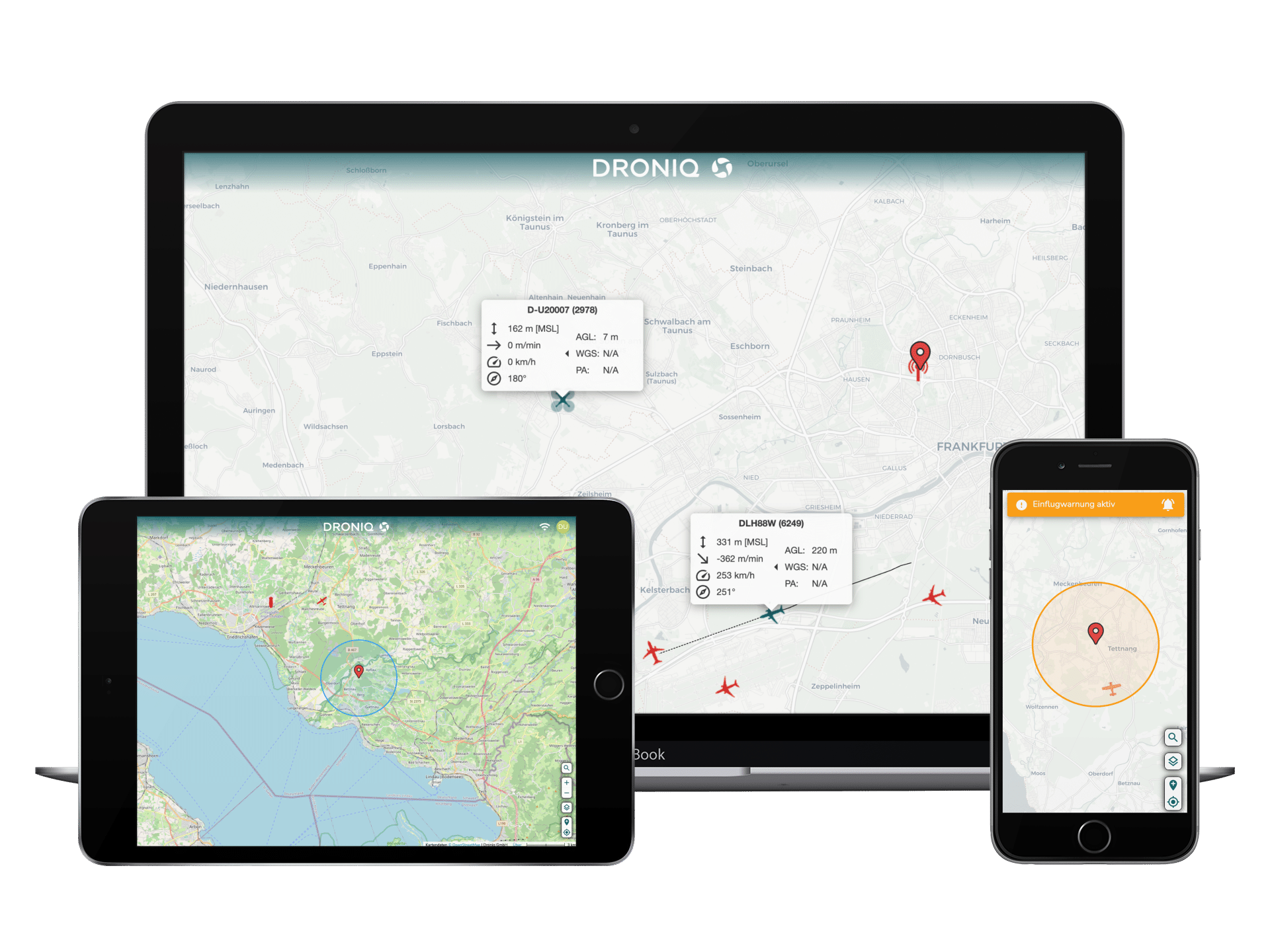
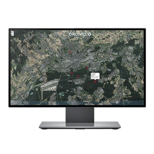
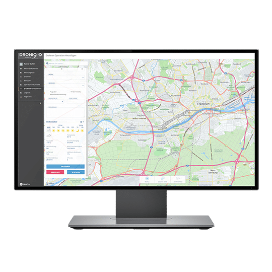
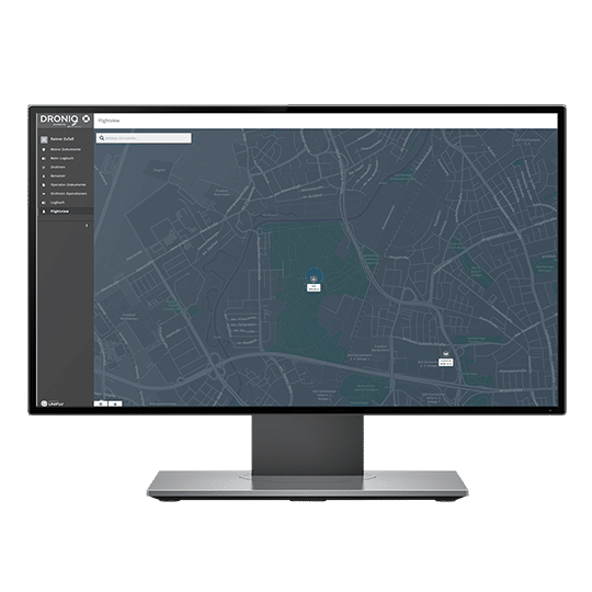
UTM (UAS Traffic Management System) - traffic management system for unmanned aircraft systemsThe UAS Traffic Management System (UTM) is a drone traffic management system that provides a combined air situation picture of manned and unmanned aircraft, as well as other functions for safe and efficient drone beyond visual line of sight (BVLOS) operations in compliance with regulations. For all phases of flight (pre-flight, in-flight and post-flight phase), the UTM provides authoritative services for the safe operation of UAS in the airspace. In the pre-flight phase, the controller can register in the UTM, plan his mission and cross-check it (Are no-fly zones / airspace restrictions present? Are there other registered flight movements? Do I need an ascent permit or a SORA?). In the in-flight phase, the remote pilot can track his drone in real time and observe other aircraft in a combined aerial situation display, including those outside the user's line of sight (manned as well as unmanned registered in the UTM). He also receives real-time data such as photos or videos as needed. The UTM components of the post-flight phase help with the evaluation and follow-up of the flight (e.g., maintenance of the logbook, incident management, battery management).
-
U-Space Service Provider (USSP)The U-Space Service Provider coordinates unmanned air traffic in U-Space and is responsible for its safety. To this end, it must provide four different technical services:- Provision of a complete air situation picture for the drone pilots (Traffic Information Service)- Continuous monitoring of drone flight movements in the respective U-Space area (Network Identification Service)- Continuous transmission of relevant airspace information to the drone pilots (Geo-awareness Service)- Provision of services for flight registration and flight authorization for drone pilots (Flight Authorization Service).
-
U-SpaceA U-Space is an airspace element for the use of unmanned aerial vehicles. The U-Space airspace is clearly demarcated from the rest of the airspace, both in terms of its maximum altitude and its geographical extent. In the U-Space, there are clear organizational structures and processes that manage the individual drone flights (e.g., the registration and deregistration of individual flights, the planning of flight routes, etc.) and at the same time ensure that these take place safely. In addition, these ensure safe and smooth interaction with manned air traffic.
-
Uncontrolled airspaceAirspace outside the area of responsibility of air traffic control.
-
Uninvolved personsPersons who are not involved in UAS operation or who are not familiar with the UAS operator's instructions and safety procedures.
-
Unmanned gliderAn unmanned aircraft that is kept aloft by the dynamic response of the air on the fixed lifting surfaces, not depending on an engine for gliding flight. It may be equipped with an engine for emergency use.
-
UAS operatorsUnmanned Aircraft System Operator. A legal or natural person that operates or intends to operate one or more UAS.
-
UAS Flight Authorization ServiceThe goal of this service is to provide USSPs with situational awareness of all UAS traffic to be operated in U-Space, even in uncontrolled airspace. This allows USSPs to apply prioritization rules before authorization is granted. With the information about the intended flight and other information about the type of operation and its duration, as well as some associated aircraft performance, USSPs should be able to manage traffic flow and mitigate potentially conflicting flights before those flights occur. To do this, all USSPs are required to share flight authorization applications with each other when more than one USSP provides U-Space services in U-Space airspace (while, of course, complying with the GDPR requirements).
-
UAS (unmanned aircraft system) - Unmanned aircraft systemAn unmanned aerial vehicle and the equipment for its remote control. Synonyms: UAV, unmanned aerial system, unmanned aerial vehicle, model aircraft.
-
UA (unmanned aircraft) - Unmanned aircraftAn aircraft that is operated or designed to be operated autonomously or remotely without a pilot on board.
-
VTOL (Vertical Take-Off and Landing)Vertical takeoff and landing
-
VLOS (Visual Line Of Sight operation) - operation in direct sightA UAS mode of operation in which the remote pilot is able to maintain uninterrupted and unassisted visual contact with the unmanned aircraft so that he can control its flight path to avoid collisions with other aircraft, people, and obstacles.
-
VFR (Visual Flight Rules)VFR flights are "see and be seen" flights where the pilot orients himself to external reference points (lakes, railroad lines, highways, etc.). VFR flights are not under the control of air traffic control or a controller; pilots are responsible for avoiding collisions with other airspace users.
-
WindVertical and horizontal air movements can have a significant influence on the operation of a UAS. Remote pilots must take this influence into account in their flight planning. On the one hand, the different air movements directly affect the flight path of the unmanned aerial vehicle. On the other hand, steering against the air movement always means higher battery consumption and consequently a sometimes considerable reduction in flight time.
-
X configurationMost manufacturers (DJI, Yuneec, Parrot) design multicopters as X-configurations. The motors are offset by 45° to the direction of flight so that the propellers and arms are not visible in the direction of flight when taking photos or filming.
-
Pliers
Vestibulum volutpat enim velit, a pharetra lacus interdum ac. Donec velit libero, sodales eu convallis non, auctor vitae arcu. Donec mollis varius diam, in hendrerit sapien viverra non. Nullam ac dolor quam. Maecenas vel purus ac tellus dapibus ultricies. Aliquam fermentum, lacus vitae dapibus scelerisque, arcu libero dapibus augue, quis blandit erat mauris non dolor. Nam est dolor, rutrum vel convallis eu, sodales imperdiet dui. Pellentesque habitant morbi tristique senectus et netus et malesuada fames ac turpis egestas. Morbi semper vulputate augue ut convallis. Cras ut urna vestibulum, tincidunt nisi in, venenatis massa. Proin vel ante tristique, tincidunt est et, aliquet quam. Curabitur a dui accumsan, feugiat ante rhoncus, rhoncus lorem. Pellentesque mollis dolor non est iaculis laoreet. Aliquam malesuada justo diam, nec finibus libero rhoncus lobortis.